1970s Maps of Spain, Georgia
Explore 2 historic maps of Spain from the 1970s. These maps offer a rare glimpse into what life looked like during the 1970s — showing old roads, neighborhoods, homes, and landmarks that have changed or disappeared over time.
Whether you're researching your family's past, planning a metal detecting trip, or studying how Spain's landscape evolved across the 1970s, these high-resolution maps are a powerful tool for exploring the history of this region.
- Focus on a specific era: All maps on this page are from the 1970s, giving you a focused view of this time period.
- See what’s changed: Compare century-old streets, trails, and buildings to today's modern landscape using overlays and satellite layers.
- Research with precision: Use these maps for genealogy, historical research, land use analysis, or educational projects.
- View, download, or print: Maps are fully viewable online in high resolution, and can be downloaded or printed for your own records.
Start exploring Spain's history through authentic maps from the 1970s. This is your window into the past.
Spain, GA maps
(2)- 1974 Map of Quitman, 1987 Print
 1974 Quitman1987 Print · USGSBrooks County is shown at a mid-century peak in this survey of Quitman and its surrounding rail junctions. Researchers can trace family roots at Oak Hill Cem or locate rural hamlets like Spain and Shiver along the Okapilco Creek basin.
 - 1977 Map of Quitman, 1978 Print
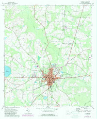
 1977 Quitman1978 Print · USGSBrooks County during the late 1970s centers on the busy rail and road corridors of QUITMAN. Genealogists and historians can trace family sites at Bethlehem Cem, Rogers Cem, and the historic Monument Ch along the SEABOARD COAST LINE route.
End of results
Showing maps 1-2 of 2
Top cities near Spain
- Valdosta historical maps
- Moultrie historical maps
- Quitman historical maps
- Hahira historical maps
- Remerton historical maps
- Morven historical maps
See more
Frequently asked questions
- What are the different types of historical maps available for Spain?
- What is the oldest map of Spain?
- Where can I purchase historical maps of Spain for my home or office?
- Where can I download high-res historical maps of Spain?
- Are there historical topographic maps available for Spain?
- Is there historical aerial imagery available for Spain?
- Where are historical maps of Spain sourced from?