Old Maps of Kingsland, Georgia for Genealogy
Trace your family roots with 40 historic maps of Kingsland. These high-res maps reveal old neighborhoods, homesites, landmarks, and streets — helping you uncover where your ancestors lived and how the area evolved over time.
- Explore historic neighborhoods: Identify where your relatives may have lived in the 1800s or 1900s.
- Compare maps over time: Trace the changes in streets, buildings, and landmarks for multi-generational research.
- Perfect for genealogy & ancestry research: Used by family historians and researchers to map out lineage and migration.
These maps are an incredible resource for exploring your personal connection to Kingsland's past.
Kingsland, GA maps
(40)- 1917 Map of Boulogne, 1966 Print
 1917 Boulogne1966 Print · USGSCoastal Georgia and Florida meet at the turn of the century along the winding banks of the Satilla and St Marys Rivers. Genealogists can trace family roots through numerous river landings like Gum Stump Landing and old community hubs such as Owens Ferry and Colerain.
 - 1918 Map of Kingsland
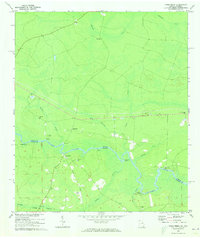
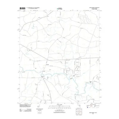
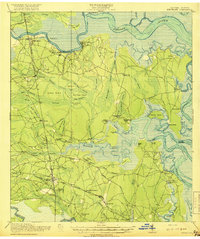 1918 Kingsland1918 Print · USGSCamden County, Georgia, at the Florida border, is shown here during the First World War era when river landings and rail junctions shaped local life. Genealogists can trace family footprints at Ruhamah School, Fairview Church, and the riverfront settlement of Ceylon.3 unique versions available
 - 1919 Map of Boulogne
 1919 Boulogne1919 Print · USGSCoastal Georgia and Florida meet along the river-carved timberlands of the late nineteen-teens. Genealogists and historians can trace defunct river landings and rural landmarks like Owens Ferry, Germantown School, and the industrial site at Baileys Mills.3 unique versions available
 - 1948 Map of Jacksonville
 1948 Jacksonville1948 Print · USGSNortheast Florida and Southeast Georgia's coastal waterways and railroad towns are captured here in the years following the war. Genealogists can trace family connections through river towns like St Marys or identify long-standing military landmarks like Jacksonville NAS.
 - 1957 Map of Jacksonville, 1967 Print
 1957 Jacksonville1967 Print · USGSCoastal Florida and Georgia meet in the late fifties, showcasing a landscape of naval aviation, deep-water terminals, and barrier island communities. Researchers can trace the mid-century footprints of NAS Jacksonville, find small communities like Franklintown, and locate the historic Fort Clinch State Park.3 unique versions available
 - 1958 Map of Woodbine, 1959 Print
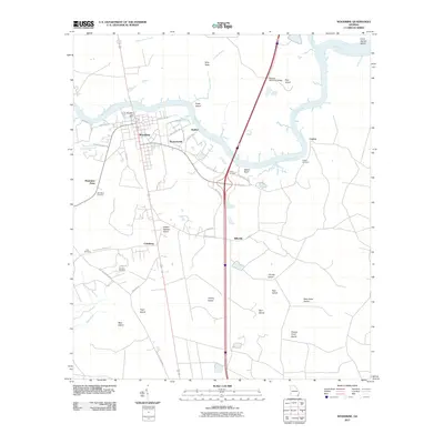
 1958 Woodbine1959 Print · USGSCamden County life moved by rail and river in the late fifties, where the town of Woodbine sits at a critical crossing of the Satilla River. Genealogists can locate family landmarks like Madison Chapel, Bunche High Sch, and the Cole Cem among the surrounding coastal swamps.2 unique versions available
 - 1958 Map of Harrietts Bluff, 1959 Print
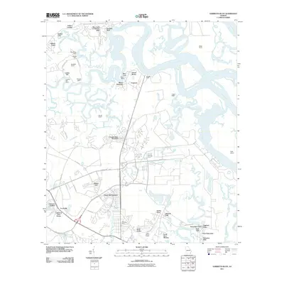
 1958 Harrietts Bluff1959 Print · USGSCoastal Georgia's river systems and military growth are documented here in the late fifties, featuring the expansive network of the Kings Bay Army Terminal. Family historians can locate rural landmarks like the Ruhamah Mission, Young Zion Ch, and the waterfront at Harrietts Bluff.2 unique versions available
 - 1958 Map of Kingsland, 1959 Print
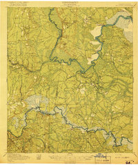
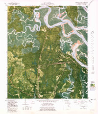
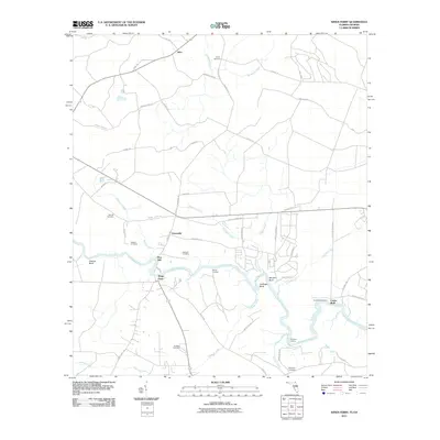
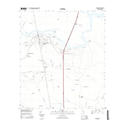
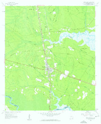 1958 Kingsland1959 Print · USGSThe coastal Georgia borderlands come alive in the late fifties, centered on the growing rail hub of Kingsland. Genealogists can trace family names through numerous burial sites like Zion Cem and Lawnwood Cem, while explorers follow the St Marys River shoreline.2 unique versions available
 - 1959 Map of Jacksonville
 1959 Jacksonville1959 Print · USGSNortheast Florida and Southeast Georgia are seen here in the late fifties, dominated by the maritime activity of the St Johns River and the Atlantic coast. Researchers can trace the mid-century layout of Jacksonville and identify sprawling military sites like Camp Blanding Military Reservation and Kings Bay Ammunition Terminal.
 - 1960 Map of Jacksonville
 1960 Jacksonville1960 Print · USGSCoastal Florida and Georgia meet in this mid-century portrait of a region shaped by naval power and the winding St Johns River. Researchers can trace the development of military sites like Cecil Field or locate historic rural landmarks such as Jerusalem Ch and Kings Ferry.
 - 1970 Map of Kings Ferry, 1973 Print
 1970 Kings Ferry1973 Print · USGSThe Georgia-Florida borderlands along the St Marys River are documented here during the early 1970s. Local historians and genealogists can locate several riverfront landings and country churches, including Blood Landing, Kings Ferry, and Mt Olive Ch.3 unique versions available
 - 1979 Map of Woodbine
 1979 Woodbine1979 Print · USGSCoastal Camden County is captured in the late seventies as modern infrastructure began to bisect the ancient river swamps. Genealogists and historians can trace family landmarks and rural communities from Billyville to Colesburg, including Woodbine Cem and Gethsemane Ch.2 unique versions available
 - 1980 Map of Kingsland
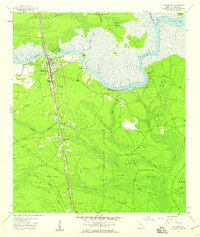
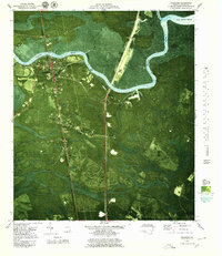
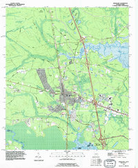
 1980 Kingsland1980 Print · USGSCoastal Camden County is captured in the early 1970s through this detailed orthophotomap, showing the Georgia shoreline’s dense wetlands and timberlands. Researchers can locate small settlements like Seals and Kinlaw among the winding coastal marshes and creek beds.
 - 1980 Map of Harrietts Bluff, 1981 Print
 1980 Harrietts Bluff1981 Print · USGSCoastal Camden County is captured here during a period of significant military and recreational development in the early eighties. Genealogists and local historians can trace family-named sites like Simmons Bluff and Mush Bluff, or locate the John H McIntosh Sugar Mill Site Ruins.2 unique versions available
 - 1981 Map of Fernandina Beach, 1982 Print
 1981 Fernandina Beach1982 Print · USGSThe coastal borderlands of Georgia and Florida are captured here in the early eighties, from the barrier islands to the rail towns of the interior. Genealogists and historians can trace family-named bluffs and sites like Franklintown, Dungeness Wharf, and St Marys Historical Park.3 unique versions available
 - 1988 Map of Jacksonville
 1988 Jacksonville1988 Print · USGSCoastal Florida and Georgia are captured here during the late eighties, documenting the rapid growth of the First Coast and its vital military installations. Researchers can trace the development of beach communities like Fernandina Beach and Atlantic Beach or locate family landmarks near Mickler Landing and Orange Park.
 - 1993 Map of Woodbine, 1995 Print
 1993 Woodbine1995 Print · USGSCoastal Camden County is defined by the winding Satilla River and its vast marshlands during the 1990s. Local researchers can trace family roots through several landmarks including Hamilton Chapel, Woodbine Cem, and the historic settlement at Ceylon.
 - 1993 Map of Kingsland, 1995 Print
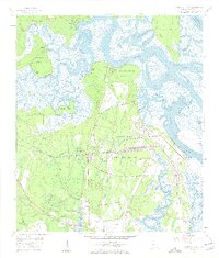
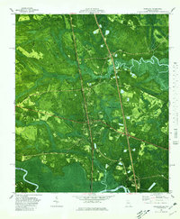
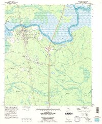
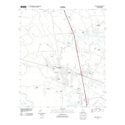
 1993 Kingsland1995 Print · USGSKingsland and the Georgia-Florida border are captured here in the early nineties as modern infrastructure began to reshape the old river landscapes. Genealogists and local historians can trace rural roots through Evergreen Cem, the St Marys Railroad, and the community at Kinlaw.
 - 1994 Map of Harrietts Bluff, 1995 Print
 1994 Harrietts Bluff1995 Print · USGSCamden County's coastal landscape is captured in the mid-nineties as the naval presence at Kings Bay expanded alongside historic riverside settlements. Researchers can locate family landmarks like Scotchville and Harrietts Bluff or trace the John H Mcintosh Sugar Mill Site Ruins.
 - 2011 Map of Kings Ferry, 2011 Print
 2011 Kings Ferry2011 Print · USGSCovers Kingsland, including Clarks Bluff, Silco, and other nearby areas
 - 2011 Map of Woodbine, 2011 Print
 2011 Woodbine2011 Print · USGSCovers Kingsland, including Woodbine, Halifax, and other nearby areas
 - 2011 Map of Harrietts Bluff, 2011 Print
 2011 Harrietts Bluff2011 Print · USGSCovers Kingsland, including St. Marys, Kings Bay Base, and other nearby areas
 - 2011 Map of Kingsland, 2011 Print
 2011 Kingsland2011 Print · USGSCovers Kingsland, including St. Marys, May Creek, and other nearby areas
 - 2012 Map of Kings Ferry, 2012 Print
 2012 Kings Ferry2012 Print · USGSCovers Kingsland, including Clarks Bluff, Silco, and other nearby areas
 - 2014 Map of Woodbine, 2014 Print
 2014 Woodbine2014 Print · USGSCovers Kingsland, including Woodbine, Halifax, and other nearby areas
Showing maps 1-25 of 40
Top cities near Kingsland
- St. Marys historical maps
- Hilliard historical maps
- Kings Bay Base historical maps
- Woodbine historical maps
Top neighborhoods of Kingsland
- Bristol Hammock historical maps
- Creekwood historical maps
- Forest Ridge historical maps
- Greentree historical maps
- Palmetto Pines Mobile Home Park historical maps
- Terra Haute historical maps
See more
Frequently asked questions
- What are the different types of historical maps available for Kingsland?
- What is the oldest map of Kingsland?
- Where can I purchase historical maps of Kingsland for my home or office?
- Where can I download high-res historical maps of Kingsland?
- Are there historical topographic maps available for Kingsland?
- Is there historical aerial imagery available for Kingsland?
- Where are historical maps of Kingsland sourced from?