1970s Maps of Bowdon, Georgia
Explore 2 historic maps of Bowdon from the 1970s. These maps offer a rare glimpse into what life looked like during the 1970s — showing old roads, neighborhoods, homes, and landmarks that have changed or disappeared over time.
Whether you're researching your family's past, planning a metal detecting trip, or studying how Bowdon's landscape evolved across the 1970s, these high-resolution maps are a powerful tool for exploring the history of this region.
- Focus on a specific era: All maps on this page are from the 1970s, giving you a focused view of this time period.
- See what’s changed: Compare century-old streets, trails, and buildings to today's modern landscape using overlays and satellite layers.
- Research with precision: Use these maps for genealogy, historical research, land use analysis, or educational projects.
- View, download, or print: Maps are fully viewable online in high resolution, and can be downloaded or printed for your own records.
Start exploring Bowdon's history through authentic maps from the 1970s. This is your window into the past.
Bowdon, GA maps
(2)- 1973 Map of Bowdon East, 1975 Print
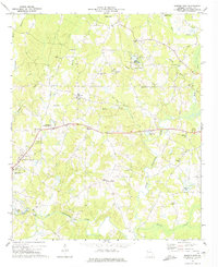 1973 Bowdon East1975 Print · USGSCarroll County’s rolling landscape is captured in the early seventies, showing a community defined by its riverbanks and rural crossroads. Genealogists and local historians can trace family roots through numerous sites like Pine Tucky Ch, Farmers High, and the grounds of John Tanner State Park.2 unique versions available
 - 1975 Map of Bowdon West, 1977 Print
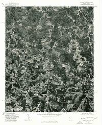 1975 Bowdon West1977 Print · USGSThe Georgia-Alabama state line is captured here in the mid-seventies, showing the agricultural and forested landscape between Cleburne and Carroll counties. Researchers can trace the layout of small settlements like Ranburne, Kansas, and the outskirts of Bowdon.
End of results
Showing maps 1-2 of 2
Top cities near Bowdon
- Carrollton historical maps
- Bremen historical maps
- Tallapoosa historical maps
- Mount Zion historical maps
- Wedowee historical maps
- Waco historical maps
See more
Top neighborhoods of Bowdon
Frequently asked questions
- What are the different types of historical maps available for Bowdon?
- What is the oldest map of Bowdon?
- Where can I purchase historical maps of Bowdon for my home or office?
- Where can I download high-res historical maps of Bowdon?
- Are there historical topographic maps available for Bowdon?
- Is there historical aerial imagery available for Bowdon?
- Where are historical maps of Bowdon sourced from?