Old Maps of Roopville, Georgia for Genealogy
Trace your family roots with 18 historic maps of Roopville. These high-res maps reveal old neighborhoods, homesites, landmarks, and streets — helping you uncover where your ancestors lived and how the area evolved over time.
- Explore historic neighborhoods: Identify where your relatives may have lived in the 1800s or 1900s.
- Compare maps over time: Trace the changes in streets, buildings, and landmarks for multi-generational research.
- Perfect for genealogy & ancestry research: Used by family historians and researchers to map out lineage and migration.
These maps are an incredible resource for exploring your personal connection to Roopville's past.
Roopville, GA maps
(18)- 1899 Map of Wedowee, 1958 Print
 1899 Wedowee1958 Print · USGSEastern Alabama and western Georgia are mapped here at the close of the nineteenth century, documenting the rural river-and-rail landscape. Researchers can trace historic crossings like Philpots Ferry and early industrial sites such as the Copper Mine.
 - 1902 Map of Wedowee
 1902 Wedowee1902 Print · USGSThe Alabama and Georgia state line bisects this turn-of-the-century landscape of river crossings and hill-country settlements. Genealogists can trace early homesteads and commerce at Philpots Ferry, the Copper Mine, or the town of Wedowee.3 unique versions available
 - 1953 Map of Atlanta, 1965 Print
 1953 Atlanta1965 Print · USGSThe growing Atlanta metro and the industrial corridors of Eastern Alabama are captured here during the mid-century transition. Researchers can trace the rail-to-road shift through hubs like Anniston and La Grange or locate sites within Fort McClellan.2 unique versions available
 - 1957 Map of Atlanta
 1957 Atlanta1957 Print · USGSAtlanta and the Alabama borderlands appear here in the mid-fifties, capturing the region's post-war suburban and industrial transition. Trace the development of early transport hubs and military sites like Fort McPherson, Anniston, and the Kennesaw Mountain National Battlefield Park.
 - 1958 Map of Atlanta
 1958 Atlanta1958 Print · USGSMid-century Georgia and Alabama are shown in this regional study of the corridor between the Chattahoochee River and the Appalachian foothills. Local historians can trace the development of suburban Atlanta alongside vital landmarks like Stone Mountain, Dobbins AFB, and the Seaboard Air Line rail routes.
 - 1964 Map of Roopville, 1966 Print
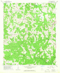 1964 Roopville1966 Print · USGSIn the mid-1960s, the borderlands between Carroll and Heard County remained a tapestry of small church-centered communities and winding creeks. Local historians can trace the foundations of Roopville and Ephesus, or locate landmarks like Unity Cem Ch and the Lookout Tower.2 unique versions available
 - 1964 Map of Lowell, 1966 Print
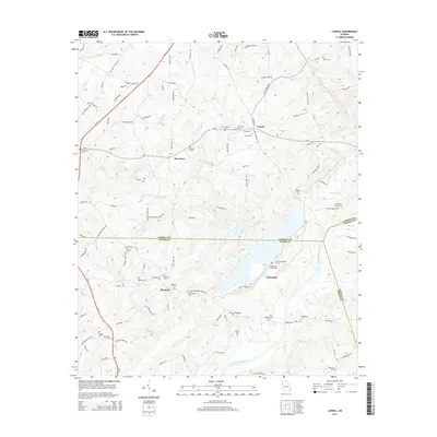
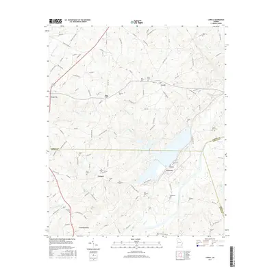
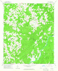 1964 Lowell1966 Print · USGSThe rural landscapes of Carroll and Heard Counties appear here in the mid-1960s, defined by tight-knit communities and winding creeks. Genealogists can trace family lines through several local burial sites like Pentecost Cem and Hollingsworth Cem.2 unique versions available
 - 1978 Map of La Grange, 1980 Print
 1978 La Grange1980 Print · USGSThe Alabama-Georgia borderlands are captured here in the late seventies, just as the newly formed West Point Lake reshaped the eastern landscape. Local historians can trace the Seaboard Coast Line rail corridor through hubs like Roanoke, Ashland, and Lineville.
 - 2011 Map of Lowell, 2011 Print
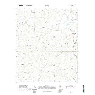
 2011 Lowell2011 Print · USGSCovers Roopville, including Centralhatchee, Glenloch, and other nearby areas
 - 2011 Map of Roopville, 2011 Print
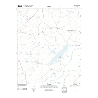
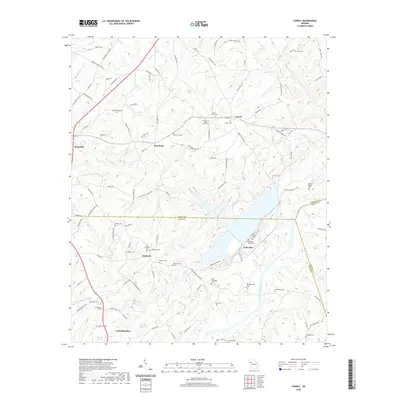
 2011 Roopville2011 Print · USGSCovers Roopville, including Ephesus, Stoney Point, and other nearby areas
 - 2014 Map of Lowell, 2014 Print
 2014 Lowell2014 Print · USGSCovers Roopville, including Centralhatchee, Glenloch, and other nearby areas
 - 2014 Map of Roopville, 2014 Print
 2014 Roopville2014 Print · USGSCovers Roopville, including Ephesus, Stoney Point, and other nearby areas
 - 2017 Map of Lowell, 2017 Print
 2017 Lowell2017 Print · USGSCovers Roopville, including Centralhatchee, Glenloch, and other nearby areas
 - 2017 Map of Roopville, 2017 Print
 2017 Roopville2017 Print · USGSCovers Roopville, including Ephesus, Stoney Point, and other nearby areas
 - 2020 Map of Lowell, 2020 Print
 2020 Lowell2020 Print · USGSCovers Roopville, including Centralhatchee, Glenloch, and other nearby areas
 - 2020 Map of Roopville, 2020 Print
 2020 Roopville2020 Print · USGSCovers Roopville, including Ephesus, Stoney Point, and other nearby areas
 - 2024 Map of Lowell, 2024 Print
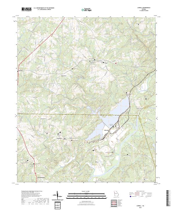 2024 Lowell2024 Print · USGSCarroll and Heard counties in western Georgia are shown at the intersection of rural tradition and modern continuity. Genealogists can trace family heritage through numerous burial sites like Lowell Community Cem and historic meeting places such as Bethel Primitive Baptist Church.
 - 2024 Map of Roopville, 2024 Print
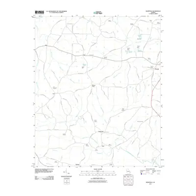
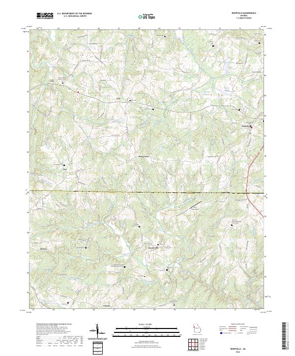 2024 Roopville2024 Print · USGSThe rolling West Georgia hills of Carroll and Heard Counties come alive in this recent survey. Genealogists and historians can trace family-named sites like Roopville City Cem, the Antioch Baptist Church, and the settlement of Roosterville.
End of results
Showing maps 1-18 of 18
Top cities near Roopville
- Carrollton historical maps
- Bremen historical maps
- Tallapoosa historical maps
- Bowdon historical maps
- Mount Zion historical maps
- Franklin historical maps
See more
Frequently asked questions
- What are the different types of historical maps available for Roopville?
- What is the oldest map of Roopville?
- Where can I purchase historical maps of Roopville for my home or office?
- Where can I download high-res historical maps of Roopville?
- Are there historical topographic maps available for Roopville?
- Is there historical aerial imagery available for Roopville?
- Where are historical maps of Roopville sourced from?