Old Maps of Saint George, Georgia for Genealogy
Trace your family roots with 13 historic maps of Saint George. These high-res maps reveal old neighborhoods, homesites, landmarks, and streets — helping you uncover where your ancestors lived and how the area evolved over time.
- Explore historic neighborhoods: Identify where your relatives may have lived in the 1800s or 1900s.
- Compare maps over time: Trace the changes in streets, buildings, and landmarks for multi-generational research.
- Perfect for genealogy & ancestry research: Used by family historians and researchers to map out lineage and migration.
These maps are an incredible resource for exploring your personal connection to Saint George's past.
Saint George, GA maps
(13)- 1918 Map of Moniac
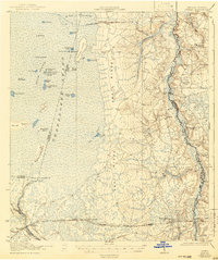
 1918 Moniac1918 Print · USGSThe borderlands of Georgia and Florida come alive in this 1917 survey of the Okeefenokee fringe and the St. Marys River. Researchers can trace the railroad economy through St George and Moniac, or locate family sites like Olivers Mill and the Chesser School.2 unique versions available
 - 1942 Map of Moniac
 1942 Moniac1942 Print · USGSThe Georgia-Florida borderlands were defined by the wilderness of the Okefenokee Swamp and the tracks of the Georgia Southern and Florida railroad. Genealogists and historians can locate old landmarks like Olivers Mill, Deep Creek Church, and several rural schools including Chesser School and Dunn Creek School.2 unique versions available
 - 1954 Map of Valdosta, 1967 Print
 1954 Valdosta1967 Print · USGSThe South Georgia and North Florida borderlands are captured here in the mid-fifties, showing the deep timber and wetland networks of the coastal plain. Researchers can trace the path of the Atlantic Coast Line through Valdosta or explore the interior of the Okefenokee Swamp.2 unique versions available
 - 1958 Map of Valdosta
 1958 Valdosta1958 Print · USGSSouth Georgia and North Florida are captured here in the mid-fifties, showing the vast Okefenokee Swamp and the vital timber and rail corridors connecting the two states. Researchers can locate the footprint of Moody Air Force Base, trace the Live Oak Perry and Gulf railroad, or find early community sites like Bakers Mill and Paradise Church.
 - 1959 Map of Valdosta
 1959 Valdosta1959 Print · USGSThe Georgia-Florida borderlands in the mid-fifties reveal a landscape of massive blackwater swamps and emerging military aviation hubs. Genealogists and historians can trace rail-stop towns like Fargo and Stockton or explore the interior reaches of the Okefenokee Swamp and Billys Island.
 - 1966 Map of St George, 1967 Print
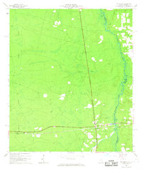 1966 St George1967 Print · USGSThe borderlands of Charlton County, Georgia, and Florida are captured here in the mid-1960s as the Southern railroad connects the rural interior. Genealogists and historians can trace family locations near St George Cemetery, Conner-Green Cem, and the Boone Creek Ch.3 unique versions available
 - 1980 Map of Okefenokee Swamp, 1981 Print
 1980 Okefenokee Swamp1981 Print · USGSThe Georgia-Florida borderlands come to life in the early 1980s, centered on the immense wilderness of the Okefenokee Swamp. Genealogists and historians can trace rail-stop settlements like Fargo and Fruitland or explore the interior geography of Billys Island and Trail Ridge.
 - 1994 Map of Saint George, 1998 Print
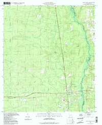 1994 Saint George1998 Print · USGSThe Georgia-Florida borderlands come into focus in the 1990s as the St Marys River meanders through the pine-and-wetland landscape. Genealogists can trace family sites at St George Cemetery and Conner-Green Cem or follow the Old Railroad Grade through St George.
 - 2011 Map of Saint George, 2011 Print
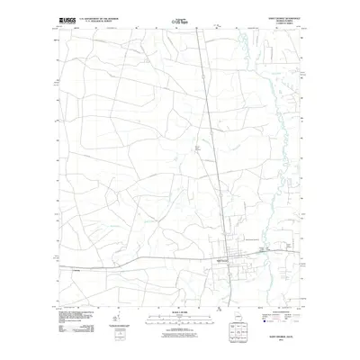 2011 Saint George2011 Print · USGSCovers Saint George, including Clarking, Nassau County, and other nearby areas
 - 2014 Map of Saint George, 2014 Print
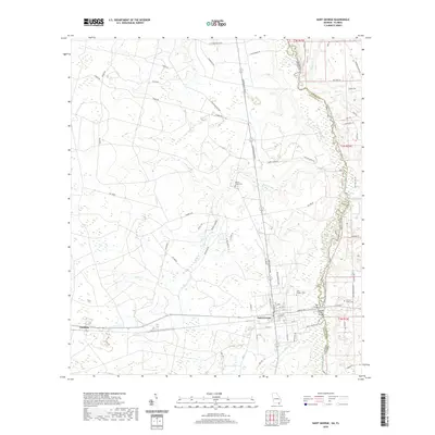
 2014 Saint George2014 Print · USGSCovers Saint George, including Clarking, Nassau County, and other nearby areas
 - 2017 Map of Saint George, 2017 Print
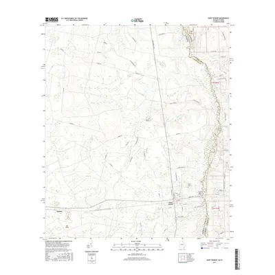 2017 Saint George2017 Print · USGSCovers Saint George, including Clarking, Nassau County, and other nearby areas
 - 2020 Map of Saint George, 2020 Print
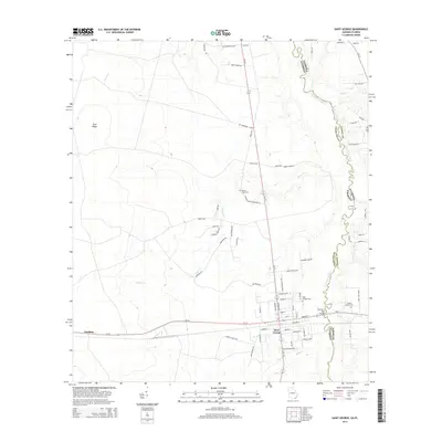
 2020 Saint George2020 Print · USGSCovers Saint George, including Clarking, Nassau County, and other nearby areas
 - 2024 Map of Saint George, 2024 Print
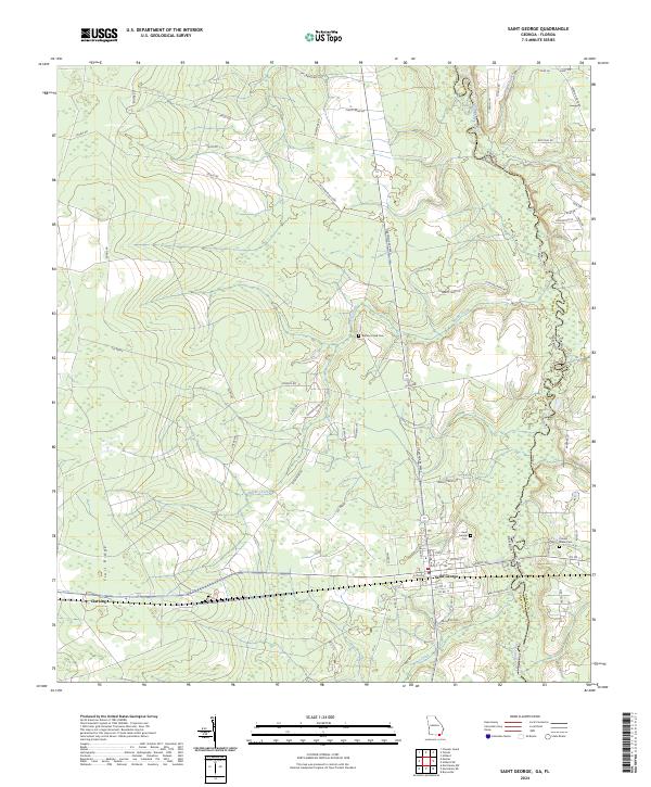 2024 Saint George2024 Print · USGSThe Georgia-Florida borderlands near the Saint Marys River come into focus in this recent survey. Genealogists and local historians can trace family-named sites like Jim Crawford Loop and burial grounds including Saint George Cem and Conner-Green Cem.
End of results
Showing maps 1-13 of 13
Top cities near Saint George
- Jacksonville historical maps
- Macclenny historical maps
- Hilliard historical maps
- Baldwin historical maps
- Callahan historical maps
Frequently asked questions
- What are the different types of historical maps available for Saint George?
- What is the oldest map of Saint George?
- Where can I purchase historical maps of Saint George for my home or office?
- Where can I download high-res historical maps of Saint George?
- Are there historical topographic maps available for Saint George?
- Is there historical aerial imagery available for Saint George?
- Where are historical maps of Saint George sourced from?