Old Maps of Half Moon River Subdivision, Chatham County for Hiking & Exploration
Hike through history with 10 historic maps of Half Moon River Subdivision. Explore old trails, ghost towns, and forgotten backroads — perfect for outdoor adventurers and local explorers.
- Rediscover forgotten places: Map out old mining camps, roads, and footpaths that no longer exist on modern maps.
- Layer with modern tools: Combine with LiDAR or satellite views to plan hikes through historical terrain.
- Made for exploration: Popular among hikers, overlanders, and local history lovers.
Use these maps to find adventure and explore the hidden past of Half Moon River Subdivision.
Half Moon River Subdivision, Chatham County maps
(10)- 1920 Map of Bluffton
 1920 Bluffton1920 Print · USGSCovers Half Moon River Subdivision, including Hilton Head Island, Wilmington Island, and other nearby areas
 - 1945 Map of Bluffton
 1945 Bluffton1945 Print · USGSCovers Half Moon River Subdivision, including Hilton Head Island, Wilmington Island, and other nearby areas
 - 1947 Map of Savannah
 1947 Savannah1947 Print · USGSCovers Half Moon River Subdivision, including Charleston, Savannah, and other nearby areas
 - 1948 Map of Savannah
 1948 Savannah1948 Print · USGSCovers Half Moon River Subdivision, including Charleston, Savannah, and other nearby areas
 - 1955 Map of Fort Pulaski, 1957 Print
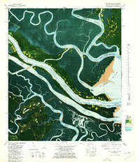
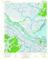 1955 Fort Pulaski1957 Print · USGSCovers Half Moon River Subdivision, including Wilmington Island, Tybee Island, and other nearby areas2 unique versions available
 - 1957 Map of Savannah, 1967 Print
 1957 Savannah1967 Print · USGSCovers Half Moon River Subdivision, including Charleston, Savannah, and other nearby areas4 unique versions available
 - 1960 Map of Savannah
 1960 Savannah1960 Print · USGSCovers Half Moon River Subdivision, including Charleston, Savannah, and other nearby areas
 - 1961 Map of Savannah
 1961 Savannah1961 Print · USGSCovers Half Moon River Subdivision, including Charleston, Savannah, and other nearby areas2 unique versions available
 - 1978 Map of Fort Pulaski
 1978 Fort Pulaski1978 Print · USGSCovers Half Moon River Subdivision, including Wilmington Island, Tybee Island, and other nearby areas2 unique versions available
 - 1978 Map of Beaufort
 1978 Beaufort1978 Print · USGSCovers Half Moon River Subdivision, including Hilton Head Island, Wilmington Island, and other nearby areas2 unique versions available
End of results
Showing maps 1-10 of 10
Frequently asked questions
- What are the different types of historical maps available for Half Moon River Subdivision?
- What is the oldest map of Half Moon River Subdivision?
- Where can I purchase historical maps of Half Moon River Subdivision for my home or office?
- Where can I download high-res historical maps of Half Moon River Subdivision?
- Are there historical topographic maps available for Half Moon River Subdivision?
- Is there historical aerial imagery available for Half Moon River Subdivision?
- Where are historical maps of Half Moon River Subdivision sourced from?