1990s Maps of Clayton County, Georgia
Explore 6 historic maps of Clayton County from the 1990s. These maps offer a rare glimpse into what life looked like during the 1990s — showing old roads, neighborhoods, homes, and landmarks that have changed or disappeared over time.
Whether you're researching your family's past, planning a metal detecting trip, or studying how Clayton County's landscape evolved across the 1990s, these high-resolution maps are a powerful tool for exploring the history of this region.
- Focus on a specific era: All maps on this page are from the 1990s, giving you a focused view of this time period.
- See what’s changed: Compare century-old streets, trails, and buildings to today's modern landscape using overlays and satellite layers.
- Research with precision: Use these maps for genealogy, historical research, land use analysis, or educational projects.
- View, download, or print: Maps are fully viewable online in high resolution, and can be downloaded or printed for your own records.
Start exploring Clayton County's history through authentic maps from the 1990s. This is your window into the past.
Clayton County, GA maps
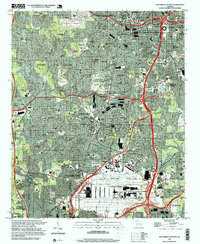
(6)- 1993 Map of Southeast Atlanta, 1995 Print
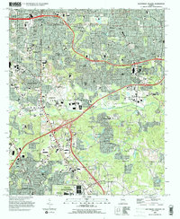 1993 Southeast Atlanta1995 Print · USGSSoutheast Atlanta and its neighboring DeKalb County communities are captured here in the early nineties during a period of established suburban growth. Local historians can trace institutional history through Fort Gillem and the U S Penitentiary, or locate family sites at Oakland Cem and Cedar Grove.
 - 1993 Map of Jonesboro, 1995 Print
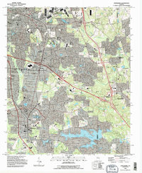 1993 Jonesboro1995 Print · USGSClayton County and parts of Henry County are shown in the early nineties, capturing a period of intense suburban growth and institutional development. Trace local family history and community roots through landmarks like Sylvester Ch, Adamson Cem, and the sprawling Spivey Lake.
 - 1993 Map of Riverdale, 1995 Print
 1993 Riverdale1995 Print · USGSThe south Atlanta suburbs of Clayton and Fulton counties are shown during a phase of rapid residential growth in the 1990s. Genealogists and local historians can trace neighborhood developments alongside longtime landmarks like Philadelphia Ch and the Mundy Cem.
 - 1993 Map of Southwest Atlanta, 1995 Print
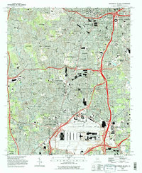 1993 Southwest Atlanta1995 Print · USGSAtlanta and its southern suburbs appear here in the early nineties, a period of massive logistical growth and institutional permanence. Trace family roots and local landmarks from Westview Cemetery to Woodward Academy and the sprawling Fort McPherson.2 unique versions available
 - 1997 Map of Southwest Atlanta, 1999 Print
 1997 Southwest Atlanta1999 Print · USGSSouthwest Atlanta and its neighboring tri-city area are captured in the late nineties as major transit and military hubs. Researchers can trace established neighborhoods and institutions like Westview Cemetery, Woodward Academy, and the Fort McPherson Military Reservation.
 - 1999 Map of Hampton, 2002 Print
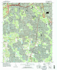
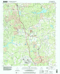 1999 Hampton2002 Print · USGSHenry and Clayton Counties are captured here at the end of the millennium, showing a landscape defined by regional aviation and racing history. Genealogists and historians can trace the areas around Hampton and Lovejoy, locating Noah Ark Ch and Liberty Hill Ch.
End of results
Showing maps 1-6 of 6
Top cities of Clayton County
- Forest Park historical maps
- Riverdale historical maps
- Irondale historical maps
- Morrow historical maps
- Lovejoy historical maps
- Conley historical maps
See more
Frequently asked questions
- What are the different types of historical maps available for Clayton County?
- What is the oldest map of Clayton County?
- Where can I purchase historical maps of Clayton County for my home or office?
- Where can I download high-res historical maps of Clayton County?
- Are there historical topographic maps available for Clayton County?
- Is there historical aerial imagery available for Clayton County?
- Where are historical maps of Clayton County sourced from?