Old Maps of Clayton County, Georgia for Academic Research
Study the evolution of Clayton County with 69 high-resolution historic maps. Whether you're teaching, researching, or modeling changes in land use, these maps provide essential visual documentation of urban, environmental, and geographic change.
- Analyze long-term change: Track patterns in development, transportation, and natural features.
- Ideal for environmental or urban studies: Support academic projects with primary historical map data.
- Use in the classroom or lab: Educators and researchers rely on these maps to bring historical context to life.
These maps are a powerful tool for teaching, research, and visualizing how Clayton County has changed over the decades.
Clayton County, GA maps
(69)- 1888 Map of Atlanta, 1955 Print
 1888 Atlanta1955 Print · USGSAtlanta and its surrounding counties emerge as a booming rail hub in the years following the Civil War. Trace early settlements and infrastructure like Jett Ferry, Oakley Mill, and the massive granite profile of Stone Mountain before the era of modern sprawl.
 - 1890 Map of Atlanta
 1890 Atlanta1890 Print · USGSGeorgia's rail and river networks converge in the late nineteenth century as the capital city expands. Genealogists can trace family homesteads near Jetts Store, Howells Mills, and the various river crossings like Paces Ferry.
 - 1892 Map of Atlanta
 1892 Atlanta1892 Print · USGSAtlanta and its surrounding counties appear at a pivotal moment of post-war growth as the region's rail network reached maturity. Genealogists and historians can trace the foundations of modern DeKalb and Fulton counties through landmarks like Stone Mountain, Roswell Junction, and Paces Ferry.
 - 1895 Map of Atlanta
 1895 Atlanta1895 Print · USGSThe growing railroad hub of Atlanta is shown here in the late nineteenth century alongside its surrounding river ferries and emerging suburbs. Trace old family names and sites like Howell Mills, Vining Station, and Ft. McPherson.7 unique versions available
 - 1953 Map of Atlanta, 1965 Print
 1953 Atlanta1965 Print · USGSThe growing Atlanta metro and the industrial corridors of Eastern Alabama are captured here during the mid-century transition. Researchers can trace the rail-to-road shift through hubs like Anniston and La Grange or locate sites within Fort McClellan.2 unique versions available
 - 1954 Map of Conley, 1956 Print
 1954 Conley1956 Print · USGSAtlanta's southeastern suburbs and industrial corridors are captured here during a period of significant post-war growth. Genealogists and local historians can trace family locations through numerous sites like South View Cem, Boulder Crest School, and the Prison Farm.5 unique versions available
 - 1954 Map of Jonesboro, 1956 Print
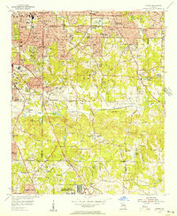
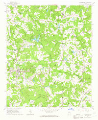
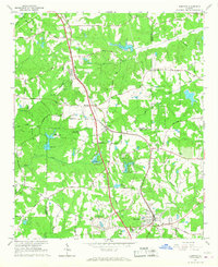
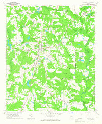
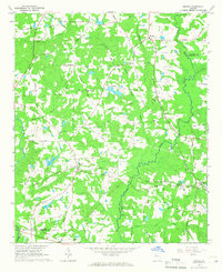
 1954 Jonesboro1956 Print · USGSClayton County in the mid-fifties shows a landscape of growing towns and significant military infrastructure along the Central of Georgia rail line. Researchers can locate early schools and rural landmarks like North Jonesboro Sch, the Boy Scout Camp, and Sylvester Ch.5 unique versions available
 - 1954 Map of Riverdale, 1956 Print
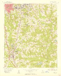
 1954 Riverdale1956 Print · USGSClayton and Fulton counties are captured in the mid-fifties, showing a landscape of burgeoning towns and deep-rooted rural churches. Researchers can trace family history through Carver Memorial Park Cemetery or locate old sites like Red Oak and Kenwood.5 unique versions available
 - 1954 Map of East Point, 1957 Print
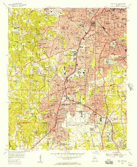 1954 East Point1957 Print · USGSSouth of the city during the mid-fifties, the booming aviation and rail corridor defines the landscape from the airport through the tri-cities. Researchers can trace established neighborhoods and institutions like Fort McPherson, Georgia Military Academy, and West View Cemetery.5 unique versions available
 - 1957 Map of Atlanta
 1957 Atlanta1957 Print · USGSAtlanta and the Alabama borderlands appear here in the mid-fifties, capturing the region's post-war suburban and industrial transition. Trace the development of early transport hubs and military sites like Fort McPherson, Anniston, and the Kennesaw Mountain National Battlefield Park.
 - 1958 Map of Atlanta
 1958 Atlanta1958 Print · USGSMid-century Georgia and Alabama are shown in this regional study of the corridor between the Chattahoochee River and the Appalachian foothills. Local historians can trace the development of suburban Atlanta alongside vital landmarks like Stone Mountain, Dobbins AFB, and the Seaboard Air Line rail routes.
 - 1964 Map of Stockbridge, 1966 Print
 1964 Stockbridge1966 Print · USGSStockbridge and its rural Henry County surroundings are captured in the mid-1960s as the area transitions from a mill-and-rail economy to modern settlement. Genealogists and historians can trace family-named sites like Millers Mill, Hannahs Millpond, and Price Quarters along the creek valleys.3 unique versions available
 - 1965 Map of Hampton, 1967 Print
 1965 Hampton1967 Print · USGSHampton and Lovejoy are captured during a period of transition in the mid-1960s, as traditional rail corridors met new regional infrastructure. Researchers can trace the Central of Georgia railroad, locate the Atlanta International Raceway, and find local landmarks like Shiloh Ch or Noah Ark.3 unique versions available
 - 1965 Map of Fayetteville, 1967 Print
 1965 Fayetteville1967 Print · USGSMid-century Fayette County comes to life in this detailed survey, showing the county seat just as modern development began to reach into its rural surrounds. Genealogists and historians can trace family locations near Inman, Mundys Mill, and country churches like Lisbon Ch.3 unique versions available
 - 1965 Map of Griffin North, 1967 Print
 1965 Griffin North1967 Print · USGSSpalding County's textile and agricultural roots are on full display during the mid-sixties as the northern outskirts of Griffin expand. Researchers can trace the industrial corridor of Highland Mills, the sprawling State Experimental Farms, and rural landmarks like West Sunny Side Ch.2 unique versions available
 - 1965 Map of Brooks, 1967 Print
 1965 Brooks1967 Print · USGSIn the mid-1960s, this portion of Georgia remained a deeply rural landscape defined by the Flint River and small rail-side communities. Genealogists can trace family footprints along the Central of Georgia railroad near Rio and Vaughn.2 unique versions available
 - 1979 Map of Griffin, 1980 Print
 1979 Griffin1980 Print · USGSWest-central Georgia at the close of the seventies reveals a landscape of historic rail towns and growing suburbs between the major river systems. Trace the rail lines and early road networks connecting Griffin, Peachtree City, and Newnan, or locate smaller settlements like Senoia and Experiment.3 unique versions available
 - 1981 Map of Atlanta, 1982 Print
 1981 Atlanta1982 Print · USGSThe Atlanta metro area is shown during its late-century boom, following the completion of the beltway and the rise of its major international airport. Trace the growth of suburbs from Mableton to Tucker and the footprints of Fort McPherson and Stone Mtn.
 - 1993 Map of Southeast Atlanta, 1995 Print
 1993 Southeast Atlanta1995 Print · USGSSoutheast Atlanta and its neighboring DeKalb County communities are captured here in the early nineties during a period of established suburban growth. Local historians can trace institutional history through Fort Gillem and the U S Penitentiary, or locate family sites at Oakland Cem and Cedar Grove.
 - 1993 Map of Jonesboro, 1995 Print
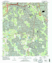
 1993 Jonesboro1995 Print · USGSClayton County and parts of Henry County are shown in the early nineties, capturing a period of intense suburban growth and institutional development. Trace local family history and community roots through landmarks like Sylvester Ch, Adamson Cem, and the sprawling Spivey Lake.
 - 1993 Map of Riverdale, 1995 Print
 1993 Riverdale1995 Print · USGSThe south Atlanta suburbs of Clayton and Fulton counties are shown during a phase of rapid residential growth in the 1990s. Genealogists and local historians can trace neighborhood developments alongside longtime landmarks like Philadelphia Ch and the Mundy Cem.
 - 1993 Map of Southwest Atlanta, 1995 Print
 1993 Southwest Atlanta1995 Print · USGSAtlanta and its southern suburbs appear here in the early nineties, a period of massive logistical growth and institutional permanence. Trace family roots and local landmarks from Westview Cemetery to Woodward Academy and the sprawling Fort McPherson.2 unique versions available
 - 1997 Map of Southwest Atlanta, 1999 Print
 1997 Southwest Atlanta1999 Print · USGSSouthwest Atlanta and its neighboring tri-city area are captured in the late nineties as major transit and military hubs. Researchers can trace established neighborhoods and institutions like Westview Cemetery, Woodward Academy, and the Fort McPherson Military Reservation.
 - 1999 Map of Hampton, 2002 Print
 1999 Hampton2002 Print · USGSHenry and Clayton Counties are captured here at the end of the millennium, showing a landscape defined by regional aviation and racing history. Genealogists and historians can trace the areas around Hampton and Lovejoy, locating Noah Ark Ch and Liberty Hill Ch.
 - 2011 Map of Jonesboro, 2011 Print
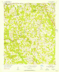
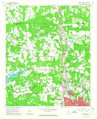
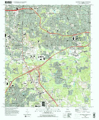
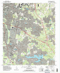
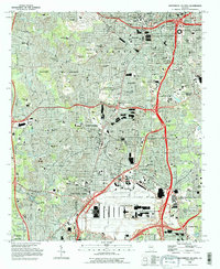
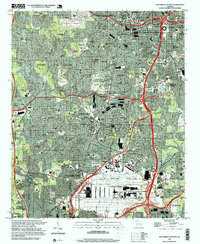
 2011 Jonesboro2011 Print · USGSCovers Clayton County, including Stockbridge, Forest Park, and other nearby areas
Showing maps 1-25 of 69
Top cities of Clayton County
- Forest Park historical maps
- Riverdale historical maps
- Irondale historical maps
- Morrow historical maps
- Lovejoy historical maps
- Conley historical maps
See more
Frequently asked questions
- What are the different types of historical maps available for Clayton County?
- What is the oldest map of Clayton County?
- Where can I purchase historical maps of Clayton County for my home or office?
- Where can I download high-res historical maps of Clayton County?
- Are there historical topographic maps available for Clayton County?
- Is there historical aerial imagery available for Clayton County?
- Where are historical maps of Clayton County sourced from?