Old Maps of Shiloh Valley, Cobb County for Hiking & Exploration
Hike through history with 22 historic maps of Shiloh Valley. Explore old trails, ghost towns, and forgotten backroads — perfect for outdoor adventurers and local explorers.
- Rediscover forgotten places: Map out old mining camps, roads, and footpaths that no longer exist on modern maps.
- Layer with modern tools: Combine with LiDAR or satellite views to plan hikes through historical terrain.
- Made for exploration: Popular among hikers, overlanders, and local history lovers.
Use these maps to find adventure and explore the hidden past of Shiloh Valley.
Shiloh Valley, Cobb County maps
(22)- 1890 Map of Cartersville
 1890 Cartersville1890 Print · USGSCovers Shiloh Valley, including Marietta, Kennesaw, and other nearby areas
 - 1891 Map of Marietta
 1891 Marietta1891 Print · USGSCovers Shiloh Valley, including Atlanta, South Fulton, and other nearby areas
 - 1891 Map of Cartersville
 1891 Cartersville1891 Print · USGSCovers Shiloh Valley, including Marietta, Kennesaw, and other nearby areas
 - 1895 Map of Marietta
 1895 Marietta1895 Print · USGSCovers Shiloh Valley, including Atlanta, South Fulton, and other nearby areas
 - 1896 Map of Cartersville
 1896 Cartersville1896 Print · USGSCovers Shiloh Valley, including Marietta, Kennesaw, and other nearby areas4 unique versions available
 - 1897 Map of Marietta
 1897 Marietta1897 Print · USGSCovers Shiloh Valley, including Atlanta, South Fulton, and other nearby areas
 - 1901 Map of Marietta
 1901 Marietta1901 Print · USGSCovers Shiloh Valley, including Atlanta, South Fulton, and other nearby areas4 unique versions available
 - 1907 Map of Acworth, 1954 Print
 1907 Acworth1954 Print · USGSCovers Shiloh Valley, including Marietta, Kennesaw, and other nearby areas
 - 1909 Map of Acworth
 1909 Acworth1909 Print · USGSCovers Shiloh Valley, including Marietta, Kennesaw, and other nearby areas
 - 1953 Map of Atlanta, 1965 Print
 1953 Atlanta1965 Print · USGSCovers Shiloh Valley, including Atlanta, Sandy Springs, and other nearby areas2 unique versions available
 - 1954 Map of Marietta, 1957 Print
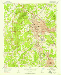 1954 Marietta1957 Print · USGSCovers Shiloh Valley, including Marietta, Smyrna, and other nearby areas6 unique versions available
 - 1955 Map of Rome
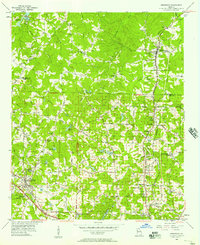
 1955 Rome1955 Print · USGSCovers Shiloh Valley, including Chattanooga, Sandy Springs, and other nearby areas
 - 1956 Map of Kennesaw, 1957 Print
 1956 Kennesaw1957 Print · USGSCovers Shiloh Valley, including Marietta, Kennesaw, and other nearby areas5 unique versions available
 - 1957 Map of Atlanta
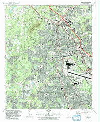
 1957 Atlanta1957 Print · USGSCovers Shiloh Valley, including Atlanta, Sandy Springs, and other nearby areas
 - 1958 Map of Atlanta
 1958 Atlanta1958 Print · USGSCovers Shiloh Valley, including Atlanta, Sandy Springs, and other nearby areas
 - 1958 Map of Rome, 1966 Print
 1958 Rome1966 Print · USGSCovers Shiloh Valley, including Chattanooga, Sandy Springs, and other nearby areas3 unique versions available
 - 1961 Map of Rome
 1961 Rome1961 Print · USGSCovers Shiloh Valley, including Chattanooga, Sandy Springs, and other nearby areas
 - 1963 Map of Rome
 1963 Rome1963 Print · USGSCovers Shiloh Valley, including Chattanooga, Sandy Springs, and other nearby areas
 - 1981 Map of Cartersville, 1982 Print
 1981 Cartersville1982 Print · USGSCovers Shiloh Valley, including Sandy Springs, Roswell, and other nearby areas2 unique versions available
 - 1981 Map of Atlanta, 1982 Print
 1981 Atlanta1982 Print · USGSCovers Shiloh Valley, including Atlanta, Sandy Springs, and other nearby areas
 - 1992 Map of Marietta
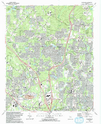
 1992 Marietta1992 Print · USGSCovers Shiloh Valley, including Marietta, Smyrna, and other nearby areas2 unique versions available
 - 1992 Map of Kennesaw, 1993 Print
 1992 Kennesaw1993 Print · USGSCovers Shiloh Valley, including Marietta, Kennesaw, and other nearby areas2 unique versions available
End of results
Showing maps 1-22 of 22
Frequently asked questions
- What are the different types of historical maps available for Shiloh Valley?
- What is the oldest map of Shiloh Valley?
- Where can I purchase historical maps of Shiloh Valley for my home or office?
- Where can I download high-res historical maps of Shiloh Valley?
- Are there historical topographic maps available for Shiloh Valley?
- Is there historical aerial imagery available for Shiloh Valley?
- Where are historical maps of Shiloh Valley sourced from?