Old Maps of Coweta County, Georgia for Metal Detecting
Plan your next treasure hunt with 122 historic maps of Coweta County. Find old homesites, ghost towns, trails, and gathering spots that may be lost to time — perfect for identifying promising metal detecting locations.
- Locate forgotten sites: Uncover places like long-lost settlements, abandoned rail lines, or gathering spots.
- Plan better hunts: Use map overlays combined with LiDAR or satellite views to narrow in on historically rich areas.
- Made for detectorists: Thousands of hobbyists use these maps to discover relics, coins, and hidden history.
Use these historic maps to boost your research and find new opportunities beneath the surface of Coweta County.
Coweta County, GA maps
(122)- 1891 Map of Marietta
 1891 Marietta1891 Print · USGSNorth Georgia at the close of the nineteenth century is captured here as the railroad began to reshape the river-dependent landscape. Genealogists can locate family-named landmarks like Allens Mills or trace historic river crossings at Campbellton Fy and Hutchinsons Ferry.
 - 1895 Map of Marietta
 1895 Marietta1895 Print · USGSNorthwest Georgia in the 1890s appears as a landscape defined by the winding Chattahoochee River and the rapid expansion of iron rails. Genealogists can trace early family-named river crossings like Morris Ferry or explore the origins of Old Villarica and Bright Star.
 - 1897 Map of Marietta
 1897 Marietta1897 Print · USGSNorthwest Georgia in the late nineteenth century was a landscape defined by river crossings and expanding rail lines. Genealogists and historians can trace defunct river crossings like Pumpkintown Ferry and old industrial sites like Daniels Mills or Beatty Switch.
 - 1899 Map of Wedowee, 1958 Print
 1899 Wedowee1958 Print · USGSEastern Alabama and western Georgia are mapped here at the close of the nineteenth century, documenting the rural river-and-rail landscape. Researchers can trace historic crossings like Philpots Ferry and early industrial sites such as the Copper Mine.
 - 1901 Map of Marietta
 1901 Marietta1901 Print · USGSNorthwest Georgia at the turn of the century is a landscape of growing rail towns and vital river crossings. Researchers can trace early rural life through features like Old Villarica, Pumpkintown Ferry, and the Mount Zion Church.4 unique versions available
 - 1902 Map of Wedowee
 1902 Wedowee1902 Print · USGSThe Alabama and Georgia state line bisects this turn-of-the-century landscape of river crossings and hill-country settlements. Genealogists can trace early homesteads and commerce at Philpots Ferry, the Copper Mine, or the town of Wedowee.3 unique versions available
 - 1953 Map of Atlanta, 1965 Print
 1953 Atlanta1965 Print · USGSThe growing Atlanta metro and the industrial corridors of Eastern Alabama are captured here during the mid-century transition. Researchers can trace the rail-to-road shift through hubs like Anniston and La Grange or locate sites within Fort McClellan.2 unique versions available
 - 1954 Map of Palmetto, 1955 Print
 1954 Palmetto1955 Print · USGSThe Palmetto area and the Chattahoochee riverfront appear here in the mid-fifties, just as the local rural character began to meet postwar growth. Researchers can locate family landmarks like Friendship Ch, Cedar Grove Sch, and the Landing Field.4 unique versions available
 - 1954 Map of Fairburn, 1956 Print
 1954 Fairburn1956 Print · USGSFulton County and its southern neighbors show a landscape of growing rail towns and rural homesteads in the early fifties. Genealogists can trace family landmarks and community centers like Word Sch, Rock Ch, and the Harmony Grove Cem before modern development.6 unique versions available
 - 1957 Map of Atlanta
 1957 Atlanta1957 Print · USGSAtlanta and the Alabama borderlands appear here in the mid-fifties, capturing the region's post-war suburban and industrial transition. Trace the development of early transport hubs and military sites like Fort McPherson, Anniston, and the Kennesaw Mountain National Battlefield Park.
 - 1958 Map of Rico
 1958 Rico1958 Print · USGSThe rural borders of Fulton and Douglas counties come alive in the late fifties along the banks of the Chattahoochee River. Genealogists and historians can trace community landmarks like Providence Ch, Fairplay Sch, and the winding Yellow Ferry Road.3 unique versions available
 - 1958 Map of Atlanta
 1958 Atlanta1958 Print · USGSMid-century Georgia and Alabama are shown in this regional study of the corridor between the Chattahoochee River and the Appalachian foothills. Local historians can trace the development of suburban Atlanta alongside vital landmarks like Stone Mountain, Dobbins AFB, and the Seaboard Air Line rail routes.
 - 1958 Map of Villa Rica, 1960 Print
 1958 Villa Rica1960 Print · USGSThe West Georgia countryside in the late fifties centered on the Chattahoochee River and the industrial activity at Banning Mills. Genealogists can trace family-named crossroads and rural landmarks like Hickory Level, Fouts Mill, and Bright Star Ch.2 unique versions available
 - 1964 Map of Hogansville, 1965 Print
 1964 Hogansville1965 Print · USGSHogansville and its surrounding crossroads are captured here in the mid-1960s, showing a landscape defined by the Atlanta and West Point rail line. Genealogists can trace family landmarks like Myrtle Hill Cemetery and old rural meeting places such as Harmonia Ch or Corinth.3 unique versions available
 - 1964 Map of Grantville, 1966 Print
 1964 Grantville1966 Print · USGSWest-central Georgia at the height of the sixties is documented here as the railroad corridor connects rural communities across three counties. Genealogists can trace family names at Holly Springs Cem or locate the High Sch and St Pauls Ch in the Lone Oak area.3 unique versions available
 - 1964 Map of Lowell, 1966 Print
 1964 Lowell1966 Print · USGSThe rural landscapes of Carroll and Heard Counties appear here in the mid-1960s, defined by tight-knit communities and winding creeks. Genealogists can trace family lines through several local burial sites like Pentecost Cem and Hollingsworth Cem.2 unique versions available
 - 1965 Map of Newnan South, 1966 Print
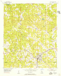
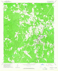
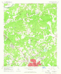
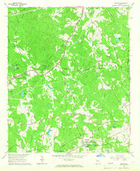
 1965 Newnan South1966 Print · USGSCoweta County comes into focus during the mid-sixties, capturing the growth of Newnan and its surrounding rail-side villages. Researchers can trace family history through numerous landmarks like Westview Cem, Bohanon Crossroad, and Old Bethlehem Ch.3 unique versions available
 - 1965 Map of Newnan North, 1966 Print
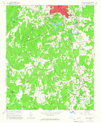
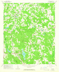
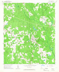
 1965 Newnan North1966 Print · USGSIn the mid-sixties, the area north of Newnan was a mix of growing neighborhoods and long-standing rural outposts. Genealogists and historians can trace family roots through landmarks like Sewell Millpond, Jones Chapel Cem, and the industrial hamlet of Arneo Mills.3 unique versions available
 - 1965 Map of Tyrone, 1966 Print
 1965 Tyrone1966 Print · USGSFayette County in the mid-sixties shows a transition from rural rail-line settlements to planned suburban growth. Genealogists and historians can trace the foundations of Peachtree City near Lake Peachtree or locate old community anchors like Shake Rag and Liberty Hill Ch.2 unique versions available
 - 1965 Map of Newnan SW, 1966 Print
 1965 Newnan SW1966 Print · USGSCoweta and Heard Counties are captured here in the mid-1960s, showing a rural landscape defined by creek drainages and small crossroads settlements. Genealogists can trace family roots through numerous landmarks such as Emory Chapel, St Smyrna Ch, and Stallings Crossroads.2 unique versions available
 - 1965 Map of Whitesburg, 1966 Print
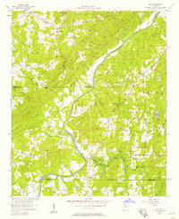
 1965 Whitesburg1966 Print · USGSThe Chattahoochee River corridor in the mid-1960s reveals a rural landscape transitioning toward modern infrastructure. Genealogists can trace family roots through landmarks like Rotherwood Ch, the Springer Cem, and schools such as Western High Sch.3 unique versions available
 - 1965 Map of Madras, 1967 Print
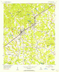
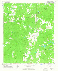
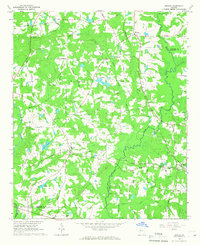
 1965 Madras1967 Print · USGSCoweta County in the mid-sixties shows a landscape of growing infrastructure along the Atlanta and West Point railroad. Genealogists and local historians can trace family-named landmarks like Sullivan Lake, McCollum, and Cokes Chapel.4 unique versions available
 - 1965 Map of Senoia, 1967 Print
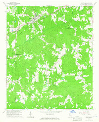
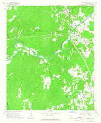
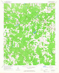
 1965 Senoia1967 Print · USGSMid-century Coweta and Fayette Counties come alive at the junction of two major rail lines during a period of steady local growth. Genealogists and researchers can locate family-named sites like Starrs Mill, Peeks Crossing, and rural landmarks such as Bethlehem Ch.2 unique versions available
 - 1965 Map of Brooks, 1967 Print
 1965 Brooks1967 Print · USGSIn the mid-1960s, this portion of Georgia remained a deeply rural landscape defined by the Flint River and small rail-side communities. Genealogists can trace family footprints along the Central of Georgia railroad near Rio and Vaughn.2 unique versions available
 - 1965 Map of Sharpsburg, 1967 Print
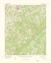
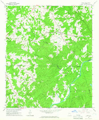
 1965 Sharpsburg1967 Print · USGSSharpsburg and Turin are at the heart of this mid-century survey of Coweta County, where the rail lines and creek bottoms shaped local life. Genealogists and historians can trace family-named landmarks like Elders Mill, White Oak Grove Ch, and Bexton.2 unique versions available
Showing maps 1-25 of 122
Top cities of Coweta County
- Newnan historical maps
- Senoia historical maps
- Grantville historical maps
- East Newnan historical maps
- Moreland historical maps
- Sharpsburg historical maps
See more
Frequently asked questions
- What are the different types of historical maps available for Coweta County?
- What is the oldest map of Coweta County?
- Where can I purchase historical maps of Coweta County for my home or office?
- Where can I download high-res historical maps of Coweta County?
- Are there historical topographic maps available for Coweta County?
- Is there historical aerial imagery available for Coweta County?
- Where are historical maps of Coweta County sourced from?