Old Maps of Decatur County, Georgia
Explore 117 old maps of Decatur County, spanning from 1953 to today. These high-resolution historic maps reveal how streets, neighborhoods, landmarks, and natural features evolved over time — perfect for genealogy, metal detecting, research, and local history exploration.
What you can do with these maps:
- See how Decatur County changed over time: Compare historical maps to modern-day views to trace roads, homesites, rail lines & more.
- View detailed metadata: Each map includes creators, publishers, year, scale, and archive source.
- Overlay maps with satellite & LiDAR: Visualize the past alongside modern tools to explore terrain & human change.
- Trusted historical sources: Maps sourced from the USGS, Library of Congress, and other archives.
- Access maps your way: View online, download high-res files, or order prints for personal or research use.
Start exploring old maps of Decatur County to uncover forgotten places, hidden landmarks, and the deep history beneath your feet.
Decatur County, GA maps
(117)- 1953 Map of Dothan, 1966 Print
 1953 Dothan1966 Print · USGSSoutheast Alabama and Southwest Georgia are captured during a period of massive hydraulic and military expansion in the mid-fifties. Genealogists and historians can trace rural landmarks like Antioch Church and School, the Andrew Jackson Monument, and the early footprint of Fort Rucker Military Reservation.3 unique versions available
 - 1954 Map of Dothan
 1954 Dothan1954 Print · USGSSoutheast Alabama and Southwest Georgia are seen here in the mid-fifties, during a decade of military expansion and rural transition. Genealogists can trace the location of country schools like Little Zion School or the grounds of Kolomoki Mounds State Park.
 - 1954 Map of Desser, 1955 Print
 1954 Desser1955 Print · USGSSeminole County was a landscape of cypress ponds and rail-linked settlements in the mid-fifties. Researchers can trace family history at Rock Pond Courthouse or find rural landmarks like Olive Grove Ch and Trawick Cem.3 unique versions available
 - 1954 Map of Tallahassee, 1967 Print
 1954 Tallahassee1967 Print · USGSThe Florida Panhandle and South Georgia are captured here during a period of mid-century growth and military expansion. Researchers can trace the development of Panama City, the footprint of Tyndall Air Force Base, and the rail lines of the Atlantic Coast Line.4 unique versions available
 - 1955 Map of Dothan
 1955 Dothan1955 Print · USGSSoutheast Alabama and Southwest Georgia are captured here in the mid-fifties, showing a landscape of river-port history and growing military bases. Researchers can trace rural life via the Andrew Jackson Monument, Bauxite mines, and the Central of Georgia RR.
 - 1955 Map of Reynoldsville, 1956 Print
 1955 Reynoldsville1956 Print · USGSThe Seminole County borderlands are seen here in the mid-fifties as massive water projects reshape the landscape near Reynoldsville. Researchers can trace old family sites at Sealy Plantation, Spring Creek Courthouse, and the FDR Sch.4 unique versions available
 - 1955 Map of Chattahoochee, 1956 Print
 1955 Chattahoochee1956 Print · USGSThe tri-river confluence at the Georgia-Florida border comes alive in the mid-fifties, showing the impact of the newly completed Jim Woodruff Dam. Genealogists and rail historians can trace the State Hospital grounds, local crossings at River Junction, and several rural burial sites like Freeman Cem.2 unique versions available
 - 1955 Map of Bainbridge, 1957 Print
 1955 Bainbridge1957 Print · USGSDecatur County, Georgia, during the mid-fifties is captured here as the new reservoir begins to reshape the landscape. Local historians can trace family roots through numerous rural landmarks like Missouri Mission Ch, Green Shade Cem, and the Fowltown PO.
 - 1955 Map of Whigham, 1957 Print
 1955 Whigham1957 Print · USGSThe rural landscape of South Georgia comes alive in the mid-1950s, showing a region shaped by dual rail lines and scattered agricultural hamlets. Genealogists and historians can trace family roots through numerous churches and schools like Union Spring Ch and Bell-Dixon Sch, or locate industrial sites such as the local Strip Mines.2 unique versions available
 - 1955 Map of Mt Pleasant, 1957 Print
 1955 Mt Pleasant1957 Print · USGSThe Florida-Georgia borderlands are captured here during the mid-twentieth century, showing a landscape of timber and rail. Researchers can locate family landmarks like Mt Glory Ch Cem and tracing the old paths of the Seaboard Air Line and Hardaway.2 unique versions available
 - 1956 Map of Havana North, 1957 Print
 1956 Havana North1957 Print · USGSCrossing the Georgia-Florida border in the mid-1950s, this area shows a rail-dependent agricultural landscape before the expansion of the modern highway system. Genealogists can trace family names at Woodberry Cem, Darsey Cem, and the Mt Zion Sch (Abandoned).2 unique versions available
 - 1956 Map of Dogtown, 1957 Print
 1956 Dogtown1957 Print · USGSThe Georgia and Florida borderlands come alive in the mid-1950s, showing a rural landscape of scattered homesteads and industrial excavations. Genealogists can trace family roots through numerous small burial grounds and pulpits, including Campbell Chapel, Pottevint Cem, and the old Oak Grove Sch.2 unique versions available
 - 1959 Map of Tallahassee
 1959 Tallahassee1959 Print · USGSFlorida's Panhandle and the Big Bend region appear here in the mid-fifties, showing a landscape defined by its great river systems and developing coast. Trace the early layout of Panama City, the expansive Apalachicola National Forest, and the coastal St Marks Lighthouse.
 - 1960 Map of Tallahassee
 1960 Tallahassee1960 Print · USGSThe Florida Panhandle and southern Georgia are captured here in the mid-twentieth century, showing a region defined by its rivers and military installations. Genealogists and historians can trace the growth of Tallahassee or locate coastal landmarks like the St Marks Lighthouse and Tyndall Air Force Base.
 - 1971 Map of Vada, 1974 Print
 1971 Vada1974 Print · USGSDecatur and Mitchell counties are captured here in the early seventies, showing a rural landscape defined by karst sinks and small farming communities. Researchers can trace family sites at Salem Cem, Vada, and numerous country churches like Oak Grove Ch.2 unique versions available
 - 1974 Map of Boykin, 1976 Print
 1974 Boykin1976 Print · USGSThe rural expanse of Miller and Decatur counties is captured here in the mid-seventies, showing the rail-side growth of communities like Boykin and Eldorendo. Genealogists can locate family landmarks including Lane Cem, Evergreen Ch, and Pilgrims Rest Ch.
 - 1974 Map of Bainbridge, 1976 Print
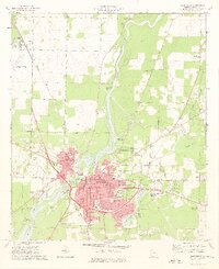 1974 Bainbridge1976 Print · USGSBainbridge sits at a technological and industrial crossroads in the mid-seventies, dominated by the Flint River and the Seaboard Coast Line. Researchers can locate numerous neighborhood landmarks like the Hutto Jr High Sch, Oak City Cem, and Mt Zion Ch.2 unique versions available
 - 1974 Map of Faceville, 1976 Print
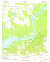 1974 Faceville1976 Print · USGSDecatur County, Georgia, is shown here in the mid-seventies, where the Flint River waters spread across the landscape. Genealogists and historians can trace the rural communities of Bethany and Faceville, or locate family landmarks like Breedlove Cem and Salem Ch.
 - 1974 Map of Donalsonville East, 1976 Print
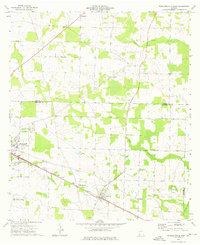 1974 Donalsonville East1976 Print · USGSSeminole County was a landscape of quiet agricultural hamlets and rail-side settlements in the mid-seventies. Genealogists can trace family landmarks like Friendship Cem and Miller Cems, or locate rural congregations at Corinth Ch and New Home Ch.
 - 1974 Map of Fowlstown, 1976 Print
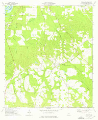 1974 Fowlstown1976 Print · USGSDecatur County in the mid-1970s is captured here at the intersection of the Seaboard Coast Line and the Flint River. Genealogists can trace several community hubs like Fowlstown and find rural landmarks such as Mt Nebo Ch Cem and Emanuel Ch.
 - 1974 Map of Brinson, 1976 Print
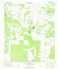 1974 Brinson1976 Print · USGSSouth Georgia's agricultural and institutional landscape comes to life in this mid-seventies survey of western Decatur County. Genealogists and researchers can trace local landmarks like Bainbridge State Hospital, Yates Springs, and the Jackson Cem.
 - 1974 Map of Climax North, 1976 Print
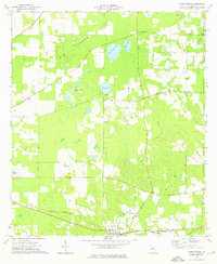 1974 Climax North1976 Print · USGSThe rural landscape of Decatur County in the mid-1970s reveals a community centered on the rail junction at Climax. Genealogists and local historians can trace rural family roots through numerous sites like Fleatown Cem, Travelers Rest Ch, and Parker Courthouse.
 - 1974 Map of Steinham Store, 1976 Print
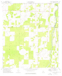 1974 Steinham Store1976 Print · USGSThe rural Georgia backcountry in the mid-seventies is defined here by the winding Flint River and a network of quiet country crossroads. Genealogists can trace family connections to several local congregations like First Macedonia Ch and the landmark Steinham Store.
 - 1974 Map of Climax South, 1976 Print
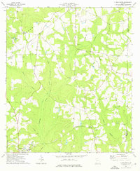 1974 Climax South1976 Print · USGSDecatur County during the mid-seventies shows a landscape of established rural settlements and rail-line communities. Researchers can trace family history through numerous rural landmarks like Samuel Cem, Antioch Ch, and the town of Attapulgus.
 - 1978 Map of Bainbridge, 1980 Print
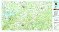 1978 Bainbridge1980 Print · USGSIn the late seventies, this Georgia-Florida borderland was defined by the confluence of the Flint and Chattahoochee rivers. Trace the region's infrastructure via the Seaboard Coast Line Railroad and find sites like Bainbridge State Hospital.
Showing maps 1-25 of 117
Top cities of Decatur County
Frequently asked questions
- What are the different types of historical maps available for Decatur County?
- What is the oldest map of Decatur County?
- Where can I purchase historical maps of Decatur County for my home or office?
- Where can I download high-res historical maps of Decatur County?
- Are there historical topographic maps available for Decatur County?
- Is there historical aerial imagery available for Decatur County?
- Where are historical maps of Decatur County sourced from?