Old Maps of DeKalb County, Georgia for Hiking & Exploration
Hike through history with 73 historic maps of DeKalb County. Explore old trails, ghost towns, and forgotten backroads — perfect for outdoor adventurers and local explorers.
- Rediscover forgotten places: Map out old mining camps, roads, and footpaths that no longer exist on modern maps.
- Layer with modern tools: Combine with LiDAR or satellite views to plan hikes through historical terrain.
- Made for exploration: Popular among hikers, overlanders, and local history lovers.
Use these maps to find adventure and explore the hidden past of DeKalb County.
DeKalb County, GA maps
(73)- 1888 Map of Atlanta, 1955 Print
 1888 Atlanta1955 Print · USGSAtlanta and its surrounding counties emerge as a booming rail hub in the years following the Civil War. Trace early settlements and infrastructure like Jett Ferry, Oakley Mill, and the massive granite profile of Stone Mountain before the era of modern sprawl.
 - 1890 Map of Atlanta
 1890 Atlanta1890 Print · USGSGeorgia's rail and river networks converge in the late nineteenth century as the capital city expands. Genealogists can trace family homesteads near Jetts Store, Howells Mills, and the various river crossings like Paces Ferry.
 - 1892 Map of Atlanta
 1892 Atlanta1892 Print · USGSAtlanta and its surrounding counties appear at a pivotal moment of post-war growth as the region's rail network reached maturity. Genealogists and historians can trace the foundations of modern DeKalb and Fulton counties through landmarks like Stone Mountain, Roswell Junction, and Paces Ferry.
 - 1895 Map of Atlanta
 1895 Atlanta1895 Print · USGSThe growing railroad hub of Atlanta is shown here in the late nineteenth century alongside its surrounding river ferries and emerging suburbs. Trace old family names and sites like Howell Mills, Vining Station, and Ft. McPherson.7 unique versions available
 - 1953 Map of Atlanta, 1965 Print
 1953 Atlanta1965 Print · USGSThe growing Atlanta metro and the industrial corridors of Eastern Alabama are captured here during the mid-century transition. Researchers can trace the rail-to-road shift through hubs like Anniston and La Grange or locate sites within Fort McClellan.2 unique versions available
 - 1954 Map of Conley, 1956 Print
 1954 Conley1956 Print · USGSAtlanta's southeastern suburbs and industrial corridors are captured here during a period of significant post-war growth. Genealogists and local historians can trace family locations through numerous sites like South View Cem, Boulder Crest School, and the Prison Farm.5 unique versions available
 - 1954 Map of Chamblee, 1956 Print
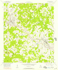
 1954 Chamblee1956 Print · USGSDeKalb and Fulton counties are caught in a moment of rapid post-war growth during the mid-fifties, just as the expressway begins to reshape the landscape. Researchers can trace the footprints of the U S Naval Reservation Atlanta Air Station, Oglethorpe Univ, and old family landmarks like Winters Chapel Cem.5 unique versions available
 - 1954 Map of Decatur, 1956 Print
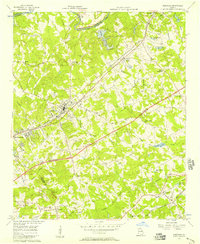
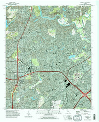
 1954 Decatur1956 Print · USGSThe eastern reaches of Atlanta and the heart of Decatur appear here during the mid-fifties post-war boom. Genealogists and historians can trace the foundations of neighborhoods like Druid Hills and Oakhurst alongside landmarks like Agnes Scott College and the Decatur Cemetery.4 unique versions available
 - 1956 Map of Stone Mountain, 1957 Print
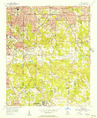
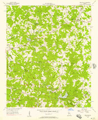
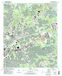
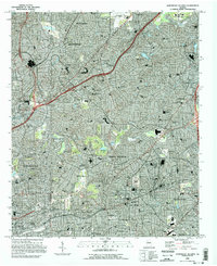
 1956 Stone Mountain1957 Print · USGSDeKalb County was entering a period of significant suburban growth in the mid-fifties, centered around its most famous geologic landmark. Genealogists and local historians can trace family locations near Stone Mountain and Tucker, or locate vanished landmarks like Simmons Sch and Mt Pleasant Ch.6 unique versions available
 - 1956 Map of Snellville, 1957 Print
 1956 Snellville1957 Print · USGSGwinnett and DeKalb counties are shown in the mid-fifties, featuring a landscape of small farming communities and winding river bottoms. Genealogists can trace family names through landmarks like Hannah Cem, Rock Chapel, and the New Bethel Sch & Ch.5 unique versions available
 - 1956 Map of Norcross, 1957 Print
 1956 Norcross1957 Print · USGSIn the mid-fifties, Gwinnett County stood at the edge of modernization as the Atlanta Expressway began carving through its rural landscape. Genealogists and local historians can trace the foundations of Norcross, Lilburn, and Mechanicsville, alongside country landmarks like Beaver Ruin Ch and Graham Cem.4 unique versions available
 - 1956 Map of Conyers, 1957 Print
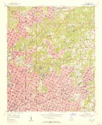
 1956 Conyers1957 Print · USGSThe rail-and-quarry landscape of DeKalb and Rockdale counties comes alive in the mid-fifties, before the heavy suburban expansion of later decades. Genealogists and local historians can trace family locations through numerous landmarks like Bruce Sch, Eastview Cem, and Whites Chapel.5 unique versions available
 - 1956 Map of Redan, 1957 Print
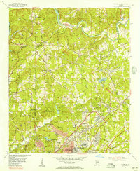
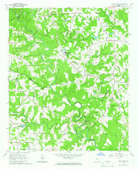
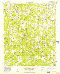 1956 Redan1957 Print · USGSDeKalb County at the mid-century mark reveals a landscape of rural crossroads and growing communities like Redan and Klondike. Genealogists and historians can trace the foundations of local life through the many country churches and schools, from Kelleys Chapel to the New County Line Sch.7 unique versions available
 - 1957 Map of Atlanta
 1957 Atlanta1957 Print · USGSAtlanta and the Alabama borderlands appear here in the mid-fifties, capturing the region's post-war suburban and industrial transition. Trace the development of early transport hubs and military sites like Fort McPherson, Anniston, and the Kennesaw Mountain National Battlefield Park.
 - 1958 Map of Atlanta
 1958 Atlanta1958 Print · USGSMid-century Georgia and Alabama are shown in this regional study of the corridor between the Chattahoochee River and the Appalachian foothills. Local historians can trace the development of suburban Atlanta alongside vital landmarks like Stone Mountain, Dobbins AFB, and the Seaboard Air Line rail routes.
 - 1964 Map of Kelleytown, 1966 Print
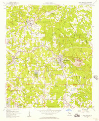
 1964 Kelleytown1966 Print · USGSRockdale and Henry counties appear in the mid-1960s as a landscape of rural family farms and quiet crossroads. Researchers can locate legacy family sites and landmarks including Kelleytown, the Monastery of the Holy Ghost, and the Whitaker Cem.3 unique versions available
 - 1981 Map of Atlanta, 1982 Print
 1981 Atlanta1982 Print · USGSThe Atlanta metro area is shown during its late-century boom, following the completion of the beltway and the rise of its major international airport. Trace the growth of suburbs from Mableton to Tucker and the footprints of Fort McPherson and Stone Mtn.
 - 1992 Map of Norcross
 1992 Norcross1992 Print · USGSGwinnett County’s rapid suburban transformation is on full display in the early nineties as residential neighborhoods spread between the Chattahoochee River and Lilburn. Researchers can trace local genealogy and land use through sites like Peachtree Mem Cem, the Southern rail line, and the massive Quarry near Beaver Ruin Creek.2 unique versions available
 - 1992 Map of Stone Mountain
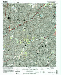
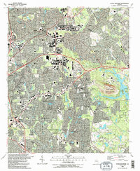 1992 Stone Mountain1992 Print · USGSDeKalb County enters a period of intense suburban growth in the early nineties, centered around the iconic granite mass of Stone Mountain. Genealogists and local historians can trace community roots through numerous landmarks like Rehoboth Cem, Zion Ch, and the Atlanta Sch for the Deaf.2 unique versions available
 - 1992 Map of Snellville, 1993 Print
 1992 Snellville1993 Print · USGSGwinnett County during the early nineties shows a landscape of growing suburbs anchored by historic family landmarks and winding river bends. Researchers can trace local genealogy through numerous sites like Hannah Cem, Annistown Cem, and the old Rock Chapel Sch.
 - 1993 Map of Northeast Atlanta, 1995 Print
 1993 Northeast Atlanta1995 Print · USGSThe Atlanta suburbs in the early nineties show a dense landscape of established neighborhoods and prestigious academic centers. Researchers can trace the development of Druid Hills, Avondale Estates, and Emory University alongside the Georgia RR and Northeast Expressway.
 - 1993 Map of Southeast Atlanta, 1995 Print
 1993 Southeast Atlanta1995 Print · USGSSoutheast Atlanta and its neighboring DeKalb County communities are captured here in the early nineties during a period of established suburban growth. Local historians can trace institutional history through Fort Gillem and the U S Penitentiary, or locate family sites at Oakland Cem and Cedar Grove.
 - 1993 Map of Chamblee, 1995 Print
 1993 Chamblee1995 Print · USGSSuburban Atlanta was reaching a peak of expansion in the early nineties, centered on the thriving DeKalb and Fulton county lines. Researchers can trace the development of local landmarks like Oglethorpe University, Perimeter Mall, and the De Kalb-Peachtree Airport.
 - 1997 Map of Northeast Atlanta, 1999 Print
 1997 Northeast Atlanta1999 Print · USGSDeKalb County is shown at a peak of late-century expansion, where historic college campuses meet modern interstate infrastructure. Researchers can trace the footprints of Emory University and Agnes Scott College or locate landmarks like Lenox Square Mall and the Georgia Railroad.
 - 1997 Map of Stone Mountain, 1999 Print
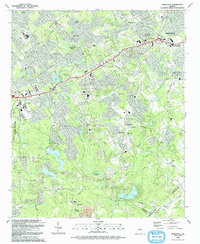
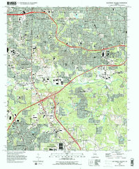
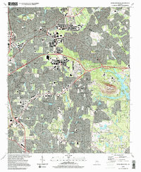 1997 Stone Mountain1999 Print · USGSDeKalb and Gwinnett counties show a mature suburban landscape in the late nineties, centered on the unmistakable profile of Stone Mountain. Genealogists and local historians can trace established communities like Tucker and Clarkston, locating numerous neighborhood landmarks such as Rehoboth Ch and Stone Mountain Cem.
Showing maps 1-25 of 73
Top cities of DeKalb County
- Stonecrest historical maps
- Brookhaven historical maps
- Dunwoody historical maps
- Tucker historical maps
- Redan historical maps
- Chamblee historical maps
See more
Frequently asked questions
- What are the different types of historical maps available for DeKalb County?
- What is the oldest map of DeKalb County?
- Where can I purchase historical maps of DeKalb County for my home or office?
- Where can I download high-res historical maps of DeKalb County?
- Are there historical topographic maps available for DeKalb County?
- Is there historical aerial imagery available for DeKalb County?
- Where are historical maps of DeKalb County sourced from?