1950s Maps of Dodge County, Georgia
Explore 5 historic maps of Dodge County from the 1950s. These maps offer a rare glimpse into what life looked like during the 1950s — showing old roads, neighborhoods, homes, and landmarks that have changed or disappeared over time.
Whether you're researching your family's past, planning a metal detecting trip, or studying how Dodge County's landscape evolved across the 1950s, these high-resolution maps are a powerful tool for exploring the history of this region.
- Focus on a specific era: All maps on this page are from the 1950s, giving you a focused view of this time period.
- See what’s changed: Compare century-old streets, trails, and buildings to today's modern landscape using overlays and satellite layers.
- Research with precision: Use these maps for genealogy, historical research, land use analysis, or educational projects.
- View, download, or print: Maps are fully viewable online in high resolution, and can be downloaded or printed for your own records.
Start exploring Dodge County's history through authentic maps from the 1950s. This is your window into the past.
Dodge County, GA maps
(5)- 1953 Map of Waycross, 1967 Print
 1953 Waycross1967 Print · USGSSouth Georgia's agricultural and rail heartland is captured here in the mid-1950s, showing a vast network of timber and farming towns. Researchers can trace the rail lines connecting Waycross and Tifton or locate landmarks like Jefferson Davis State Park and Lake Blackshear.2 unique versions available
 - 1956 Map of Cochran, 1957 Print
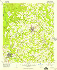 1956 Cochran1957 Print · USGSBleckley and Pulaski counties are captured in the mid-fifties, centered on the railroad corridor and the Middle Georgia College campus. Genealogists can trace family landmarks like Lizzie Bloomer Ch, St Paul Sch, and the riverside community of Hartford.2 unique versions available
 - 1957 Map of Macon
 1957 Macon1957 Print · USGSMid-century Georgia comes into focus as the river-and-rail economy shifts toward a new era of aviation and highway travel. Trace family roots and vanished landmarks across the Ocmulgee River valley from Macon to the onion fields of Vidalia.
 - 1958 Map of Macon
 1958 Macon1958 Print · USGSMiddle Georgia during the late fifties shows the post-war expansion of Warner Robins alongside the deep-rooted rail hubs of the Central of Georgia line. Researchers can trace the river-bound boundaries of numerous counties and find local landmarks like Veterans Memorial Hospital and Robins AFB.
 - 1958 Map of Waycross
 1958 Waycross1958 Print · USGSSoutheast Georgia in the late fifties remains a landscape of deep river basins and vital rail junctions. Genealogists and historians can trace family-named landmarks and rural hubs like Union Church, South Georgia College, and the sprawling Okefenokee Swamp.2 unique versions available
End of results
Showing maps 1-5 of 5
Top cities of Dodge County
Frequently asked questions
- What are the different types of historical maps available for Dodge County?
- What is the oldest map of Dodge County?
- Where can I purchase historical maps of Dodge County for my home or office?
- Where can I download high-res historical maps of Dodge County?
- Are there historical topographic maps available for Dodge County?
- Is there historical aerial imagery available for Dodge County?
- Where are historical maps of Dodge County sourced from?