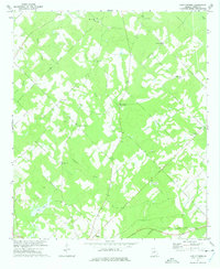
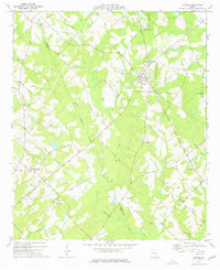
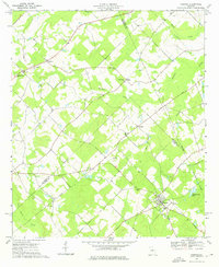
1970s Maps of Dodge County, Georgia
Explore 21 historic maps of Dodge County from the 1970s. These maps offer a rare glimpse into what life looked like during the 1970s — showing old roads, neighborhoods, homes, and landmarks that have changed or disappeared over time.
Whether you're researching your family's past, planning a metal detecting trip, or studying how Dodge County's landscape evolved across the 1970s, these high-resolution maps are a powerful tool for exploring the history of this region.
- Focus on a specific era: All maps on this page are from the 1970s, giving you a focused view of this time period.
- See what’s changed: Compare century-old streets, trails, and buildings to today's modern landscape using overlays and satellite layers.
- Research with precision: Use these maps for genealogy, historical research, land use analysis, or educational projects.
- View, download, or print: Maps are fully viewable online in high resolution, and can be downloaded or printed for your own records.
Start exploring Dodge County's history through authentic maps from the 1970s. This is your window into the past.
Dodge County, GA maps
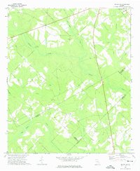
(21)- 1970 Map of Alamo, 1973 Print
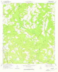
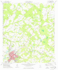
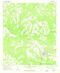 1970 Alamo1973 Print · USGSThe town of Alamo sits at a historical rail crossroads in the early seventies, surrounded by a landscape of creeks and rural congregations. Genealogists can locate numerous family-named burial sites and churches, including Mt Carmel Ch, Union Springs Cems, and McRae Cem.2 unique versions available
 - 1972 Map of Eastman, 1975 Print
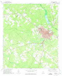
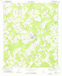
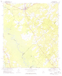
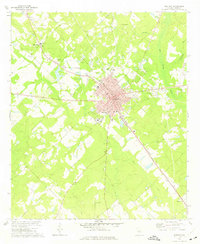 1972 Eastman1975 Print · USGSDodge County during the early seventies centers on the growing hub of Eastman and its surrounding rail corridors. Researchers can trace local heritage through numerous rural landmarks like Orphans Cem, Dodge High, and Zebulon Ch.2 unique versions available
 - 1972 Map of West Of Eastman, 1975 Print
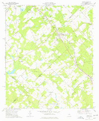
 1972 West Of Eastman1975 Print · USGSCentral Georgia in the early seventies is mapped here as a network of rural parishes and family lands between Pulaski and Dodge counties. Trace family roots at Salem Ch, Lancaster Cem, and Zion Hill Ch along the drainages of Mosquito Creek.2 unique versions available
 - 1972 Map of Cooks Still, 1975 Print
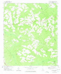
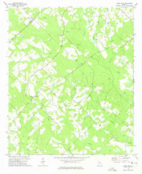 1972 Cooks Still1975 Print · USGSTelfair County in the early seventies is a landscape of rural schoolhouses and country churches along the creek bottoms. Genealogists and local historians can locate West Telfair Academy, Cooks Still, and several family-named landmarks like Pearson Cem.
 - 1972 Map of Mc Rae NW, 1975 Print
 1972 Mc Rae NW1975 Print · USGSLaurens County and its neighbors in south-central Georgia are captured here in the early seventies as a landscape of timber and tobacco farms. Researchers can locate community anchors like New Bethel Ch, Cedar Grove, and the Harrelson Cem tucked between Gum Swamp Creek and Alligator Creek.2 unique versions available
 - 1972 Map of Jay Bird Springs, 1975 Print
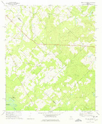
 1972 Jay Bird Springs1975 Print · USGSDodge and Laurens counties are mapped here in the early seventies, showing a landscape defined by the winding Gum Swamp Creek. Genealogists can trace family roots at Taylor Cem, Ryals Cem, and country congregations like Hopewell Ch.
 - 1972 Map of Abbeville North, 1975 Print
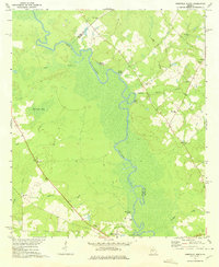 1972 Abbeville North1975 Print · USGSWilcox and Dodge counties are captured here in the early seventies, centered on the winding corridor of the Ocmulgee River. Local researchers can trace rural church locations and family sites such as Daniels Millpond, Springfield Ch, and Mitchell Cem.
 - 1972 Map of Milan, 1975 Print
 1972 Milan1975 Print · USGSMilan and Chauncey are captured in the early seventies during a period of rural stability along the rail lines of Dodge and Telfair Counties. Researchers can trace family roots at Antioch Cem or find local landmarks like Antioch Number Two Sch and Suomi.
 - 1972 Map of Mc Rae, 1975 Print
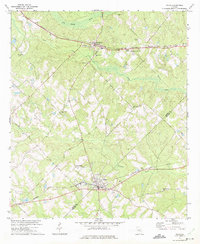
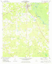
 1972 Mc Rae1975 Print · USGSThe twin cities of McRae and Helena are shown during a period of steady growth at the junction of two major rail lines. Researchers can trace the civic footprint of the era, from the Oak Grove Cem and Co High Sch to the rural tracks of Old Milan Road.2 unique versions available
 - 1972 Map of Lake Cypress, 1975 Print
 1972 Lake Cypress1975 Print · USGSThe community of Rhine and the waters of Lake Cypress anchor this 1970s Georgia landscape. Researchers can trace rural genealogy through family landmarks like Old Fair Haven Cem and the Burney-Cooper Cem.
 - 1973 Map of Cadwell, 1976 Print
 1973 Cadwell1976 Print · USGSThe Laurens County countryside is centered on the town of Cadwell during the early 1970s, as rural life continued around historic churches and small family farms. Genealogists can trace family names and ancestral sites across Mullis Cem, Bee Hive Cem, and the Old Railroad Grade.
 - 1974 Map of Chester, 1976 Print
 1974 Chester1976 Print · USGSThe rural borderlands of Dodge and Laurens counties are captured here in the mid-seventies, centered on the community of Chester. Family historians can trace local roots through numerous landmarks like Mullis-Cole Cem, Christian Hope Ch, and Goldsboro.
 - 1974 Map of Yonkers, 1976 Print
 1974 Yonkers1976 Print · USGSDodge County in the mid-1970s remained a quiet expanse of swamp-fed creeks and rural settlements along the Southern railroad. Genealogists and local historians can locate several family burial grounds like the Douglas Cem and community hubs such as Yonkers and Bethel Ch.
 - 1974 Map of Dexter, 1976 Print
 1974 Dexter1976 Print · USGSIn the mid-1970s, this area of Laurens County centered on the active town of Dexter and its surrounding farmsteads. Genealogists can trace family landmarks and rural communities through labels like St Lukes Cem, Antioch Ch, and the Old Railroad Grade.
 - 1974 Map of Empire, 1977 Print
 1974 Empire1977 Print · USGSThe Georgia coastal plain comes into focus in the mid-seventies, showing the rail-linked communities of Empire, Frazier, and Dubois along the SOUTHERN line. Genealogists can trace local roots through numerous sites like Hart Cem, Antioch Ch, and Simmons Cem.
 - 1974 Map of Abbeville South, 1977 Print
 1974 Abbeville South1977 Print · USGSWilcox County in the mid-1970s centers on the riverfront town of Abbeville and the serpentine Ocmulgee River. Genealogists and local researchers can trace numerous family burial sites and rural landmarks, from Stubbs Cem to the old railroad grade near Browning.
 - 1974 Map of Cochran, 1977 Print
 1974 Cochran1977 Print · USGSCochran and its surrounding Bleckley County countryside are shown here during the mid-seventies, featuring the growing campus of Middle Georgia College. Researchers can locate several rural landmarks including Cedar Hill Cem, Antioch Ch, and the old County Fairground.
 - 1977 Map of Rhine
 1977 Rhine1977 Print · USGSThe community of Rhine and the rural reaches of Dodge County are captured here in the late seventies as the river and rail economy shaped the landscape. Researchers can trace family history at sites like Reaves-Bates Cem or locate the remote Dodges Lake Landing on the Ocmulgee River.
 - 1977 Map of Hawkinsville
 1977 Hawkinsville1977 Print · USGSSouth Georgia’s agricultural and rail heartland is meticulously documented during the late seventies. Researchers can trace family ties and transit routes through old depots and towns like Unadilla, Pineview, and Hawkinsville along the Ocmulgee River.
 - 1978 Map of Hawkinsville, 1979 Print
 1978 Hawkinsville1979 Print · USGSMiddle Georgia's agricultural and rail heartland is captured here in the late seventies, showing the vital connections between the Ocmulgee River and the rural plains. Genealogists and historians can trace family locations near Vienna, Hawkinsville, or along the tracks of the Southern railroad.
 - 1979 Map of Vidalia, 1980 Print
 1979 Vidalia1980 Print · USGSSoutheast Georgia in the late 1970s is a landscape of river-bend settlements and crossing rail lines. Researchers can trace family roots and land patterns through several towns like Vidalia, Soperton, and Mount Vernon, or locate regional landmarks like the State Prison.2 unique versions available
End of results
Showing maps 1-21 of 21
Top cities of Dodge County
Frequently asked questions
- What are the different types of historical maps available for Dodge County?
- What is the oldest map of Dodge County?
- Where can I purchase historical maps of Dodge County for my home or office?
- Where can I download high-res historical maps of Dodge County?
- Are there historical topographic maps available for Dodge County?
- Is there historical aerial imagery available for Dodge County?
- Where are historical maps of Dodge County sourced from?