Old Maps of Rhine, Georgia for Genealogy
Trace your family roots with 22 historic maps of Rhine. These high-res maps reveal old neighborhoods, homesites, landmarks, and streets — helping you uncover where your ancestors lived and how the area evolved over time.
- Explore historic neighborhoods: Identify where your relatives may have lived in the 1800s or 1900s.
- Compare maps over time: Trace the changes in streets, buildings, and landmarks for multi-generational research.
- Perfect for genealogy & ancestry research: Used by family historians and researchers to map out lineage and migration.
These maps are an incredible resource for exploring your personal connection to Rhine's past.
Rhine, GA maps
(22)- 1953 Map of Waycross, 1967 Print
 1953 Waycross1967 Print · USGSSouth Georgia's agricultural and rail heartland is captured here in the mid-1950s, showing a vast network of timber and farming towns. Researchers can trace the rail lines connecting Waycross and Tifton or locate landmarks like Jefferson Davis State Park and Lake Blackshear.2 unique versions available
 - 1957 Map of Macon
 1957 Macon1957 Print · USGSMid-century Georgia comes into focus as the river-and-rail economy shifts toward a new era of aviation and highway travel. Trace family roots and vanished landmarks across the Ocmulgee River valley from Macon to the onion fields of Vidalia.
 - 1958 Map of Macon
 1958 Macon1958 Print · USGSMiddle Georgia during the late fifties shows the post-war expansion of Warner Robins alongside the deep-rooted rail hubs of the Central of Georgia line. Researchers can trace the river-bound boundaries of numerous counties and find local landmarks like Veterans Memorial Hospital and Robins AFB.
 - 1958 Map of Waycross
 1958 Waycross1958 Print · USGSSoutheast Georgia in the late fifties remains a landscape of deep river basins and vital rail junctions. Genealogists and historians can trace family-named landmarks and rural hubs like Union Church, South Georgia College, and the sprawling Okefenokee Swamp.2 unique versions available
 - 1964 Map of Macon
 1964 Macon1964 Print · USGSCentral Georgia in the mid-sixties is defined by its major river valleys and a booming military presence. Genealogists and historians can trace the growth of Warner Robins near Robins AFB or locate smaller rural junctions like Allentown and Jeffersonville along the historic Southern railroad lines.2 unique versions available
 - 1972 Map of Lake Cypress, 1975 Print
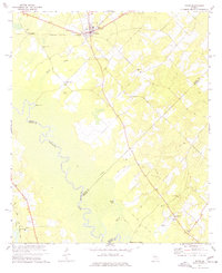
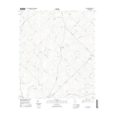
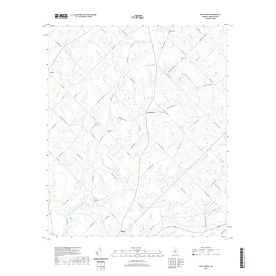
 1972 Lake Cypress1975 Print · USGSThe community of Rhine and the waters of Lake Cypress anchor this 1970s Georgia landscape. Researchers can trace rural genealogy through family landmarks like Old Fair Haven Cem and the Burney-Cooper Cem.
 - 1977 Map of Rhine
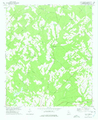
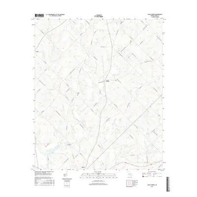
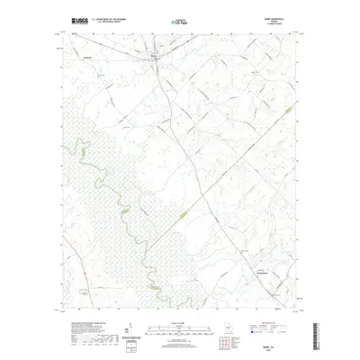
 1977 Rhine1977 Print · USGSThe community of Rhine and the rural reaches of Dodge County are captured here in the late seventies as the river and rail economy shaped the landscape. Researchers can trace family history at sites like Reaves-Bates Cem or locate the remote Dodges Lake Landing on the Ocmulgee River.
 - 1977 Map of Hawkinsville
 1977 Hawkinsville1977 Print · USGSSouth Georgia’s agricultural and rail heartland is meticulously documented during the late seventies. Researchers can trace family ties and transit routes through old depots and towns like Unadilla, Pineview, and Hawkinsville along the Ocmulgee River.
 - 1978 Map of Hawkinsville, 1979 Print
 1978 Hawkinsville1979 Print · USGSMiddle Georgia's agricultural and rail heartland is captured here in the late seventies, showing the vital connections between the Ocmulgee River and the rural plains. Genealogists and historians can trace family locations near Vienna, Hawkinsville, or along the tracks of the Southern railroad.
 - 1981 Map of Cordele, 1982 Print
 1981 Cordele1982 Print · USGSSouth Georgia’s agricultural heartland is documented here in the early eighties, showing the convergence of the Seaboard Coast Line Railroad and the Georgia Southern and Florida lines. Genealogists and researchers can trace local landmarks like Bowens Mill Pond, the University of Georgia Research Center, and the shores of Lake Blackshear.
 - 1988 Map of Waycross
 1988 Waycross1988 Print · USGSSouth Georgia's wiregrass and timber country is documented here in the late eighties, centered on the vital rail junction of Waycross. Genealogists and historians can trace the rural landscape from Okefenokee up to the Ocmulgee, finding sites like Lumber City and Jefferson Davis Memorial State Park.
 - 1988 Map of Macon, 1989 Print
 1988 Macon1989 Print · USGSCentral Georgia is captured during the late eighties, showing the expansive river systems and growing urban hubs of the regional interior. Genealogists and historians can trace the paths of the Central of Georgia Railroad and locate communities like Warner Robbins, Dublin, and Sandersville.
 - 2011 Map of Rhine, 2011 Print
 2011 Rhine2011 Print · USGSCovers Rhine, including Sharon, Copeland, and other nearby areas
 - 2011 Map of Lake Cypress, 2011 Print
 2011 Lake Cypress2011 Print · USGSCovers Rhine, including Calvin, Five Points, and other nearby areas
 - 2014 Map of Lake Cypress, 2014 Print
 2014 Lake Cypress2014 Print · USGSCovers Rhine, including Calvin, Five Points, and other nearby areas
 - 2014 Map of Rhine, 2014 Print
 2014 Rhine2014 Print · USGSCovers Rhine, including Sharon, Copeland, and other nearby areas
 - 2017 Map of Rhine, 2017 Print
 2017 Rhine2017 Print · USGSCovers Rhine, including Sharon, Copeland, and other nearby areas
 - 2017 Map of Lake Cypress, 2017 Print
 2017 Lake Cypress2017 Print · USGSCovers Rhine, including Calvin, Five Points, and other nearby areas
 - 2020 Map of Lake Cypress, 2020 Print
 2020 Lake Cypress2020 Print · USGSCovers Rhine, including Calvin, Five Points, and other nearby areas
 - 2020 Map of Rhine, 2020 Print
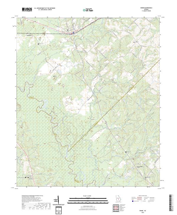
 2020 Rhine2020 Print · USGSCovers Rhine, including Sharon, Copeland, and other nearby areas
 - 2024 Map of Rhine, 2024 Print
 2024 Rhine2024 Print · USGSThe community of Rhine and the banks of the Ocmulgee River are documented here in 2024, showing the rural crossroads of Dodge and Telfair counties. Genealogists can trace family names through several rural burial sites, including Barney I Cem, Williams Cem, and Sharon Cem.
 - 2024 Map of Lake Cypress, 2024 Print
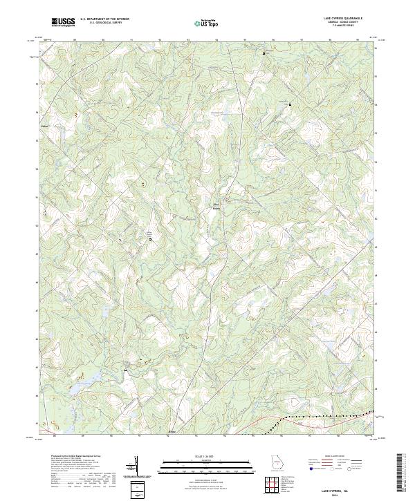 2024 Lake Cypress2024 Print · USGSDodge County's rural landscape is mapped here in the modern era, centered on the settlement of Rhine. Local historians can trace family land ties near Old Fair Haven Cem and the waters of Lake Cypress or Peterson Pond.
End of results
Showing maps 1-22 of 22
Top cities near Rhine
- Eastman historical maps
- Abbeville historical maps
- Chauncey historical maps
- Jacksonville historical maps
Frequently asked questions
- What are the different types of historical maps available for Rhine?
- What is the oldest map of Rhine?
- Where can I purchase historical maps of Rhine for my home or office?
- Where can I download high-res historical maps of Rhine?
- Are there historical topographic maps available for Rhine?
- Is there historical aerial imagery available for Rhine?
- Where are historical maps of Rhine sourced from?