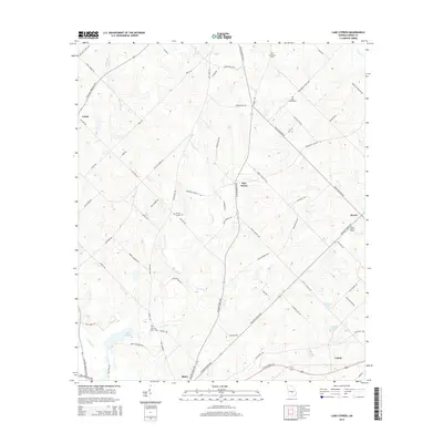
2014 Map of Lake Cypress
USGS Topo · Published 2014About this map
Rhine anchors the southern portion of this Dodge County landscape, where the agricultural and woodland patterns of south-central Georgia are documented in the early 2010s. The area is defined by a network of local roads and state highways that connect small rural settlements like Ararat, Five Points, and Union. To the east, Calvin sits near the rail line and major thoroughfares. The drainage of Crooked Cr and the Cypress River shapes the low-lying terrain, creating wetlands and notable water bodies such as Lake Cypress, Peterson Pond, and Jamieson Pond. For genealogists, the map preserves the locations of several community burial sites, including Old Fair Haven Cem and Burney Cooper Cem. The prominence of the O'Barr Lookout Tower near the eastern edge indicates the significance of forestry and fire management in this section of the coastal plain.
Find a feature on this map
72 named features on this map. Tap any name to fly to it.
Don’t see what you’re looking for? This feature index may not catch every label — zoom into the map to look around manually.
Map Details
Editions of this 2014 Lake Cypress Map
This is the sole edition of this map. No revisions or reprints were ever made.
Other maps of this area

1953 · Waycross
USGS Topo · 1:250,000

1957 · Macon
USGS Topo · 1:250,000

1958 · Macon
USGS Topo · 1:250,000

1958 · Waycross
USGS Topo · 1:250,000

1964 · Macon
USGS Topo · 1:250,000

1972 · Eastman
USGS Topo · 1:24,000

1972 · West Of Eastman
USGS Topo · 1:24,000

1972 · Cooks Still
USGS Topo · 1:24,000

1972 · Jay Bird Springs
USGS Topo · 1:24,000

1972 · Abbeville North
USGS Topo · 1:24,000