1972 Map of Abbeville North
USGS Topo · Published 1975About this map
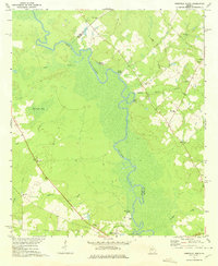
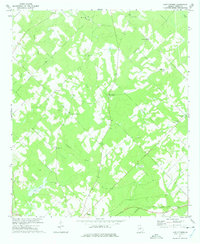
The Ocmulgee River meanders through the heart of this landscape, forming the natural border between Wilcox and Dodge counties. This early 1970s survey reveals a rural territory defined by a network of creeks like Cedar Creek, Gum Creek, and Sagegrass Creek that feed into the river basin. Cultural landmarks are frequent throughout the terrain, particularly in the form of rural congregations such as Cannonville Ch, Springfield Ch, and Englewood Ch. The southern edge of the map shows the northern portion of Abbeville, with local landmarks including Mitchell Cem and Poor Robin Spring. Notable family-named features like Daniels Millpond and Phelps Bluff reflect the long-standing community ties to the land and water in this corner of Georgia.
Find a feature on this map
32 named features on this map. Tap any name to fly to it.
Don’t see what you’re looking for? This feature index may not catch every label — zoom into the map to look around manually.
Map Details
Editions of this 1972 Abbeville North Map
This is the sole edition of this map. No revisions or reprints were ever made.
Other maps of this area

1953 · Waycross
USGS Topo · 1:250,000

1957 · Macon
USGS Topo · 1:250,000

1958 · Macon
USGS Topo · 1:250,000

1958 · Waycross
USGS Topo · 1:250,000

1964 · Macon
USGS Topo · 1:250,000
1972 · Eastman
USGS Topo · 1:24,000

1972 · Finleyson East
USGS Topo · 1:24,000
1972 · West Of Eastman
USGS Topo · 1:24,000
1972 · Pineview East
USGS Topo · 1:24,000
1972 · Lake Cypress
USGS Topo · 1:24,000