
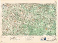
1958 Map of Waycross
USGS Topo · Published 1958About this map
Waycross and the surrounding coastal plain of Southeast Georgia are defined by a complex network of blackwater rivers and significant rail corridors in the late 1950s. The regional economy and landscape center on the Satilla River, Alapaha River, and Ocmulgee River basins, which supported timber and transit for decades. Major transportation arteries like the Atlantic Coast Line and Seaboard Air Line railroads intersect at key hubs like Douglas, Tifton, and Fitzgerald.
Find a feature on this map
68 named features on this map. Tap any name to fly to it.
Don’t see what you’re looking for? This feature index may not catch every label — zoom into the map to look around manually.
Map Details
Editions of this 1958 Waycross Map
2 editions found
Other maps of this area

1917 · Nahunta
USGS Topo · 1:62,500

1917 · Boulogne
USGS Topo · 1:62,500

1918 · Jesup
USGS Topo · 1:62,500

1918 · Folkston
USGS Topo · 1:62,500

1918 · Hortense
USGS Topo · 1:62,500

1918 · Nahunta
USGS Topo · 1:62,500

1919 · Claxton
USGS Topo · 1:62,500

1919 · Boulogne
USGS Topo · 1:62,500

1920 · Glennville
USGS Topo · 1:62,500

1943 · Jesup
USGS Topo · 1:62,500