
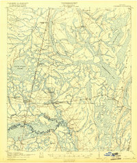
1918 Map of Hortense
USGS Topo · Published 1918About this map
The Satilla River and Little Satilla River converge in this 1917 military survey, defining a landscape of wetlands and timber-line settlements. The terrain is dominated by the massive Penholoway Bay and Duck Pond Swamp, which dictated the early infrastructure of Southeast Georgia. The Atlantic Coast Line and the Atlantic and Birmingham railroads form the backbone of the region, intersecting at Hortense. This junction and nearby stops like Needmore and McKinnon represent the small-town commercial hubs of the era. Genealogists will find a wealth of specific landmarks, including Mt Zion Church, Smyrna Church, and several rural schools such as the Cypress School and Strickland School. The presence of Rosin Landing along the river highlights the importance of the naval stores industry that once thrived in these pine forests.
Find a feature on this map
45 named features on this map. Tap any name to fly to it.
Don’t see what you’re looking for? This feature index may not catch every label — zoom into the map to look around manually.
Map Details
Editions of this 1918 Hortense Map
2 editions found
Other maps of this area

1917 · Nahunta
USGS Topo · 1:62,500

1918 · Jesup
USGS Topo · 1:62,500

1918 · Everett City
USGS Topo · 1:62,500

1918 · Nahunta
USGS Topo · 1:62,500

1918 · Bladen
USGS Topo · 1:62,500

1920 · Everett City
USGS Topo · 1:62,500

1939 · Bladen
USGS Topo · 1:62,500

1943 · Ludowici
USGS Topo · 1:62,500

1943 · Jesup
USGS Topo · 1:62,500

1944 · Everett City
USGS Topo · 1:62,500