
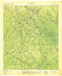
1918 Map of Everett City
USGS Topo · Published 1918About this map
The Altamaha River floodplain dominates this 1917 survey, revealing a landscape defined by expansive wetlands and isolated islands like Jasmine Island and Joes Island. This era was characterized by a heavy reliance on river crossings and rail transit before modern highway development. The map meticulously records numerous landings such as Opossum Landing and Holland Landing, alongside crucial river transit points like Ft Barrington Ferry.
Find a feature on this map
101 named features on this map. Tap any name to fly to it.
Don’t see what you’re looking for? This feature index may not catch every label — zoom into the map to look around manually.
Map Details
Editions of this 1918 Everett City Map
2 editions found
Other maps of this area

1917 · Nahunta
USGS Topo · 1:62,500

1918 · Jesup
USGS Topo · 1:62,500

1918 · Hortense
USGS Topo · 1:62,500

1918 · Nahunta
USGS Topo · 1:62,500

1918 · Bladen
USGS Topo · 1:62,500

1920 · Sapelo River
USGS Topo · 1:62,500

1920 · Everett City
USGS Topo · 1:62,500

1921 · Darien
USGS Topo · 1:62,500

1939 · Bladen
USGS Topo · 1:62,500

1943 · Ludowici
USGS Topo · 1:62,500