Loading...
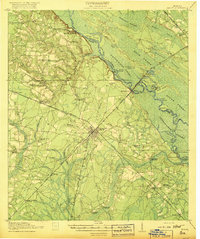
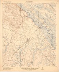
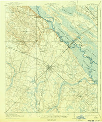
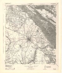
Loading map...1918 Map of Jesup
USGS Topo · Published 1918About this map
Jesup serves as a vital rail hub in this 1917 survey, situated at the convergence of the Southern Ry, Atlantic Coast Line, and Georgia Coast and Piedmont RR. This density of infrastructure highlights the area's role in the regional timber and agricultural economy during the early twentieth century. Beyond the rail lines, the landscape is defined by the vast wetlands of the Altamaha River basin, including Vinzant Swamp and Penholoway Swamp.
Find a feature on this map
78 named features on this map. Tap any name to fly to it.
Don’t see what you’re looking for? This feature index may not catch every label — zoom into the map to look around manually.
Map Details
Date Portrayed1918
Date Published1918
PublisherU.S. Geological Survey
Map TypeTopographic
Scale1:62,500
Physical Dimensions16.6 x 19.9 inches
Editions of this 1918 Jesup Map
3 editions found
Historical Maps of Jesup Through Time

Featured Locations
Source Details
SourceU.S. Geological Survey
CopyrightPublic Domain