Old Maps of Ducker, Georgia for Metal Detecting
Plan your next treasure hunt with 11 historic maps of Ducker. Find old homesites, ghost towns, trails, and gathering spots that may be lost to time — perfect for identifying promising metal detecting locations.
- Locate forgotten sites: Uncover places like long-lost settlements, abandoned rail lines, or gathering spots.
- Plan better hunts: Use map overlays combined with LiDAR or satellite views to narrow in on historically rich areas.
- Made for detectorists: Thousands of hobbyists use these maps to discover relics, coins, and hidden history.
Use these historic maps to boost your research and find new opportunities beneath the surface of Ducker.
Ducker, GA maps
(11)- 1953 Map of Dothan, 1966 Print
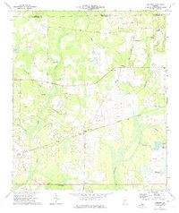
 1953 Dothan1966 Print · USGSSoutheast Alabama and Southwest Georgia are captured during a period of massive hydraulic and military expansion in the mid-fifties. Genealogists and historians can trace rural landmarks like Antioch Church and School, the Andrew Jackson Monument, and the early footprint of Fort Rucker Military Reservation.3 unique versions available
 - 1954 Map of Dothan
 1954 Dothan1954 Print · USGSSoutheast Alabama and Southwest Georgia are seen here in the mid-fifties, during a decade of military expansion and rural transition. Genealogists can trace the location of country schools like Little Zion School or the grounds of Kolomoki Mounds State Park.
 - 1955 Map of Dothan
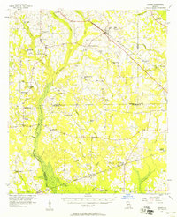
 1955 Dothan1955 Print · USGSSoutheast Alabama and Southwest Georgia are captured here in the mid-fifties, showing a landscape of river-port history and growing military bases. Researchers can trace rural life via the Andrew Jackson Monument, Bauxite mines, and the Central of Georgia RR.
 - 1956 Map of Sasser, 1958 Print
 1956 Sasser1958 Print · USGSTerrell and Dougherty counties are mapped here during the mid-fifties, revealing a rural Georgia landscape of swampy creeks and rail-side hamlets. Researchers can locate specific family landmarks like Clarks Mill, the Andrew Jackson Historical Monument, and Mt Mary Cem & Ch.2 unique versions available
 - 1973 Map of Pretoria, 1974 Print
 1973 Pretoria1974 Print · USGSDougherty County in the early seventies shows a landscape of rail-connected settlements and winding creek bottoms. Genealogists and local historians can trace family locations near Pretoria, Lockett Crossing, and rural landmarks like Mossy Grove Ch.2 unique versions available
 - 1981 Map of Albany, 1982 Print
 1981 Albany1982 Print · USGSSouthwest Georgia in the early eighties was a region defined by its rail hubs and winding river systems. Here you can trace the agricultural landscape from Albany to Dawson, locating sites like Radium Springs, the U S Naval Reservation, and the historic junction at Shellman.
 - 2011 Map of Pretoria, 2011 Print
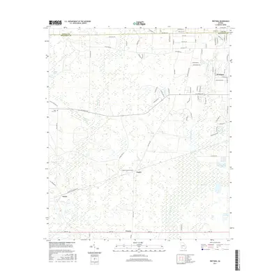
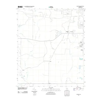 2011 Pretoria2011 Print · USGSCovers Ducker, including Albany, Walker, and other nearby areas
 - 2014 Map of Pretoria, 2014 Print
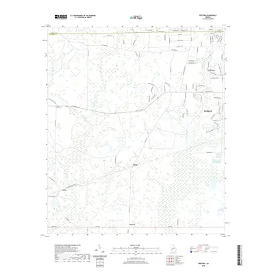
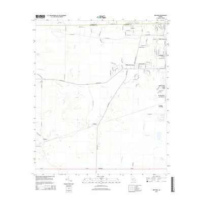 2014 Pretoria2014 Print · USGSCovers Ducker, including Albany, Walker, and other nearby areas
 - 2017 Map of Pretoria, 2017 Print
 2017 Pretoria2017 Print · USGSCovers Ducker, including Albany, Walker, and other nearby areas
 - 2020 Map of Pretoria, 2020 Print
 2020 Pretoria2020 Print · USGSCovers Ducker, including Albany, Walker, and other nearby areas
 - 2024 Map of Pretoria, 2024 Print
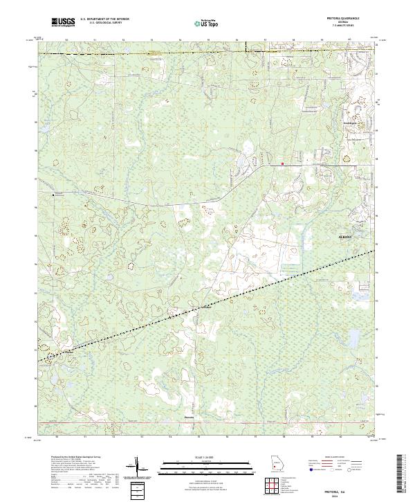 2024 Pretoria2024 Print · USGSDougherty County's rural transitions are visible in this recent study of the land between the western edge of Albany and the farming communities of Pretoria and Ducker. Trace the local waterways of Kiokee Creek and Tullahassee Creek or locate the Hopewell Church Cem.
End of results
Showing maps 1-11 of 11
Top cities near Ducker
- Albany historical maps
- Putney historical maps
- Leesburg historical maps
- Morgan historical maps
- Baconton historical maps
- Newton historical maps
See more
Frequently asked questions
- What are the different types of historical maps available for Ducker?
- What is the oldest map of Ducker?
- Where can I purchase historical maps of Ducker for my home or office?
- Where can I download high-res historical maps of Ducker?
- Are there historical topographic maps available for Ducker?
- Is there historical aerial imagery available for Ducker?
- Where are historical maps of Ducker sourced from?