Old Maps of Fulton County, Georgia for Hiking & Exploration
Hike through history with 162 historic maps of Fulton County. Explore old trails, ghost towns, and forgotten backroads — perfect for outdoor adventurers and local explorers.
- Rediscover forgotten places: Map out old mining camps, roads, and footpaths that no longer exist on modern maps.
- Layer with modern tools: Combine with LiDAR or satellite views to plan hikes through historical terrain.
- Made for exploration: Popular among hikers, overlanders, and local history lovers.
Use these maps to find adventure and explore the hidden past of Fulton County.
Fulton County, GA maps
(162)- 1888 Map of Atlanta, 1955 Print
 1888 Atlanta1955 Print · USGSAtlanta and its surrounding counties emerge as a booming rail hub in the years following the Civil War. Trace early settlements and infrastructure like Jett Ferry, Oakley Mill, and the massive granite profile of Stone Mountain before the era of modern sprawl.
 - 1890 Map of Suwanee
 1890 Suwanee1890 Print · USGSNorth Georgia in the 1890s was a landscape of river-powered commerce and gold prospecting. Genealogists and historians can trace family-named river crossings like Jones Ferry and Pirkle's Ferry or locate the historic Kin Mori Gold Mine.
 - 1890 Map of Atlanta
 1890 Atlanta1890 Print · USGSGeorgia's rail and river networks converge in the late nineteenth century as the capital city expands. Genealogists can trace family homesteads near Jetts Store, Howells Mills, and the various river crossings like Paces Ferry.
 - 1891 Map of Marietta
 1891 Marietta1891 Print · USGSNorth Georgia at the close of the nineteenth century is captured here as the railroad began to reshape the river-dependent landscape. Genealogists can locate family-named landmarks like Allens Mills or trace historic river crossings at Campbellton Fy and Hutchinsons Ferry.
 - 1892 Map of Atlanta
 1892 Atlanta1892 Print · USGSAtlanta and its surrounding counties appear at a pivotal moment of post-war growth as the region's rail network reached maturity. Genealogists and historians can trace the foundations of modern DeKalb and Fulton counties through landmarks like Stone Mountain, Roswell Junction, and Paces Ferry.
 - 1894 Map of Suwanee
 1894 Suwanee1894 Print · USGSNorth Georgia in the late nineteenth century was a landscape of river ferries and rising industry, from marble quarries to gold mines. Genealogists can trace family landmarks like Fields Cross Roads, the Kin Mori Gold Mine, and Fort Buffington.6 unique versions available
 - 1895 Map of Atlanta
 1895 Atlanta1895 Print · USGSThe growing railroad hub of Atlanta is shown here in the late nineteenth century alongside its surrounding river ferries and emerging suburbs. Trace old family names and sites like Howell Mills, Vining Station, and Ft. McPherson.7 unique versions available
 - 1895 Map of Marietta
 1895 Marietta1895 Print · USGSNorthwest Georgia in the 1890s appears as a landscape defined by the winding Chattahoochee River and the rapid expansion of iron rails. Genealogists can trace early family-named river crossings like Morris Ferry or explore the origins of Old Villarica and Bright Star.
 - 1897 Map of Marietta
 1897 Marietta1897 Print · USGSNorthwest Georgia in the late nineteenth century was a landscape defined by river crossings and expanding rail lines. Genealogists and historians can trace defunct river crossings like Pumpkintown Ferry and old industrial sites like Daniels Mills or Beatty Switch.
 - 1901 Map of Marietta
 1901 Marietta1901 Print · USGSNorthwest Georgia at the turn of the century is a landscape of growing rail towns and vital river crossings. Researchers can trace early rural life through features like Old Villarica, Pumpkintown Ferry, and the Mount Zion Church.4 unique versions available
 - 1953 Map of Atlanta, 1965 Print
 1953 Atlanta1965 Print · USGSThe growing Atlanta metro and the industrial corridors of Eastern Alabama are captured here during the mid-century transition. Researchers can trace the rail-to-road shift through hubs like Anniston and La Grange or locate sites within Fort McClellan.2 unique versions available
 - 1954 Map of Palmetto, 1955 Print
 1954 Palmetto1955 Print · USGSThe Palmetto area and the Chattahoochee riverfront appear here in the mid-fifties, just as the local rural character began to meet postwar growth. Researchers can locate family landmarks like Friendship Ch, Cedar Grove Sch, and the Landing Field.4 unique versions available
 - 1954 Map of Conley, 1956 Print
 1954 Conley1956 Print · USGSAtlanta's southeastern suburbs and industrial corridors are captured here during a period of significant post-war growth. Genealogists and local historians can trace family locations through numerous sites like South View Cem, Boulder Crest School, and the Prison Farm.5 unique versions available
 - 1954 Map of Chamblee, 1956 Print
 1954 Chamblee1956 Print · USGSDeKalb and Fulton counties are caught in a moment of rapid post-war growth during the mid-fifties, just as the expressway begins to reshape the landscape. Researchers can trace the footprints of the U S Naval Reservation Atlanta Air Station, Oglethorpe Univ, and old family landmarks like Winters Chapel Cem.5 unique versions available
 - 1954 Map of Campbellton, 1956 Print
 1954 Campbellton1956 Print · USGSDouglas and Fulton counties meet along the winding river corridor in the mid-1950s. Family historians can trace rural roots near the Chattahoochee River, finding landmarks like Holly Springs Cem, Mount Carmel Sch, and the community of Campbellton.4 unique versions available
 - 1954 Map of Mableton, 1956 Print
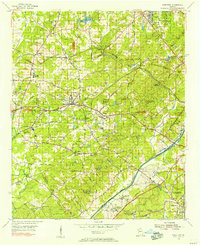 1954 Mableton1956 Print · USGSNorthwest of Atlanta in the mid-fifties, this area shows a landscape transitioning between its rural roots and suburban growth. Researchers can trace family history through sites like Mable Cemetery or locate early industrial landmarks such as Orange Hill Mill and Cobb Airfield.5 unique versions available
 - 1954 Map of Decatur, 1956 Print
 1954 Decatur1956 Print · USGSThe eastern reaches of Atlanta and the heart of Decatur appear here during the mid-fifties post-war boom. Genealogists and historians can trace the foundations of neighborhoods like Druid Hills and Oakhurst alongside landmarks like Agnes Scott College and the Decatur Cemetery.4 unique versions available
 - 1954 Map of Fairburn, 1956 Print
 1954 Fairburn1956 Print · USGSFulton County and its southern neighbors show a landscape of growing rail towns and rural homesteads in the early fifties. Genealogists can trace family landmarks and community centers like Word Sch, Rock Ch, and the Harmony Grove Cem before modern development.6 unique versions available
 - 1954 Map of Ben Hill, 1956 Print
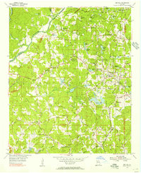 1954 Ben Hill1956 Print · USGSFulton County south of the river is caught in transition during the mid-fifties, balancing historic rural churches with the approaching reach of Atlanta. Researchers can locate family landmarks like the Mt Gilead Campground, Sandtown Sch, and the Atlantic Coast Line railroad.6 unique versions available
 - 1954 Map of Riverdale, 1956 Print
 1954 Riverdale1956 Print · USGSClayton and Fulton counties are captured in the mid-fifties, showing a landscape of burgeoning towns and deep-rooted rural churches. Researchers can trace family history through Carver Memorial Park Cemetery or locate old sites like Red Oak and Kenwood.5 unique versions available
 - 1954 Map of Bolton, 1957 Print
 1954 Bolton1957 Print · USGSNorthwest Georgia in the mid-fifties reveals the dense intersection of industrial rail lines and established neighborhoods at the edge of the capital. Researchers can trace historic family plots and campus footprints at Crestlawn Cemetery, Georgia Institute of Technology, and Vinings.7 unique versions available
 - 1954 Map of East Point, 1957 Print
 1954 East Point1957 Print · USGSSouth of the city during the mid-fifties, the booming aviation and rail corridor defines the landscape from the airport through the tri-cities. Researchers can trace established neighborhoods and institutions like Fort McPherson, Georgia Military Academy, and West View Cemetery.5 unique versions available
 - 1955 Map of Rome
 1955 Rome1955 Print · USGSThe tri-state borderlands of Georgia, Alabama, and Tennessee appear in the mid-fifties as a landscape of ridge-and-valley industry and river navigation. Genealogists can trace family footprints near Chattanooga, the iron works of Gadsden, and textile towns like Trion or Summerville.
 - 1955 Map of Sandy Springs, 1957 Print
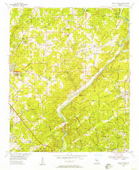 1955 Sandy Springs1957 Print · USGSThe northern edge of Atlanta and the banks of the Chattahoochee meet during a period of suburban transformation in the mid-fifties. Genealogists and local historians can trace family land via Heards Cem or locate community centers like the Powers Ferry Road Sch and Sardis Ch.6 unique versions available
 - 1956 Map of Duluth, 1957 Print
 1956 Duluth1957 Print · USGSGwinnett and Fulton counties are captured in the mid-fifties, just as the rural river settlements began to evolve. Genealogists can trace early landmarks like Shake Rag, Hull High Sch, and the many churches from Warsaw to Brookwood.4 unique versions available
Showing maps 1-25 of 162
Top cities of Fulton County
- Atlanta historical maps
- Sandy Springs historical maps
- South Fulton historical maps
- Roswell historical maps
- Johns Creek historical maps
- Alpharetta historical maps
See more
Frequently asked questions
- What are the different types of historical maps available for Fulton County?
- What is the oldest map of Fulton County?
- Where can I purchase historical maps of Fulton County for my home or office?
- Where can I download high-res historical maps of Fulton County?
- Are there historical topographic maps available for Fulton County?
- Is there historical aerial imagery available for Fulton County?
- Where are historical maps of Fulton County sourced from?