1970s Maps of Tama, Georgia
Explore 2 historic maps of Tama from the 1970s. These maps offer a rare glimpse into what life looked like during the 1970s — showing old roads, neighborhoods, homes, and landmarks that have changed or disappeared over time.
Whether you're researching your family's past, planning a metal detecting trip, or studying how Tama's landscape evolved across the 1970s, these high-resolution maps are a powerful tool for exploring the history of this region.
- Focus on a specific era: All maps on this page are from the 1970s, giving you a focused view of this time period.
- See what’s changed: Compare century-old streets, trails, and buildings to today's modern landscape using overlays and satellite layers.
- Research with precision: Use these maps for genealogy, historical research, land use analysis, or educational projects.
- View, download, or print: Maps are fully viewable online in high resolution, and can be downloaded or printed for your own records.
Start exploring Tama's history through authentic maps from the 1970s. This is your window into the past.
Tama, GA maps
(2)- 1974 Map of Reno, 1976 Print
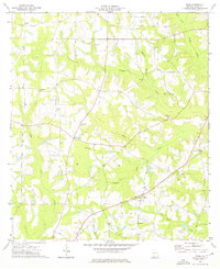 1974 Reno1976 Print · USGSGrady County rural life in the mid-seventies is defined by its quiet settlements and an extensive network of country churches. Researchers can trace family ties through Nickleville, Butler Cem, and the many local congregations like St Lukes Ch.
 - 1978 Map of Bainbridge, 1980 Print
 1978 Bainbridge1980 Print · USGSIn the late seventies, this Georgia-Florida borderland was defined by the confluence of the Flint and Chattahoochee rivers. Trace the region's infrastructure via the Seaboard Coast Line Railroad and find sites like Bainbridge State Hospital.
End of results
Showing maps 1-2 of 2
Top cities near Tama
- Bainbridge historical maps
- Cairo historical maps
- Havana historical maps
- Meigs historical maps
- Ochlocknee historical maps
- Attapulgus historical maps
See more
Frequently asked questions
- What are the different types of historical maps available for Tama?
- What is the oldest map of Tama?
- Where can I purchase historical maps of Tama for my home or office?
- Where can I download high-res historical maps of Tama?
- Are there historical topographic maps available for Tama?
- Is there historical aerial imagery available for Tama?
- Where are historical maps of Tama sourced from?