Old Maps of Irwin County, Georgia for Genealogy
Trace your family roots with 102 historic maps of Irwin County. These high-res maps reveal old neighborhoods, homesites, landmarks, and streets — helping you uncover where your ancestors lived and how the area evolved over time.
- Explore historic neighborhoods: Identify where your relatives may have lived in the 1800s or 1900s.
- Compare maps over time: Trace the changes in streets, buildings, and landmarks for multi-generational research.
- Perfect for genealogy & ancestry research: Used by family historians and researchers to map out lineage and migration.
These maps are an incredible resource for exploring your personal connection to Irwin County's past.
Irwin County, GA maps
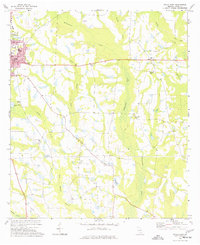
(102)- 1953 Map of Waycross, 1967 Print
 1953 Waycross1967 Print · USGSSouth Georgia's agricultural and rail heartland is captured here in the mid-1950s, showing a vast network of timber and farming towns. Researchers can trace the rail lines connecting Waycross and Tifton or locate landmarks like Jefferson Davis State Park and Lake Blackshear.2 unique versions available
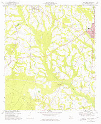
 - 1958 Map of Waycross
 1958 Waycross1958 Print · USGSSoutheast Georgia in the late fifties remains a landscape of deep river basins and vital rail junctions. Genealogists and historians can trace family-named landmarks and rural hubs like Union Church, South Georgia College, and the sprawling Okefenokee Swamp.2 unique versions available
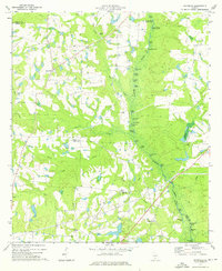
 - 1972 Map of Broxton North, 1975 Print
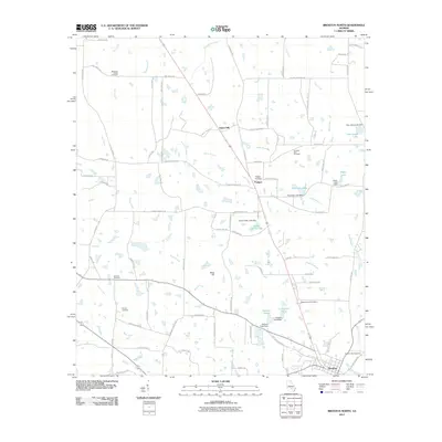
 1972 Broxton North1975 Print · USGSCoffee County agriculture and rail life are on full display in the early seventies, centered on the town of Broxton. Family historians can trace rural church and cemetery locations like Benjamin Chapel Cem, De Berry Ch, and the settlement at Pridgen.
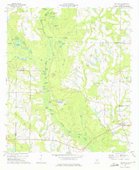
 - 1972 Map of Fitzgerald East, 1976 Print
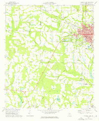
 1972 Fitzgerald East1976 Print · USGSGeorgia's Wiregrass region comes into focus during the early 1970s, as the county line between Ben Hill and Irwin follows the path of the Seaboard Coast Line. Genealogists can locate family sites at Evergreen Cemetery or Troup Cem and trace rural congregations at Anderson Mem Ch and Prospect Ch.2 unique versions available
 - 1972 Map of Lax, 1977 Print
 1972 Lax1977 Print · USGSCoastal plain agricultural life in the early seventies centered on small communities and river bottomlands. Genealogists can trace family roots through numerous local landmarks like St Johns Ch, Beulah Ch, and the settlement of Lax.2 unique versions available
 - 1972 Map of Ambrose, 1977 Print
 1972 Ambrose1977 Print · USGSThe rural landscapes of Coffee and Irwin Counties come into focus in the early 1970s as the Seaboard Coast Line railroad passes through Ambrose and Wray. Genealogists can trace family roots at New Hope Ch, Satilla Ch, and through landmarks like Smith Cem.
 - 1972 Map of Ocilla East, 1977 Print
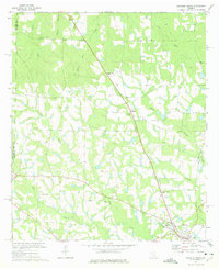
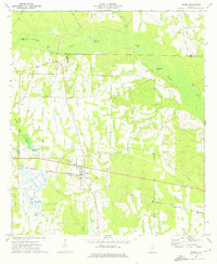
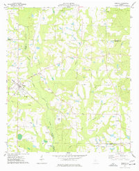
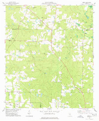
 1972 Ocilla East1977 Print · USGSIrwin County in the early seventies is mapped here as a landscape of river-bottom lowlands and established farming communities. Genealogists and local historians can locate Whitleys Cem, the settlement of Holt, and several country churches including Midway Ch.
 - 1973 Map of Ocilla West, 1975 Print
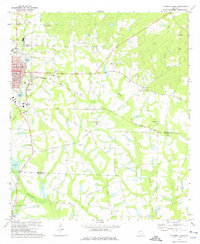
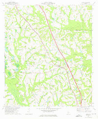
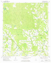
 1973 Ocilla West1975 Print · USGSIn the early 1970s, the rural reaches of Irwin County were defined by small agricultural settlements and the Seaboard Coast Line railroad. Genealogists and local historians can trace family ties through Fletcher Cem, Old Valley Grove Ch, and the streets of Ocilla.2 unique versions available
 - 1973 Map of Waterloo, 1975 Print
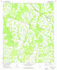
 1973 Waterloo1975 Print · USGSThe rural borderlands of Irwin, Turner, and Tift counties come into focus in the early 1970s, centered on the swampy reaches of the Alapaha River. Genealogists and local historians can trace the foundations of Waterloo and Harding, alongside rural landmarks like Eureka Ch and St Pauls Ch.2 unique versions available
 - 1973 Map of Irwinville, 1975 Print
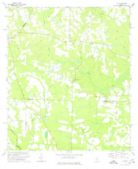
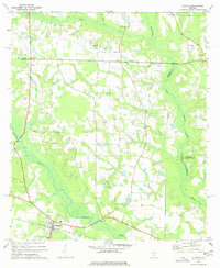
 1973 Irwinville1975 Print · USGSThe rural landscape of Irwin County comes into focus in the early 1970s, featuring the site of Jefferson Davis Memorial State Park. Researchers can trace the river-centered geography of Irwinville and locate historical community sites like Ebenezer Cem and Big Creek Ch.2 unique versions available
 - 1973 Map of Enigma, 1976 Print
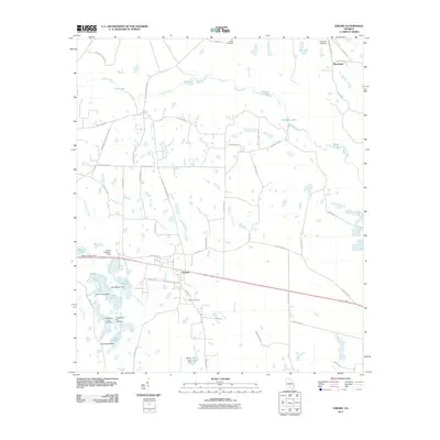
 1973 Enigma1976 Print · USGSThe settlement of Enigma and the surrounding Berrien County wetlands are captured here in the early seventies. Genealogists and local historians can trace rural landmarks like Turner Ch, Hardy Millpond, and the Seaboard Coast Line railroad.2 unique versions available
 - 1973 Map of Chula, 1976 Print
 1973 Chula1976 Print · USGSTift County in the early seventies shows an evolving agricultural landscape defined by its rail and research history. Researchers can trace rural lineages at Mt Zion Ch, locate old water features like Whiddons Millpond, and explore the rail corridor of the Georgia Southern and Florida.2 unique versions available
 - 1973 Map of Tifton East, 1976 Print
 1973 Tifton East1976 Print · USGSThe Tifton area in the early seventies shows a growing Georgia community where vital rail lines like the Seaboard Coast Line meet rural agriculture. Local historians can trace established landmarks including Vanceville, Corinth Ch, and the Henry Tift Myers Airport.2 unique versions available
 - 1973 Map of Fitzgerald West, 1976 Print
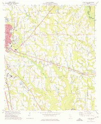
 1973 Fitzgerald West1976 Print · USGSThe city of Fitzgerald and the surrounding Ben Hill and Irwin County countryside are documented here in the early 1970s. Trace local family roots through country landmarks like New Prospect Ch, Dixon Cem, and the old settlement at Mystic.2 unique versions available
 - 1974 Map of Rebecca, 1977 Print
 1974 Rebecca1977 Print · USGSThe rural landscape of Turner County comes to life in the mid-1970s, showcasing the intersection of the Seaboard Coast Line and the Alapaha River. Genealogists can trace local roots at New Providence Ch, Paulk Cem, and the small settlement of Arp.
 - 1977 Map of Osierfield
 1977 Osierfield1977 Print · USGSOsierfield and the surrounding Georgia timberlands are captured here in the 1970s as the Seaboard Coast Line railroad shaped local life. Researchers can trace rural church and family history through sites like Macedonia Ch and Tucker Cem.2 unique versions available
 - 1977 Map of Alapaha
 1977 Alapaha1977 Print · USGSBerrien County and the surrounding river lands are captured here in the mid-seventies, centered on the railroad town of Alapaha. Genealogists and historians can trace numerous rural congregations, from Glory Ch and New Bethel Ch to the riverside St Lukes Ch.
 - 1977 Map of Sibbie
 1977 Sibbie1977 Print · USGSBen Hill County was still a landscape of quiet farms and timber stands in the 1970s. Genealogists and local historians can trace family-named sites like Tomberlin Cem, the community at Sibbie, and the Seaboard Coast Line railroad.
 - 1979 Map of Moultrie, 1980 Print
 1979 Moultrie1980 Print · USGSSouth Georgia’s agricultural heartland is documented here in the late 1970s, showcasing the intricate rail and river networks of Colquitt and Tift Counties. Researchers can trace historic settlements along the Georgia Northern railroad or locate landmarks like Spence Air Force Auxiliary Field and Banks Lake.2 unique versions available
 - 1979 Map of Hazlehurst, 1980 Print
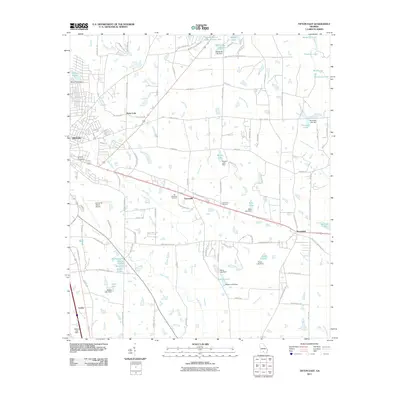
 1979 Hazlehurst1980 Print · USGSSoutheast Georgia in the late seventies is defined by the convergence of major rail lines and river basins in Jeff Davis and Appling counties. Genealogists and local historians can trace the development of Hazlehurst and Baxley alongside features like the Pine Grove Pipeline and the Altamaha River wetlands.
 - 1981 Map of Cordele, 1982 Print
 1981 Cordele1982 Print · USGSSouth Georgia’s agricultural heartland is documented here in the early eighties, showing the convergence of the Seaboard Coast Line Railroad and the Georgia Southern and Florida lines. Genealogists and researchers can trace local landmarks like Bowens Mill Pond, the University of Georgia Research Center, and the shores of Lake Blackshear.
 - 1988 Map of Waycross
 1988 Waycross1988 Print · USGSSouth Georgia's wiregrass and timber country is documented here in the late eighties, centered on the vital rail junction of Waycross. Genealogists and historians can trace the rural landscape from Okefenokee up to the Ocmulgee, finding sites like Lumber City and Jefferson Davis Memorial State Park.
 - 2011 Map of Broxton North, 2011 Print
 2011 Broxton North2011 Print · USGSCovers Irwin County, including Broxton, Sapps Still, and other nearby areas
 - 2011 Map of Tifton East, 2011 Print
 2011 Tifton East2011 Print · USGSCovers Irwin County, including Tifton, Brookfield, and other nearby areas
 - 2011 Map of Enigma, 2011 Print
 2011 Enigma2011 Print · USGSCovers Irwin County, including Enigma, Riverbend, and other nearby areas
Showing maps 1-25 of 102
Top cities of Irwin County
Frequently asked questions
- What are the different types of historical maps available for Irwin County?
- What is the oldest map of Irwin County?
- Where can I purchase historical maps of Irwin County for my home or office?
- Where can I download high-res historical maps of Irwin County?
- Are there historical topographic maps available for Irwin County?
- Is there historical aerial imagery available for Irwin County?
- Where are historical maps of Irwin County sourced from?