Old Maps of McElheneys Crossroads, Georgia
Explore 13 old maps of McElheneys Crossroads, spanning from 1951 to today. These high-resolution historic maps reveal how streets, neighborhoods, landmarks, and natural features evolved over time — perfect for genealogy, metal detecting, research, and local history exploration.
What you can do with these maps:
- See how McElheneys Crossroads changed over time: Compare historical maps to modern-day views to trace roads, homesites, rail lines & more.
- View detailed metadata: Each map includes creators, publishers, year, scale, and archive source.
- Overlay maps with satellite & LiDAR: Visualize the past alongside modern tools to explore terrain & human change.
- Trusted historical sources: Maps sourced from the USGS, Library of Congress, and other archives.
- Access maps your way: View online, download high-res files, or order prints for personal or research use.
Start exploring old maps of McElheneys Crossroads to uncover forgotten places, hidden landmarks, and the deep history beneath your feet.
McElheneys Crossroads, GA maps
(13)- 1951 Map of Forsyth, 1953 Print
 1951 Forsyth1953 Print · USGSThe Monroe County seat and the Ocmulgee River corridor are captured here during the early fifties, showing a landscape defined by rail-fed industry and deep-rooted rural communities. Genealogists can locate family landmarks like Brighton Mills, Bessie Tift College, and the riverside settlement of Juliette.3 unique versions available
 - 1953 Map of Athens, 1966 Print
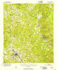
 1953 Athens1966 Print · USGSGeorgia's Piedmont and Savannah River borderlands come alive in this mid-century survey of the region surrounding Athens and Augusta. Trace the rail-and-river economy through the Georgia RR and landmarks like the Fort Gordon Military Reservation.3 unique versions available
 - 1958 Map of Athens
 1958 Athens1958 Print · USGSNorth-central Georgia and the Savannah River valley are captured in the late fifties, showing the region as the new reservoirs were filling. Researchers can trace historic rail lines like the Georgia RR and locate rural landmarks such as Social Circle, Graves Mountain, and the Fort Gordon Military Reservation.
 - 1959 Map of Athens
 1959 Athens1959 Print · USGSNortheast Georgia and the South Carolina borderlands appear here in the mid-fifties, during a decade of infrastructure growth. Genealogists and historians can trace the rail-and-river geography of towns like Social Circle, the sprawl of Fort Gordon Military Reservation, and the newly formed Clark Hill Reservoir.
 - 1963 Map of Athens
 1963 Athens1963 Print · USGSGeorgia's Piedmont and the Savannah River valley are captured in the early sixties as major reservoirs and military installations reshaped the landscape. Researchers can trace the development of Clark Hill Reservoir, locate the Fort Gordon Military Reservation, and find historic towns like Social Circle and Eatonton.
 - 1973 Map of Berner, 1975 Print
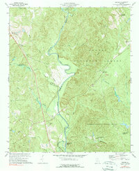 1973 Berner1975 Print · USGSCentral Georgia's river-cut timberlands are captured here in the early seventies, showing the rural communities of Jasper and Butts counties. Genealogists and historians can trace the Southern railroad corridor through Berner and locate country congregations like Ward Ch.2 unique versions available
 - 1981 Map of Milledgeville
 1981 Milledgeville1981 Print · USGSMiddle Georgia in the early eighties shows a landscape shaped by major reservoirs and deep forests. Genealogists and historians can trace the rail networks of the Southern and Central of Georgia through towns like Monticello and Eatonton.2 unique versions available
 - 1988 Map of Athens
 1988 Athens1988 Print · USGSThe Georgia Piedmont and South Carolina borderlands appear in the late eighties as a landscape of vast reservoirs and growing towns. Researchers can trace the legacy of the Georgia RR connecting Athens and Augusta, or locate landmarks within Oconee National Forest.
 - 2011 Map of Berner, 2011 Print
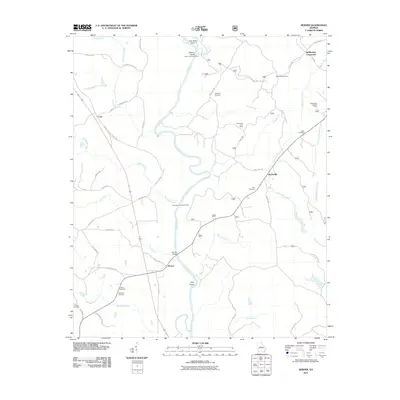 2011 Berner2011 Print · USGSCovers McElheneys Crossroads, including Gladesville, Berner, and other nearby areas
 - 2014 Map of Berner, 2014 Print
 2014 Berner2014 Print · USGSCovers McElheneys Crossroads, including Gladesville, Berner, and other nearby areas
 - 2017 Map of Berner, 2017 Print
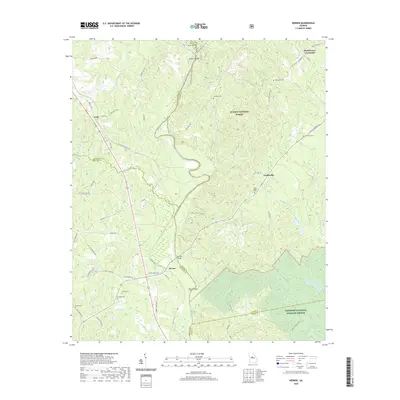
 2017 Berner2017 Print · USGSCovers McElheneys Crossroads, including Gladesville, Berner, and other nearby areas
 - 2020 Map of Berner, 2020 Print
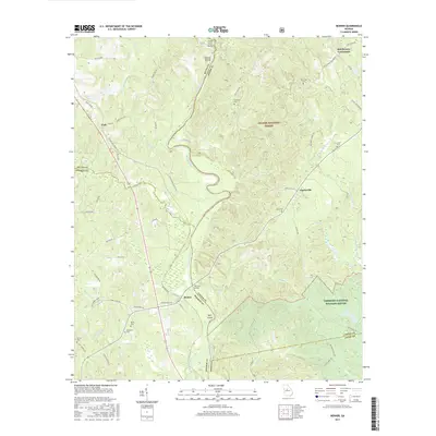
 2020 Berner2020 Print · USGSCovers McElheneys Crossroads, including Gladesville, Berner, and other nearby areas
 - 2024 Map of Berner, 2024 Print
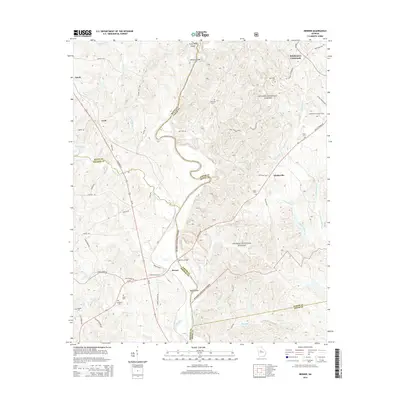
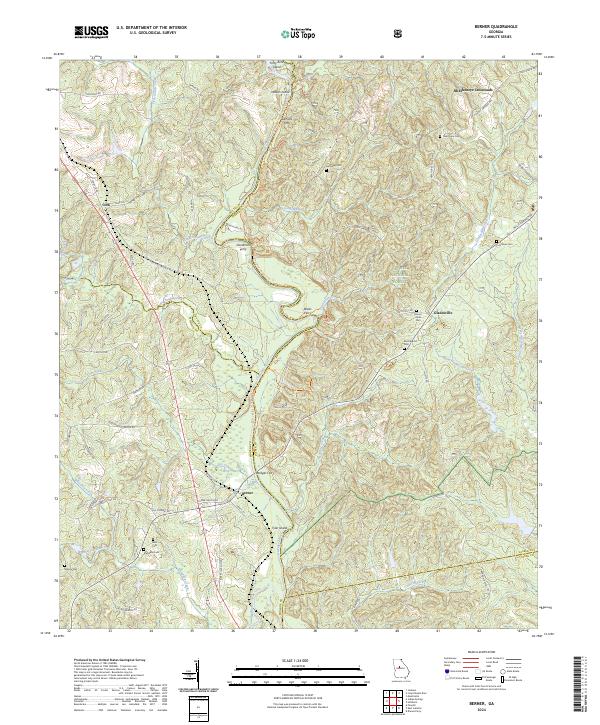 2024 Berner2024 Print · USGSThe Ocmulgee River corridor comes to life in this recent survey of the Jasper and Monroe county border. Genealogists can trace family landmarks and river crossings like Bridges Ferry, Mount Olive Cem, and the crossroads at Berner.
End of results
Showing maps 1-13 of 13
Top cities near McElheneys Crossroads
- Jackson historical maps
- Forsyth historical maps
- Gray historical maps
- Monticello historical maps
- Flovilla historical maps
- Shady Dale historical maps
Frequently asked questions
- What are the different types of historical maps available for McElheneys Crossroads?
- What is the oldest map of McElheneys Crossroads?
- Where can I purchase historical maps of McElheneys Crossroads for my home or office?
- Where can I download high-res historical maps of McElheneys Crossroads?
- Are there historical topographic maps available for McElheneys Crossroads?
- Is there historical aerial imagery available for McElheneys Crossroads?
- Where are historical maps of McElheneys Crossroads sourced from?