Old Maps of Cisco, Georgia for Genealogy
Trace your family roots with 17 historic maps of Cisco. These high-res maps reveal old neighborhoods, homesites, landmarks, and streets — helping you uncover where your ancestors lived and how the area evolved over time.
- Explore historic neighborhoods: Identify where your relatives may have lived in the 1800s or 1900s.
- Compare maps over time: Trace the changes in streets, buildings, and landmarks for multi-generational research.
- Perfect for genealogy & ancestry research: Used by family historians and researchers to map out lineage and migration.
These maps are an incredible resource for exploring your personal connection to Cisco's past.
Cisco, GA maps
(17)- 1886 Map of Dalton
 1886 Dalton1886 Print · USGSNorthwest Georgia in the 1880s is a landscape of mountain gaps and vital river ferries. Trace family roots and vanished infrastructure from Dalton to Spring Place, including named landmarks like Shackelfords Ferry and Fort Mountain.
 - 1892 Map of Dalton
 1892 Dalton1892 Print · USGSNorthwest Georgia in the late nineteenth century was defined by its river crossings and the emerging rail lines through Dalton. Researchers can trace the Federal Road and locate family landmarks like Newtown Ferry or Talking Rock Mills.
 - 1897 Map of Dalton
 1897 Dalton1897 Print · USGSNorthwest Georgia in the late nineteenth century was a rugged landscape of river crossings and mountain gaps. Genealogists can trace early homesteads and commerce at Praters Mill, Spring Place, and historic river crossings like Montgomery Ferry.4 unique versions available
 - 1911 Map of Cohutta Mtn
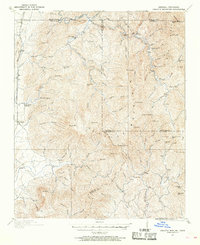 1911 Cohutta Mtn1911 Print · USGSThe Georgia-Tennessee borderlands in the early twentieth century were defined by mountain rail and timber. Genealogists can trace family roots through settlements like Tennga and Crandall or locate historic operations like Hassler Mill along the rail line.2 unique versions available
 - 1913 Map of Cohutta Mtn.
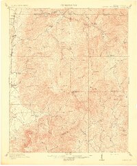 1913 Cohutta Mtn.1913 Print · USGSThe Georgia and Tennessee borderlands appear here in the years before the Great Depression, centered on the high peaks of the Blue Ridge. Researchers can trace early railroad life along the Louisville & Nashville RR or locate old sites like Cohutta Springs and Hassler Mill.3 unique versions available
 - 1955 Map of Rome
 1955 Rome1955 Print · USGSThe tri-state borderlands of Georgia, Alabama, and Tennessee appear in the mid-fifties as a landscape of ridge-and-valley industry and river navigation. Genealogists can trace family footprints near Chattanooga, the iron works of Gadsden, and textile towns like Trion or Summerville.
 - 1958 Map of Rome, 1966 Print
 1958 Rome1966 Print · USGSNorthwest Georgia and neighboring Tennessee and Alabama are captured here in the late fifties, showcasing a landscape of high ridges and river valleys. Researchers can trace historic rail lines like the Seaboard Air Line RR and explore the bounds of Cloudland Canyon State Park or Fort Oglethorpe.3 unique versions available
 - 1961 Map of Rome
 1961 Rome1961 Print · USGSNorthwest Georgia and neighboring Tennessee and Alabama are shown here at a moment of significant mid-century growth. Researchers can trace the rail networks of the Central of Georgia or locate landmarks within Chickamauga and Chattanooga Nat Military Park.
 - 1963 Map of Rome
 1963 Rome1963 Print · USGSThe tri-state corner of Georgia, Alabama, and Tennessee is captured here during a period of massive reservoir expansion and post-war growth. Genealogists and historians can trace the rail corridors of the Southern Ry or locate landmarks like Fort Oglethorpe and Cloudland Canyon State Park.
 - 1968 Map of Tennga, 1973 Print
 1968 Tennga1973 Print · USGSThe Georgia-Tennessee borderlands appear here in the late sixties, where rail lines and river valleys dictated the pace of life. Genealogists can trace family landmarks like Cohutta Springs, Mt Sumac Ch, and the small siding at Cisco.3 unique versions available
 - 1981 Map of Dalton, 1982 Print
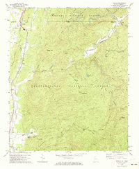
 1981 Dalton1982 Print · USGSNorth Georgia and the tristate borderlands are captured in the early eighties as the textile economy of Dalton thrived alongside the expanding Chattahoochee National Forest. Genealogists and hikers can trace the Appalachian Trail through the high country or locate family-named landmarks like Haskins Mill and Carters Mill.
 - 1997 Map of Tennga, 2000 Print
 1997 Tennga2000 Print · USGSThe borderlands of Murray County and Tennessee are captured here in the late nineties, showing the rural communities along the L & N RR. Genealogists and hikers can trace old routes near Tennga, find country churches like Mt Suman Ch, and explore the Cohutta Wilderness.
 - 2011 Map of Tennga, 2011 Print
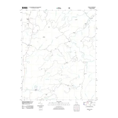 2011 Tennga2011 Print · USGSCovers Cisco, including Tennga, Doogan, and other nearby areas
 - 2014 Map of Tennga, 2014 Print
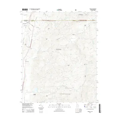 2014 Tennga2014 Print · USGSCovers Cisco, including Tennga, Doogan, and other nearby areas
 - 2017 Map of Tennga, 2017 Print
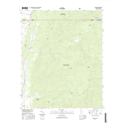 2017 Tennga2017 Print · USGSCovers Cisco, including Tennga, Doogan, and other nearby areas
 - 2020 Map of Tennga, 2020 Print
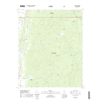 2020 Tennga2020 Print · USGSCovers Cisco, including Tennga, Doogan, and other nearby areas
 - 2024 Map of Tennga, 2024 Print
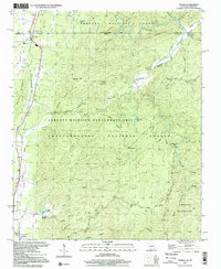
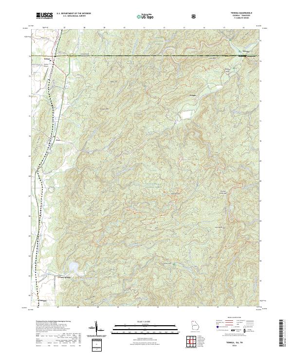 2024 Tennga2024 Print · USGSThe northern Georgia borderlands come alive in this survey of Murray County, showing the intersection of the Cohutta Wilderness and rural valley life. Genealogists and hikers can trace the geography around Cohutta Springs, Cisco, and the remote Alaculsy Valley.
End of results
Showing maps 1-17 of 17
Top cities near Cisco
- Cleveland historical maps
- Dalton historical maps
- Chatsworth historical maps
- Varnell historical maps
- Benton historical maps
- Cohutta historical maps
See more
Frequently asked questions
- What are the different types of historical maps available for Cisco?
- What is the oldest map of Cisco?
- Where can I purchase historical maps of Cisco for my home or office?
- Where can I download high-res historical maps of Cisco?
- Are there historical topographic maps available for Cisco?
- Is there historical aerial imagery available for Cisco?
- Where are historical maps of Cisco sourced from?