Old Maps of Midland, Columbus
Explore 14 old maps of Midland, spanning from 1907 to today. These high-resolution historic maps reveal how streets, neighborhoods, landmarks, and natural features evolved over time — perfect for genealogy, metal detecting, research, and local history exploration.
What you can do with these maps:
- See how Midland changed over time: Compare historical maps to modern-day views to trace roads, homesites, rail lines & more.
- View detailed metadata: Each map includes creators, publishers, year, scale, and archive source.
- Overlay maps with satellite & LiDAR: Visualize the past alongside modern tools to explore terrain & human change.
- Trusted historical sources: Maps sourced from the USGS, Library of Congress, and other archives.
- Access maps your way: View online, download high-res files, or order prints for personal or research use.
Start exploring old maps of Midland to uncover forgotten places, hidden landmarks, and the deep history beneath your feet.
Midland, Columbus maps
(14)- 1907 Map of Talbotton
 1907 Talbotton1907 Print · USGSWest-central Georgia at the turn of the century is a landscape of ridges and rail-lines, dominated by the thermal waters of Warm Springs. Local historians can trace the foundations of Talbotton and rural life at Turntime Crossroads, Cataula Camp Ground, and Greens Mill.3 unique versions available
 - 1949 Map of Midland
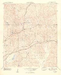 1949 Midland1949 Print · USGSMuscogee and Harris Counties appear here just after the war, showing the expansion of the Fort Benning Military Reservation. Researchers can trace the Southern rail lines connecting Midland and Schatulga.2 unique versions available
 - 1950 Map of Ellerslie, 1955 Print
 1950 Ellerslie1955 Print · USGSThe Muscogee and Harris County borderlands appear here in the mid-twentieth century as the city of Columbus begins its northward expansion. Researchers can trace the rural roots of the region through landmarks like Turntime Crossroads, Double Churches, and the Columbus Speedway Racetrack.
 - 1955 Map of Midland, 1959 Print
 1955 Midland1959 Print · USGSThe Muscogee and Harris County borderlands in the mid-fifties show a landscape of rail-fed settlements and expanding military borders. Genealogists can find legacy sites like Lynch Road Sch, Pitts Chapel, and the intersection of the SOUTHERN and CENTRAL OF GEORGIA rail lines.4 unique versions available
 - 1955 Map of Ellerslie, 1961 Print
 1955 Ellerslie1961 Print · USGSMid-century Harris and Muscogee counties were defined by rural crossroads and the northward expansion of Columbus. Genealogists and researchers can trace family landmarks like Turntime Crossroads, Pierce Chapel, and the Good Samaritan Home for Aged.
 - 1955 Map of Phenix City, 1964 Print
 1955 Phenix City1964 Print · USGSPost-war Alabama and Georgia meet along the Chattahoochee River as industry and military installations expand. Trace the rail lines of the Central of Georgia through towns like Opelika, Tuskegee, and Alexander City.3 unique versions available
 - 1957 Map of Phenix City
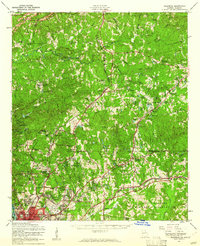
 1957 Phenix City1957 Print · USGSThe Alabama-Georgia borderlands are captured here in the mid-fifties, centered on the bustling river crossing at Phenix City and Columbus. Researchers can trace the mid-century footprint of the Fort Benning Military Reservation or locate smaller textile and railroad towns like Langdale and Camp Hill.
 - 1958 Map of Phenix City
 1958 Phenix City1958 Print · USGSThe Alabama-Georgia borderlands thrive during the late fifties, anchored by the river-driven industry of Columbus and Phenix City. Researchers can trace the mid-century footprints of Fort Benning, Auburn, and the textile towns of Fairfax and Lanett.
 - 1981 Map of Thomaston, 1982 Print
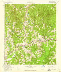
 1981 Thomaston1982 Print · USGSCentral Georgia’s ridgeline and river country comes into focus in this early 1980s survey of the Pine Mountain corridor. Researchers can trace historic church sites like Oak Grove Ch, the rail junctions at Manchester, and the expansive Franklin D Roosevelt State Park.
 - 2011 Map of Midland, 2011 Print
 2011 Midland2011 Print · USGSCovers Midland, including Columbus, Gordydale, and other nearby areas
 - 2014 Map of Midland, 2014 Print
 2014 Midland2014 Print · USGSCovers Midland, including Columbus, Gordydale, and other nearby areas
 - 2017 Map of Midland, 2017 Print
 2017 Midland2017 Print · USGSCovers Midland, including Columbus, Gordydale, and other nearby areas
 - 2020 Map of Midland, 2020 Print
 2020 Midland2020 Print · USGSCovers Midland, including Columbus, Gordydale, and other nearby areas
 - 2024 Map of Midland, 2024 Print
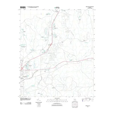
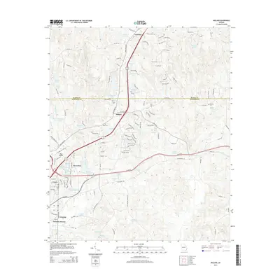
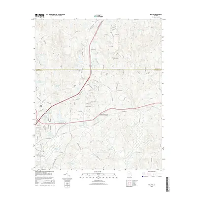
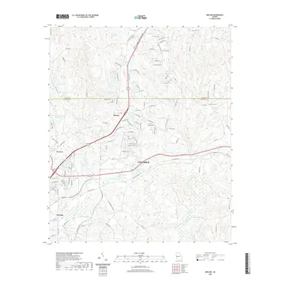
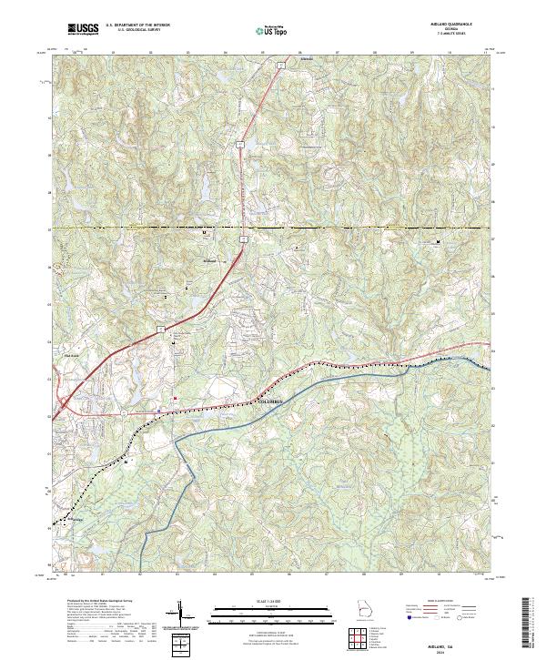 2024 Midland2024 Print · USGSThe northern suburbs of Columbus and the village of Midland are captured in this modern survey, showing a landscape defined by creeks and military boundaries. Genealogists can locate several historic burial sites, including Jenkin Cem, Willis Cem, and the Pitts Chapel AME Church Cem.
End of results
Showing maps 1-14 of 14
Top cities near Midland
- Columbus historical maps
- Phenix City historical maps
- Waverly Hall historical maps
- Hamilton historical maps
- Shiloh historical maps
Frequently asked questions
- What are the different types of historical maps available for Midland?
- What is the oldest map of Midland?
- Where can I purchase historical maps of Midland for my home or office?
- Where can I download high-res historical maps of Midland?
- Are there historical topographic maps available for Midland?
- Is there historical aerial imagery available for Midland?
- Where are historical maps of Midland sourced from?