1900s (20th Century) Maps of Paulding County, Georgia
Explore 32 historic maps of Paulding County from the 1900s (20th Century). These maps offer a rare glimpse into what life looked like during the 1900s — showing old roads, neighborhoods, homes, and landmarks that have changed or disappeared over time.
Whether you're researching your family's past, planning a metal detecting trip, or studying how Paulding County's landscape evolved across the 1900s, these high-resolution maps are a powerful tool for exploring the history of this region.
- Focus on a specific era: All maps on this page are from the 1900s, giving you a focused view of this time period.
- See what’s changed: Compare century-old streets, trails, and buildings to today's modern landscape using overlays and satellite layers.
- Research with precision: Use these maps for genealogy, historical research, land use analysis, or educational projects.
- View, download, or print: Maps are fully viewable online in high resolution, and can be downloaded or printed for your own records.
Start exploring Paulding County's history through authentic maps from the 1900s. This is your window into the past.
Paulding County, GA maps
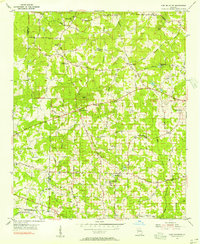
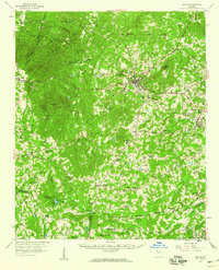
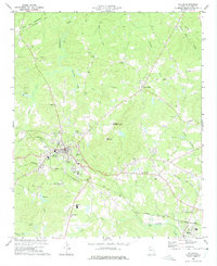
(32)- 1901 Map of Marietta
 1901 Marietta1901 Print · USGSCovers Paulding County, including Atlanta, South Fulton, and other nearby areas4 unique versions available
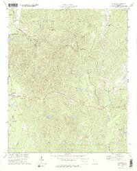
 - 1906 Map of Stilesboro, 1971 Print
 1906 Stilesboro1971 Print · USGSCovers Paulding County, including Cartersville, Euharlee, and other nearby areas
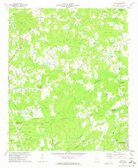
 - 1907 Map of Acworth, 1954 Print
 1907 Acworth1954 Print · USGSCovers Paulding County, including Marietta, Kennesaw, and other nearby areas
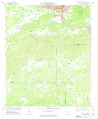
 - 1908 Map of Stilesboro
 1908 Stilesboro1908 Print · USGSCovers Paulding County, including Cartersville, Euharlee, and other nearby areas
 - 1909 Map of Acworth
 1909 Acworth1909 Print · USGSCovers Paulding County, including Marietta, Kennesaw, and other nearby areas
 - 1953 Map of Atlanta, 1965 Print
 1953 Atlanta1965 Print · USGSCovers Paulding County, including Atlanta, Sandy Springs, and other nearby areas2 unique versions available
 - 1954 Map of Lost Mountain, 1956 Print
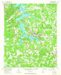
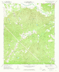
 1954 Lost Mountain1956 Print · USGSCovers Paulding County, including Kennesaw, Powder Springs, and other nearby areas4 unique versions available
 - 1954 Map of Austell, 1956 Print
 1954 Austell1956 Print · USGSCovers Paulding County, including Douglasville, Lithia Springs, and other nearby areas5 unique versions available
 - 1955 Map of Rome
 1955 Rome1955 Print · USGSCovers Paulding County, including Chattanooga, Sandy Springs, and other nearby areas
 - 1956 Map of Acworth, 1957 Print
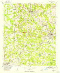
 1956 Acworth1957 Print · USGSCovers Paulding County, including Kennesaw, Acworth, and other nearby areas6 unique versions available
 - 1957 Map of Atlanta
 1957 Atlanta1957 Print · USGSCovers Paulding County, including Atlanta, Sandy Springs, and other nearby areas
 - 1958 Map of Atlanta
 1958 Atlanta1958 Print · USGSCovers Paulding County, including Atlanta, Sandy Springs, and other nearby areas
 - 1958 Map of Buchanan, 1960 Print
 1958 Buchanan1960 Print · USGSCovers Paulding County, including Cedartown, Rockmart, and other nearby areas2 unique versions available
 - 1958 Map of Dallas, 1960 Print
 1958 Dallas1960 Print · USGSCovers Paulding County, including Douglasville, Villa Rica, and other nearby areas2 unique versions available
 - 1958 Map of Rome, 1966 Print
 1958 Rome1966 Print · USGSCovers Paulding County, including Chattanooga, Sandy Springs, and other nearby areas3 unique versions available
 - 1961 Map of Rome
 1961 Rome1961 Print · USGSCovers Paulding County, including Chattanooga, Sandy Springs, and other nearby areas
 - 1963 Map of Rome
 1963 Rome1963 Print · USGSCovers Paulding County, including Chattanooga, Sandy Springs, and other nearby areas
 - 1972 Map of Burnt Hickory Ridge, 1974 Print
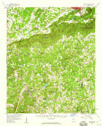
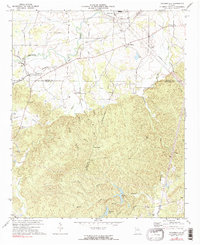
 1972 Burnt Hickory Ridge1974 Print · USGSCovers Paulding County, including Cartersville, Emerson, and other nearby areas2 unique versions available
 - 1972 Map of Taylorsville, 1974 Print
 1972 Taylorsville1974 Print · USGSCovers Paulding County, including Euharlee, Taylorsville, and other nearby areas2 unique versions available
 - 1973 Map of Draketown, 1975 Print
 1973 Draketown1975 Print · USGSCovers Paulding County, including Temple, Draketown, and other nearby areas2 unique versions available
 - 1973 Map of Dallas, 1975 Print
 1973 Dallas1975 Print · USGSCovers Paulding County, including Dallas, Hiram, and other nearby areas3 unique versions available
 - 1973 Map of Yorkville, 1975 Print
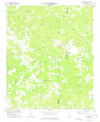
 1973 Yorkville1975 Print · USGSCovers Paulding County, including Dallas, Braswell, and other nearby areas2 unique versions available
 - 1973 Map of Nebo, 1975 Print
 1973 Nebo1975 Print · USGSCovers Paulding County, including Douglasville, Villa Rica, and other nearby areas3 unique versions available
 - 1973 Map of Rockmart South, 1975 Print
 1973 Rockmart South1975 Print · USGSCovers Paulding County, including Rockmart, Beulah, and other nearby areas2 unique versions available
 - 1973 Map of New Georgia, 1975 Print
 1973 New Georgia1975 Print · USGSCovers Paulding County, including Villa Rica, Rollins, and other nearby areas2 unique versions available
Showing maps 1-25 of 32
Top cities of Paulding County
Frequently asked questions
- What are the different types of historical maps available for Paulding County?
- What is the oldest map of Paulding County?
- Where can I purchase historical maps of Paulding County for my home or office?
- Where can I download high-res historical maps of Paulding County?
- Are there historical topographic maps available for Paulding County?
- Is there historical aerial imagery available for Paulding County?
- Where are historical maps of Paulding County sourced from?