1900s (20th Century) Maps of Polk County, Georgia
Explore 28 historic maps of Polk County from the 1900s (20th Century). These maps offer a rare glimpse into what life looked like during the 1900s — showing old roads, neighborhoods, homes, and landmarks that have changed or disappeared over time.
Whether you're researching your family's past, planning a metal detecting trip, or studying how Polk County's landscape evolved across the 1900s, these high-resolution maps are a powerful tool for exploring the history of this region.
- Focus on a specific era: All maps on this page are from the 1900s, giving you a focused view of this time period.
- See what’s changed: Compare century-old streets, trails, and buildings to today's modern landscape using overlays and satellite layers.
- Research with precision: Use these maps for genealogy, historical research, land use analysis, or educational projects.
- View, download, or print: Maps are fully viewable online in high resolution, and can be downloaded or printed for your own records.
Start exploring Polk County's history through authentic maps from the 1900s. This is your window into the past.
Polk County, GA maps
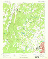
(28)- 1901 Map of Marietta
 1901 Marietta1901 Print · USGSNorthwest Georgia at the turn of the century is a landscape of growing rail towns and vital river crossings. Researchers can trace early rural life through features like Old Villarica, Pumpkintown Ferry, and the Mount Zion Church.4 unique versions available
 - 1904 Map of Rome
 1904 Rome1904 Print · USGSNorthwest Georgia and the Alabama borderlands are captured here during a period of heavy river traffic and expanding rail lines. Genealogists can trace family footprints across dozens of river crossings like Freeman Ferry and early settlements such as Chubbtown or Raccoon Mills.4 unique versions available
 - 1906 Map of Stilesboro, 1971 Print
 1906 Stilesboro1971 Print · USGSBartow County at the turn of the century was a bustling nexus of rail and river commerce before the modern highway era. Genealogists and historians can trace the foundations of Cartersville and find rural landmarks like Euharlee Ch, Malbone, and Petrobutte PO.
 - 1908 Map of Stilesboro
 1908 Stilesboro1908 Print · USGSBartow County's industrial and agricultural landscape at the turn of the century is defined by its busy rail junctions and the winding Etowah River. Genealogists and historians can trace the early road networks and rail stops from Cartersville to Stilesboro, finding named points like Rogers Ferrobutte PO and Harden Bridge.
 - 1953 Map of Atlanta, 1965 Print
 1953 Atlanta1965 Print · USGSThe growing Atlanta metro and the industrial corridors of Eastern Alabama are captured here during the mid-century transition. Researchers can trace the rail-to-road shift through hubs like Anniston and La Grange or locate sites within Fort McClellan.2 unique versions available
 - 1955 Map of Rome
 1955 Rome1955 Print · USGSThe tri-state borderlands of Georgia, Alabama, and Tennessee appear in the mid-fifties as a landscape of ridge-and-valley industry and river navigation. Genealogists can trace family footprints near Chattanooga, the iron works of Gadsden, and textile towns like Trion or Summerville.
 - 1957 Map of Atlanta
 1957 Atlanta1957 Print · USGSAtlanta and the Alabama borderlands appear here in the mid-fifties, capturing the region's post-war suburban and industrial transition. Trace the development of early transport hubs and military sites like Fort McPherson, Anniston, and the Kennesaw Mountain National Battlefield Park.
 - 1958 Map of Atlanta
 1958 Atlanta1958 Print · USGSMid-century Georgia and Alabama are shown in this regional study of the corridor between the Chattahoochee River and the Appalachian foothills. Local historians can trace the development of suburban Atlanta alongside vital landmarks like Stone Mountain, Dobbins AFB, and the Seaboard Air Line rail routes.
 - 1958 Map of Buchanan, 1960 Print
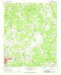
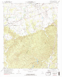
 1958 Buchanan1960 Print · USGSHaralson and Polk Counties are shown in the late fifties as a landscape of ridge-top churches and valley railroads. Genealogists can trace family footprints at Lees Chapel, Abernathys Mill, and along the Central of Georgia Railroad.2 unique versions available
 - 1958 Map of Dallas, 1960 Print
 1958 Dallas1960 Print · USGSPaulding County and parts of Carroll and Douglas emerge in the late 1950s as a landscape of rail-junction towns and rural church communities. Researchers can trace family roots at Willow Springs Ch, locate the old Drive-in Theater, or follow the SEABOARD rail lines.2 unique versions available
 - 1958 Map of Rome, 1966 Print
 1958 Rome1966 Print · USGSNorthwest Georgia and neighboring Tennessee and Alabama are captured here in the late fifties, showcasing a landscape of high ridges and river valleys. Researchers can trace historic rail lines like the Seaboard Air Line RR and explore the bounds of Cloudland Canyon State Park or Fort Oglethorpe.3 unique versions available
 - 1961 Map of Rome
 1961 Rome1961 Print · USGSNorthwest Georgia and neighboring Tennessee and Alabama are shown here at a moment of significant mid-century growth. Researchers can trace the rail networks of the Central of Georgia or locate landmarks within Chickamauga and Chattanooga Nat Military Park.
 - 1963 Map of Rome
 1963 Rome1963 Print · USGSThe tri-state corner of Georgia, Alabama, and Tennessee is captured here during a period of massive reservoir expansion and post-war growth. Genealogists and historians can trace the rail corridors of the Southern Ry or locate landmarks like Fort Oglethorpe and Cloudland Canyon State Park.
 - 1966 Map of Benedict, 1967 Print
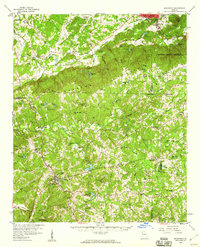
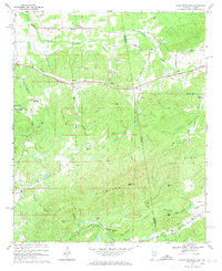
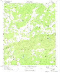
 1966 Benedict1967 Print · USGSThe rural borderlands of Polk and Haralson counties are captured here in the mid-1960s, showing a landscape shaped by high ridges and rail lines. Genealogists and local historians can locate several country churches like Macedonia Ch and family-named landmarks such as Akes and Brewster Mtn.2 unique versions available
 - 1966 Map of Borden Springs, 1967 Print
 1966 Borden Springs1967 Print · USGSSettlements along the Alabama-Georgia border were defined by the railroads and furnace industry in the 1960s. Genealogists and historians can locate family landmarks like Arrington Chapel Cem, the site of Tecumseh Furnace, and Borden Wheeler Springs.3 unique versions available
 - 1967 Map of Cedartown West, 1968 Print
 1967 Cedartown West1968 Print · USGSIn the late sixties, the landscape between Cave Spring and Cedartown was defined by small rural settlements and a strong network of country churches. Genealogists and local historians can trace family locations through landmarks like Chubbtown, Red Hill Cem, and the State School for the Deaf.3 unique versions available
 - 1967 Map of Cedartown East, 1968 Print
 1967 Cedartown East1968 Print · USGSCedartown and its rural surroundings are captured here in the late sixties as a vital crossroads of Georgia's rail and community life. Researchers can find numerous family-named landmarks and old congregations, from Lake Creek Sch to Wesley Chapel and Fish Creek.4 unique versions available
 - 1967 Map of Indian Mountain, 1969 Print
 1967 Indian Mountain1969 Print · USGSCherokee County, Alabama and Polk County, Georgia meet here in the late sixties along the slopes of the Appalachian foothills. Local historians can trace the foundations of the area through family-named landmarks and old communities like Forney, Bluffton, and Etna.3 unique versions available
 - 1968 Map of Rockmart North, 1970 Print
 1968 Rockmart North1970 Print · USGSNorthwest Georgia during the late sixties was a landscape of rail-dependent industrial towns and rural family farmsteads. Genealogists can trace ancestral sites like Shady Grove Ch, Rose Hill Cemetery, and the old quarries around Portland.2 unique versions available
 - 1972 Map of Taylorsville, 1974 Print
 1972 Taylorsville1974 Print · USGSThe rural borderlands of Bartow and Polk counties are captured here in the early 1970s, showing a landscape defined by valley farming and rail junctions. You can trace local genealogy and land use through landmarks like Taylorsville Sch, Euharlee Ch, and the Claypit near the Seaboard tracks.2 unique versions available
 - 1973 Map of Felton, 1975 Print
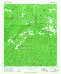
 1973 Felton1975 Print · USGSThe rural border of Polk and Haralson Counties is documented here in the early 1970s, showing a landscape of ridgelines and mountain valleys. Researchers can trace families and communities through landmarks like Felton, Hightower Falls, and old country churches such as Bethlehem Ch and Youngs Grove Ch.2 unique versions available
 - 1973 Map of Yorkville, 1975 Print
 1973 Yorkville1975 Print · USGSThe Paulding County highlands come into focus in the early 1970s as a landscape of rural communities and railroad junctions. Researchers can trace family sites at Yorkville or New Liberty Ch and locate historic industrial markers like the Ship Mine.2 unique versions available
 - 1973 Map of Rockmart South, 1975 Print
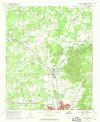
 1973 Rockmart South1975 Print · USGSThe industrial and rural landscape of Polk County comes into focus in the early 1970s, from the rail yards of Rockmart to the banks of the TALLAPOOSA RIVER. Researchers can trace old family settlements and local landmarks like Van Wert, Noah Chapel, and the County Line Cem.2 unique versions available
 - 1975 Map of Borden Springs, 1977 Print
 1975 Borden Springs1977 Print · USGSThe Alabama and Georgia borderlands are captured in clear aerial detail during the mid-1970s. Local history enthusiasts can trace the exact buildings and road networks surrounding Borden Springs and the border settlement of Esom Hill.
 - 1981 Map of Cartersville, 1982 Print
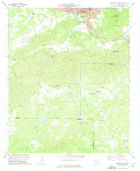
 1981 Cartersville1982 Print · USGSNorth Georgia at the start of the eighties shows a landscape defined by massive reservoirs and historic rail corridors. Researchers can trace the heritage of the Etowah Indian Mounds or locate old junctions along the Southern Railway and Seaboard Coast Line.2 unique versions available
Showing maps 1-25 of 28
Top cities of Polk County
Frequently asked questions
- What are the different types of historical maps available for Polk County?
- What is the oldest map of Polk County?
- Where can I purchase historical maps of Polk County for my home or office?
- Where can I download high-res historical maps of Polk County?
- Are there historical topographic maps available for Polk County?
- Is there historical aerial imagery available for Polk County?
- Where are historical maps of Polk County sourced from?