1950s Maps of Rockdale County, Georgia
Explore 9 historic maps of Rockdale County from the 1950s. These maps offer a rare glimpse into what life looked like during the 1950s — showing old roads, neighborhoods, homes, and landmarks that have changed or disappeared over time.
Whether you're researching your family's past, planning a metal detecting trip, or studying how Rockdale County's landscape evolved across the 1950s, these high-resolution maps are a powerful tool for exploring the history of this region.
- Focus on a specific era: All maps on this page are from the 1950s, giving you a focused view of this time period.
- See what’s changed: Compare century-old streets, trails, and buildings to today's modern landscape using overlays and satellite layers.
- Research with precision: Use these maps for genealogy, historical research, land use analysis, or educational projects.
- View, download, or print: Maps are fully viewable online in high resolution, and can be downloaded or printed for your own records.
Start exploring Rockdale County's history through authentic maps from the 1950s. This is your window into the past.
Rockdale County, GA maps
(9)- 1953 Map of Atlanta, 1965 Print
 1953 Atlanta1965 Print · USGSThe growing Atlanta metro and the industrial corridors of Eastern Alabama are captured here during the mid-century transition. Researchers can trace the rail-to-road shift through hubs like Anniston and La Grange or locate sites within Fort McClellan.2 unique versions available
 - 1953 Map of Athens, 1966 Print
 1953 Athens1966 Print · USGSGeorgia's Piedmont and Savannah River borderlands come alive in this mid-century survey of the region surrounding Athens and Augusta. Trace the rail-and-river economy through the Georgia RR and landmarks like the Fort Gordon Military Reservation.3 unique versions available
 - 1956 Map of Snellville, 1957 Print
 1956 Snellville1957 Print · USGSGwinnett and DeKalb counties are shown in the mid-fifties, featuring a landscape of small farming communities and winding river bottoms. Genealogists can trace family names through landmarks like Hannah Cem, Rock Chapel, and the New Bethel Sch & Ch.5 unique versions available
 - 1956 Map of Conyers, 1957 Print
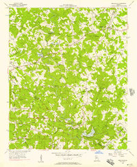
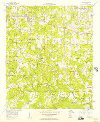
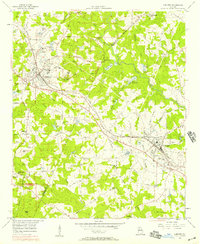 1956 Conyers1957 Print · USGSThe rail-and-quarry landscape of DeKalb and Rockdale counties comes alive in the mid-fifties, before the heavy suburban expansion of later decades. Genealogists and local historians can trace family locations through numerous landmarks like Bruce Sch, Eastview Cem, and Whites Chapel.5 unique versions available
 - 1956 Map of Redan, 1957 Print
 1956 Redan1957 Print · USGSDeKalb County at the mid-century mark reveals a landscape of rural crossroads and growing communities like Redan and Klondike. Genealogists and historians can trace the foundations of local life through the many country churches and schools, from Kelleys Chapel to the New County Line Sch.7 unique versions available
 - 1957 Map of Atlanta
 1957 Atlanta1957 Print · USGSAtlanta and the Alabama borderlands appear here in the mid-fifties, capturing the region's post-war suburban and industrial transition. Trace the development of early transport hubs and military sites like Fort McPherson, Anniston, and the Kennesaw Mountain National Battlefield Park.
 - 1958 Map of Athens
 1958 Athens1958 Print · USGSNorth-central Georgia and the Savannah River valley are captured in the late fifties, showing the region as the new reservoirs were filling. Researchers can trace historic rail lines like the Georgia RR and locate rural landmarks such as Social Circle, Graves Mountain, and the Fort Gordon Military Reservation.
 - 1958 Map of Atlanta
 1958 Atlanta1958 Print · USGSMid-century Georgia and Alabama are shown in this regional study of the corridor between the Chattahoochee River and the Appalachian foothills. Local historians can trace the development of suburban Atlanta alongside vital landmarks like Stone Mountain, Dobbins AFB, and the Seaboard Air Line rail routes.
 - 1959 Map of Athens
 1959 Athens1959 Print · USGSNortheast Georgia and the South Carolina borderlands appear here in the mid-fifties, during a decade of infrastructure growth. Genealogists and historians can trace the rail-and-river geography of towns like Social Circle, the sprawl of Fort Gordon Military Reservation, and the newly formed Clark Hill Reservoir.
End of results
Showing maps 1-9 of 9
Top cities of Rockdale County
Frequently asked questions
- What are the different types of historical maps available for Rockdale County?
- What is the oldest map of Rockdale County?
- Where can I purchase historical maps of Rockdale County for my home or office?
- Where can I download high-res historical maps of Rockdale County?
- Are there historical topographic maps available for Rockdale County?
- Is there historical aerial imagery available for Rockdale County?
- Where are historical maps of Rockdale County sourced from?