1960s Maps of Spalding County, Georgia
Explore 5 historic maps of Spalding County from the 1960s. These maps offer a rare glimpse into what life looked like during the 1960s — showing old roads, neighborhoods, homes, and landmarks that have changed or disappeared over time.
Whether you're researching your family's past, planning a metal detecting trip, or studying how Spalding County's landscape evolved across the 1960s, these high-resolution maps are a powerful tool for exploring the history of this region.
- Focus on a specific era: All maps on this page are from the 1960s, giving you a focused view of this time period.
- See what’s changed: Compare century-old streets, trails, and buildings to today's modern landscape using overlays and satellite layers.
- Research with precision: Use these maps for genealogy, historical research, land use analysis, or educational projects.
- View, download, or print: Maps are fully viewable online in high resolution, and can be downloaded or printed for your own records.
Start exploring Spalding County's history through authentic maps from the 1960s. This is your window into the past.
Spalding County, GA maps
(5)- 1964 Map of Luella, 1965 Print
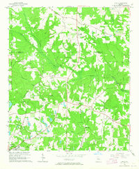 1964 Luella1965 Print · USGSHenry and Spalding Counties are captured here in the mid-sixties, showing a rural landscape anchored by the Southern railroad. Genealogists can locate family landmarks like Pullin Cem, Steeles Mill, and Hosanna Ch near the settlement of Luella.3 unique versions available
 - 1964 Map of Locust Grove, 1965 Print
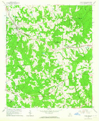 1964 Locust Grove1965 Print · USGSThe Piedmont landscape of Henry and Butts Counties is shown during the mid-sixties, centered on the railroad towns of Locust Grove and Jenkinsburg. Genealogists can trace family names at the Beersheba Cem or locate rural meeting places like England Chapel.3 unique versions available
 - 1965 Map of Senoia, 1967 Print
 1965 Senoia1967 Print · USGSMid-century Coweta and Fayette Counties come alive at the junction of two major rail lines during a period of steady local growth. Genealogists and researchers can locate family-named sites like Starrs Mill, Peeks Crossing, and rural landmarks such as Bethlehem Ch.2 unique versions available
 - 1965 Map of Griffin North, 1967 Print
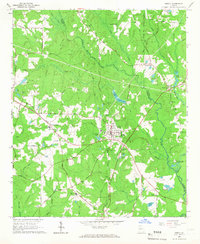
 1965 Griffin North1967 Print · USGSSpalding County's textile and agricultural roots are on full display during the mid-sixties as the northern outskirts of Griffin expand. Researchers can trace the industrial corridor of Highland Mills, the sprawling State Experimental Farms, and rural landmarks like West Sunny Side Ch.2 unique versions available
 - 1965 Map of Brooks, 1967 Print
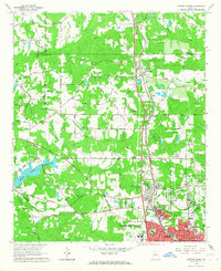
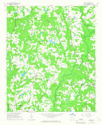 1965 Brooks1967 Print · USGSIn the mid-1960s, this portion of Georgia remained a deeply rural landscape defined by the Flint River and small rail-side communities. Genealogists can trace family footprints along the Central of Georgia railroad near Rio and Vaughn.2 unique versions available
End of results
Showing maps 1-5 of 5
Top cities of Spalding County
- Griffin historical maps
- Experiment historical maps
- East Griffin historical maps
- Orchard Hill historical maps
- Sunny Side historical maps
Frequently asked questions
- What are the different types of historical maps available for Spalding County?
- What is the oldest map of Spalding County?
- Where can I purchase historical maps of Spalding County for my home or office?
- Where can I download high-res historical maps of Spalding County?
- Are there historical topographic maps available for Spalding County?
- Is there historical aerial imagery available for Spalding County?
- Where are historical maps of Spalding County sourced from?