Old Maps of Walton County, Georgia for Hiking & Exploration
Hike through history with 81 historic maps of Walton County. Explore old trails, ghost towns, and forgotten backroads — perfect for outdoor adventurers and local explorers.
- Rediscover forgotten places: Map out old mining camps, roads, and footpaths that no longer exist on modern maps.
- Layer with modern tools: Combine with LiDAR or satellite views to plan hikes through historical terrain.
- Made for exploration: Popular among hikers, overlanders, and local history lovers.
Use these maps to find adventure and explore the hidden past of Walton County.
Walton County, GA maps
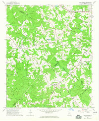
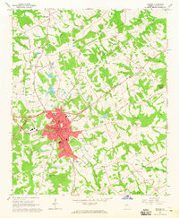
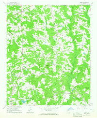
(81)- 1896 Map of Monroe
 1896 Monroe1896 Print · USGSNorth-central Georgia thrives during the late nineteenth century as a hub of river-powered industry and rail expansion. Genealogists and historians can trace family locations near Salem Camp Ground, the local commerce at Carithers Store, and several early crossings like Bells Bridge.5 unique versions available
 - 1953 Map of Athens, 1966 Print
 1953 Athens1966 Print · USGSGeorgia's Piedmont and Savannah River borderlands come alive in this mid-century survey of the region surrounding Athens and Augusta. Trace the rail-and-river economy through the Georgia RR and landmarks like the Fort Gordon Military Reservation.3 unique versions available
 - 1958 Map of Athens
 1958 Athens1958 Print · USGSNorth-central Georgia and the Savannah River valley are captured in the late fifties, showing the region as the new reservoirs were filling. Researchers can trace historic rail lines like the Georgia RR and locate rural landmarks such as Social Circle, Graves Mountain, and the Fort Gordon Military Reservation.
 - 1959 Map of Athens
 1959 Athens1959 Print · USGSNortheast Georgia and the South Carolina borderlands appear here in the mid-fifties, during a decade of infrastructure growth. Genealogists and historians can trace the rail-and-river geography of towns like Social Circle, the sprawl of Fort Gordon Military Reservation, and the newly formed Clark Hill Reservoir.
 - 1963 Map of Athens
 1963 Athens1963 Print · USGSGeorgia's Piedmont and the Savannah River valley are captured in the early sixties as major reservoirs and military installations reshaped the landscape. Researchers can trace the development of Clark Hill Reservoir, locate the Fort Gordon Military Reservation, and find historic towns like Social Circle and Eatonton.
 - 1964 Map of Bold Springs, 1965 Print
 1964 Bold Springs1965 Print · USGSBarrow and Gwinnett counties appear here in the mid-sixties, a landscape of family-run farms and quiet rural crossroads. Researchers can trace historic land use through sites like Kilgore Cem, the Seaboard Air Line rail corridor, and the settlement at Bold Springs.4 unique versions available
 - 1964 Map of Loganville, 1965 Print
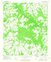
 1964 Loganville1965 Print · USGSLoganville and its rural surroundings appear here in the mid-sixties, where the corners of Walton, Gwinnett, and Rockdale counties converge. Researchers can trace family roots at Old Zion Cem or locate the site of McElroys Mill on the banks of Haynes Creek.2 unique versions available
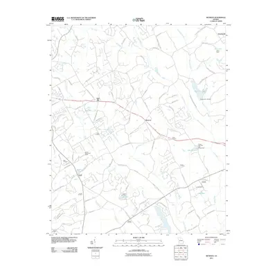
 - 1964 Map of Between, 1965 Print
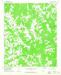 1964 Between1965 Print · USGSWalton County communities come into focus in the mid-sixties, showing the rural crossroads of Between and Split Silk before the area's later suburbanization. Genealogists can trace family footprints through numerous sites like West Walton Sch, Guthrie Cem, and Sardis Ch.2 unique versions available
 - 1964 Map of High Shoals, 1965 Print
 1964 High Shoals1965 Print · USGSWalton and Oconee counties are separated by the winding Apalachee River in the mid-1960s, showing a landscape of small farms and family cemeteries. Researchers can trace rural landmarks like Good Hope Peters Sch, Snows Mill, and Carlton Cem.2 unique versions available
 - 1964 Map of Monroe, 1965 Print
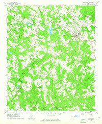
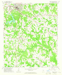
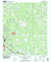
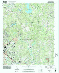
 1964 Monroe1965 Print · USGSMid-1960s Walton County shows a landscape of growing towns and deep-rooted rural communities. Genealogists can locate family names and burial sites at Rest Haven Cem and Aycock Cem or trace the early footprint of Monroe and Walker Park.3 unique versions available
 - 1964 Map of Winder South, 1965 Print
 1964 Winder South1965 Print · USGSBarrow and Walton counties come to life in the mid-sixties, showing the transition from the city of Winder to rural crossroads like Bethlehem. Family historians can locate several local landmarks, including the Rose Hill Cem, the Old Fort, and a Covered Bridge on the Apalachee River.3 unique versions available
 - 1964 Map of Statham, 1965 Print
 1964 Statham1965 Print · USGSThe rail-and-road corridor between Statham and Bogart is captured here in the mid-1960s, showing a rural landscape of Piedmont farms and creek-side settlements. Researchers can trace historic family landmarks such as Pleasant Hill Ch, Barber Creek Sch, and the Millsap Cem.4 unique versions available
 - 1964 Map of Milstead, 1966 Print
 1964 Milstead1966 Print · USGSThe Yellow River valley of northern Georgia is shown in the mid-1960s, a period when rural church communities and historic mill sites still defined the landscape. Genealogists and historians can trace family locations near Milstead, Philadelphia Ch, and Costley Millpond.4 unique versions available
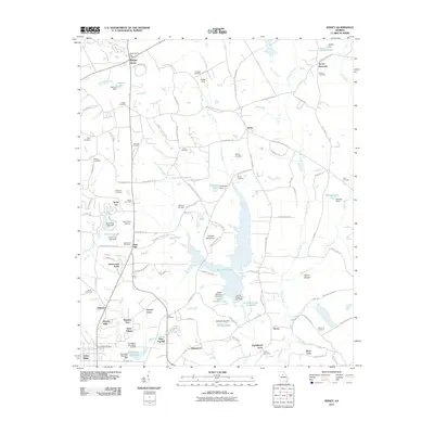
 - 1964 Map of Jersey, 1966 Print
 1964 Jersey1966 Print · USGSWalton and Newton counties are captured in the mid-1960s as rural crossroads and family homesteads defined the landscape. Genealogists can trace family landmarks like Carter Cem and Brodnax Cem alongside local centers like Jersey and Walnut Grove.3 unique versions available
 - 1971 Map of Rutledge North, 1974 Print
 1971 Rutledge North1974 Print · USGSThe rural communities of Morgan and Walton Counties are captured here in the early 1970s, from the streets of Bostwick to the recreation areas at Lake Rutledge. Genealogists and local historians can trace legacy landmarks like Gibbs Memorial Ch, Chestnut Grove Ch, and the crossroads at Fairplay.2 unique versions available
 - 1971 Map of Social Circle, 1974 Print
 1971 Social Circle1974 Print · USGSSocial Circle and its neighboring rural communities are captured here in the early seventies, centered on the Georgia Railroad corridor. Researchers can locate family landmarks like Annie Mary Ch, Circle View Cem, and the small settlement of Herndonville.3 unique versions available
 - 1972 Map of Mansfield, 1974 Print
 1972 Mansfield1974 Print · USGSNewton County in the early seventies remains a landscape of rail-connected towns and country churches. Genealogists can trace family names and old landmarks across the Central of Georgia line between Mansfield and the historic Brick Store settlement.2 unique versions available
 - 1980 Map of Athens, 1981 Print
 1980 Athens1981 Print · USGSNorth Georgia in the early eighties exhibits a landscape of growing university towns and deep-rooted rail hubs. Genealogists can trace family lands near Social Circle or Watkinsville while following the routes of the Central of Georgia and the Appalachee River.2 unique versions available
 - 1988 Map of Athens
 1988 Athens1988 Print · USGSThe Georgia Piedmont and South Carolina borderlands appear in the late eighties as a landscape of vast reservoirs and growing towns. Researchers can trace the legacy of the Georgia RR connecting Athens and Augusta, or locate landmarks within Oconee National Forest.
 - 1993 Map of Milstead, 2000 Print
 1993 Milstead2000 Print · USGSRockdale and Newton counties are captured here in the early nineties, showing a landscape of river valleys and rural crossroads. Genealogists and historians can trace old community sites like Zingara and Almon, or locate family landmarks such as Philadelphia Ch and Deals Millpond.
 - 1999 Map of Milstead, 2002 Print
 1999 Milstead2002 Print · USGSThe Yellow River valley transitions from its industrial roots to modern development in the late nineties. Researchers can trace historic church sites like Philadelphia Church and early family markers at Almand Cemetery near Conyers.
 - 2011 Map of Monroe, 2011 Print
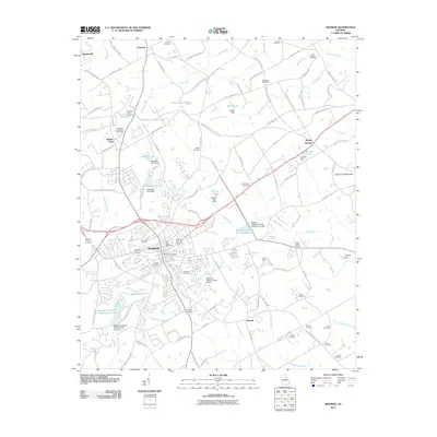 2011 Monroe2011 Print · USGSCovers Walton County, including Monroe, Walker Park, and other nearby areas
 - 2011 Map of Loganville, 2011 Print
 2011 Loganville2011 Print · USGSCovers Walton County, including Snellville, Loganville, and other nearby areas
 - 2011 Map of Between, 2011 Print
 2011 Between2011 Print · USGSCovers Walton County, including Monroe, Loganville, and other nearby areas
 - 2011 Map of Jersey, 2011 Print
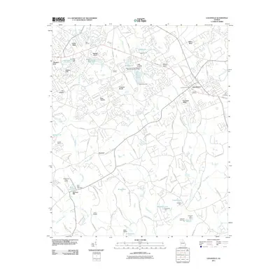
 2011 Jersey2011 Print · USGSCovers Walton County, including Covington, Social Circle, and other nearby areas
Showing maps 1-25 of 81
Top cities of Walton County
- Monroe historical maps
- Social Circle historical maps
- Walnut Grove historical maps
- Between historical maps
- Good Hope historical maps
- Jersey historical maps
Frequently asked questions
- What are the different types of historical maps available for Walton County?
- What is the oldest map of Walton County?
- Where can I purchase historical maps of Walton County for my home or office?
- Where can I download high-res historical maps of Walton County?
- Are there historical topographic maps available for Walton County?
- Is there historical aerial imagery available for Walton County?
- Where are historical maps of Walton County sourced from?