1960s Maps of Fern Forest, Hawaii
Explore 7 historic maps of Fern Forest from the 1960s. These maps offer a rare glimpse into what life looked like during the 1960s — showing old roads, neighborhoods, homes, and landmarks that have changed or disappeared over time.
Whether you're researching your family's past, planning a metal detecting trip, or studying how Fern Forest's landscape evolved across the 1960s, these high-resolution maps are a powerful tool for exploring the history of this region.
- Focus on a specific era: All maps on this page are from the 1960s, giving you a focused view of this time period.
- See what’s changed: Compare century-old streets, trails, and buildings to today's modern landscape using overlays and satellite layers.
- Research with precision: Use these maps for genealogy, historical research, land use analysis, or educational projects.
- View, download, or print: Maps are fully viewable online in high resolution, and can be downloaded or printed for your own records.
Start exploring Fern Forest's history through authentic maps from the 1960s. This is your window into the past.
Fern Forest, HI maps
(7)- 1961 Map of Hawaii North
 1961 Hawaii North1961 Print · USGSThe Big Island's northern reaches are shown here in the early sixties, during the peak of the sugar era and before modern resort development. Researchers can trace the Hawaii Consolidated railroad, locate the Ahu a Umi Heiau Ruins, and explore sugar industry landmarks like the Pacific Sugar Mill.2 unique versions available
 - 1961 Map of Hawaii South
 1961 Hawaii South1961 Print · USGSThe southern region of the Big Island appears here in the early sixties, illustrating a landscape of volcanic craters and remote agricultural outposts. Genealogists and historians can trace the locations of Wood Valley Camp, the Koa Mill, and the ruins at Kahio.
 - 1962 Map of Hawaii South
 1962 Hawaii South1962 Print · USGSThe southern half of Hawaii Island in the early sixties showcases a landscape defined by volcanic rifts and coastal settlements. Researchers can trace the Hawaii Consolidated rail line, find the Kuee (Ruined) site, and locate remote camps like Hooper Camp.2 unique versions available
 - 1963 Map of Volcano, 1964 Print
 1963 Volcano1964 Print · USGSThe community of Volcano and the surrounding forest reserves are captured here in the early 1960s. Genealogists and researchers can trace the early layout of Volcano and Glenwood, alongside iconic landmarks like the Thurston Lava Tube.
 - 1963 Map of Puu Makaala, 1964 Print
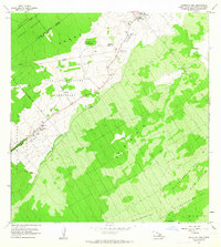
 1963 Puu Makaala1964 Print · USGSThe upland forests of Hawaii's Big Island are captured here in the early 1960s as homesteading and resource management shaped the landscape. Genealogists and historians can trace family plots in the Keaau Homesteads or follow the route of the Old Railroad Grade.2 unique versions available
 - 1963 Map of Mountain View, 1964 Print
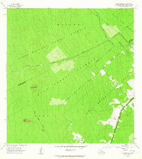
 1963 Mountain View1964 Print · USGSThe Puna District comes to life in the early sixties, showing the agricultural settlements and numbered camps that defined local life. Trace family land in Olaa Reservation Homesteads and locate historic sites like Kurtistown Sch or Olaa Dispensary.2 unique versions available
 - 1966 Map of Kalalua, 1967 Print
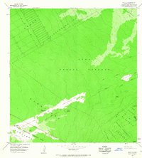 1966 Kalalua1967 Print · USGSThe Puna District in the mid-1960s was a landscape defined by recent volcanic activity and remote settlement patterns. Researchers can trace the progression of active geology through the Lava Flow of 1963 and locate family land within the Kauka Homesteads or Kupahua Homesteads.
End of results
Showing maps 1-7 of 7
Top cities near Fern Forest
Frequently asked questions
- What are the different types of historical maps available for Fern Forest?
- What is the oldest map of Fern Forest?
- Where can I purchase historical maps of Fern Forest for my home or office?
- Where can I download high-res historical maps of Fern Forest?
- Are there historical topographic maps available for Fern Forest?
- Is there historical aerial imagery available for Fern Forest?
- Where are historical maps of Fern Forest sourced from?