2020s Maps of Fern Forest, Hawaii
Explore 4 historic maps of Fern Forest from the 2020s. These maps offer a rare glimpse into what life looked like during the 2020s — showing old roads, neighborhoods, homes, and landmarks that have changed or disappeared over time.
Whether you're researching your family's past, planning a metal detecting trip, or studying how Fern Forest's landscape evolved across the 2020s, these high-resolution maps are a powerful tool for exploring the history of this region.
- Focus on a specific era: All maps on this page are from the 2020s, giving you a focused view of this time period.
- See what’s changed: Compare century-old streets, trails, and buildings to today's modern landscape using overlays and satellite layers.
- Research with precision: Use these maps for genealogy, historical research, land use analysis, or educational projects.
- View, download, or print: Maps are fully viewable online in high resolution, and can be downloaded or printed for your own records.
Start exploring Fern Forest's history through authentic maps from the 2020s. This is your window into the past.
Fern Forest, HI maps
(4)- 2024 Map of Mountain View, 2024 Print
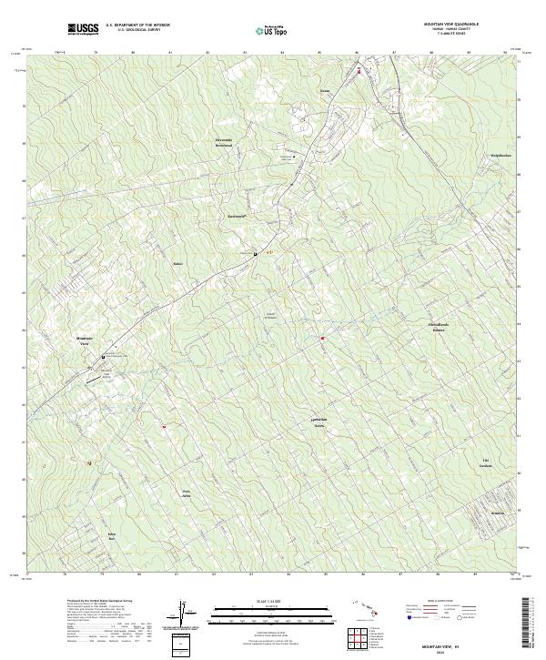 2024 Mountain View2024 Print · USGSThe Puna district of Hawaii is shown here in the mid-2020s, featuring the extensive grid-style subdivisions and agricultural homesteads that define the region. Genealogists can locate several historic burial sites like the Filipino Cem and Jodo Cem, alongside local landmarks like Uetama Camp.
 - 2024 Map of Kalalua, 2024 Print
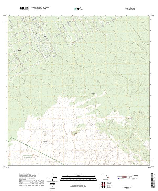 2024 Kalalua2024 Print · USGSThe windward slopes of the Big Island are shown in this contemporary study of volcanic terrain and forest subdivisions. You can trace the paths of the Lava Flow of 1963 near Pu'u'o'o or locate properties in Eden Roc and Fern Acres.
 - 2024 Map of Volcano, 2024 Print
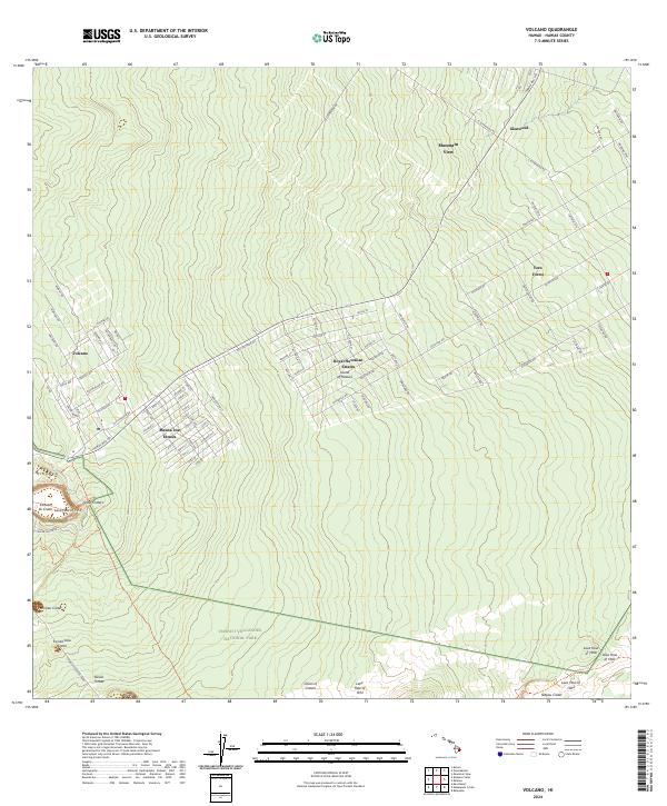 2024 Volcano2024 Print · USGSThe Big Island's volcanic landscape and residential growth meet in this contemporary survey of the area around Volcano. Researchers can trace property lines in Mauna Loa Estates and locate geologic features like Devils Throat and the Lava Flow of 1972.
 - 2024 Map of Puumakaala, 2024 Print
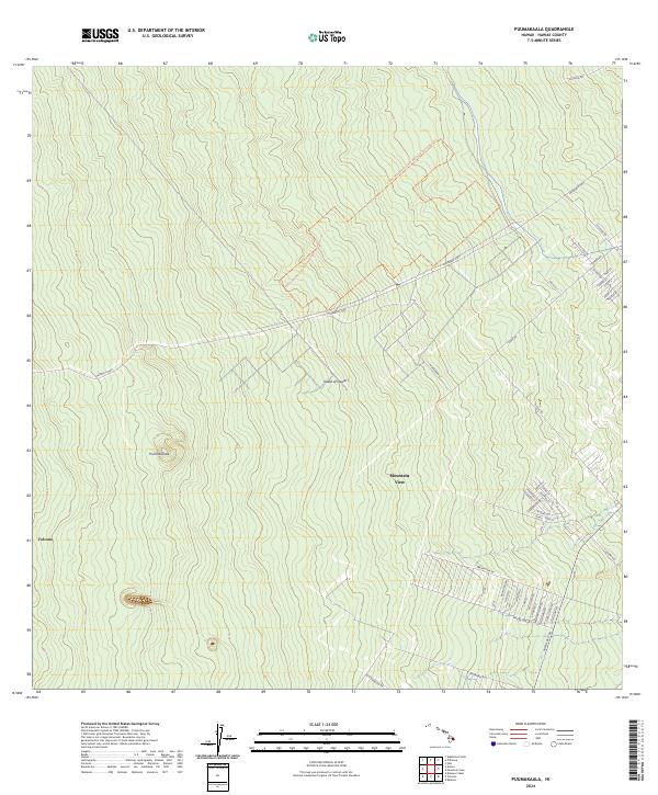 2024 Puumakaala2024 Print · USGSThe eastern slopes of the Island of Hawai'i are captured in detail in this modern survey, showing the residential growth of the windward side. Researchers can trace the street grids of Mountain View and the boundaries of the Hawai'i Volcanoes Wilderness near the community of Volcano.
End of results
Showing maps 1-4 of 4
Top cities near Fern Forest
Frequently asked questions
- What are the different types of historical maps available for Fern Forest?
- What is the oldest map of Fern Forest?
- Where can I purchase historical maps of Fern Forest for my home or office?
- Where can I download high-res historical maps of Fern Forest?
- Are there historical topographic maps available for Fern Forest?
- Is there historical aerial imagery available for Fern Forest?
- Where are historical maps of Fern Forest sourced from?