1900s (20th Century) Maps of Hoʻōpūloa, Hawaii
Explore 10 historic maps of Hoʻōpūloa from the 1900s (20th Century). These maps offer a rare glimpse into what life looked like during the 1900s — showing old roads, neighborhoods, homes, and landmarks that have changed or disappeared over time.
Whether you're researching your family's past, planning a metal detecting trip, or studying how Hoʻōpūloa's landscape evolved across the 1900s, these high-resolution maps are a powerful tool for exploring the history of this region.
- Focus on a specific era: All maps on this page are from the 1900s, giving you a focused view of this time period.
- See what’s changed: Compare century-old streets, trails, and buildings to today's modern landscape using overlays and satellite layers.
- Research with precision: Use these maps for genealogy, historical research, land use analysis, or educational projects.
- View, download, or print: Maps are fully viewable online in high resolution, and can be downloaded or printed for your own records.
Start exploring Hoʻōpūloa's history through authentic maps from the 1900s. This is your window into the past.
Hoʻōpūloa, HI maps
(10)- 1928 Map of Hoopuloa, 1933 Print
 1928 Hoopuloa1933 Print · USGSThe southwest Hawaii coastline in the mid-1920s shows a landscape transformed by volcanic activity and early land settlement. Researchers can trace the paths of recent lava flows and locate specific cultural sites like Milolii, Ohin Mill, and the Alika Homesteads.
 - 1954 Map of Hawaii South
 1954 Hawaii South1954 Print · USGSThe southern reaches of the Big Island in the mid-fifties show a landscape of volcanic peaks, coastal villages, and upland timber mills. Researchers can trace the old island infrastructure through sites like Koa Mill, Hoopuloa, and the remote Mountain House.
 - 1959 Map of Hawaii South
 1959 Hawaii South1959 Print · USGSThe southern half of the Big Island appears here in the late fifties, dominated by the active volcanic peaks and extensive forest reserves. Researchers can trace the mid-century footprints of Pahala, Waiohinu, and the agricultural grounds of Gaspard Dairy.
 - 1961 Map of Hawaii South
 1961 Hawaii South1961 Print · USGSThe southern region of the Big Island appears here in the early sixties, illustrating a landscape of volcanic craters and remote agricultural outposts. Genealogists and historians can trace the locations of Wood Valley Camp, the Koa Mill, and the ruins at Kahio.
 - 1962 Map of Hawaii South
 1962 Hawaii South1962 Print · USGSThe southern half of Hawaii Island in the early sixties showcases a landscape defined by volcanic rifts and coastal settlements. Researchers can trace the Hawaii Consolidated rail line, find the Kuee (Ruined) site, and locate remote camps like Hooper Camp.2 unique versions available
 - 1962 Map of Milolii, 1964 Print
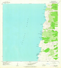 1962 Milolii1964 Print · USGSThe South Kona coast in the early sixties reveals a landscape shaped by recent volcanic events and ancient Hawaiian heritage. Genealogists and historians can trace the Alika Lava Flow of 1919 and find archaeological sites like the Ahole Heiau and scattered coastal ruins.
 - 1975 Map of Hawaii, 1977 Print
 1975 Hawaii1977 Print · USGSThe Big Island in the mid-seventies is captured here as a landscape of volcanic giants and coastal sugar communities. Genealogists and historians can locate former plantation sites like Pepeekeo Mill or trace the routes of the Mamalahoa Highway through Kamuela.
 - 1980 Map of Hawaii County Sheet 3, 1984 Print
 1980 Hawaii County Sheet 31984 Print · USGSThe Big Island's South Kona and Kau districts are captured here in the early 1980s, from the historic coffee lands to the southern tip. Researchers can trace the layout of coastal villages and sugar-era settlements like Milolii, Pahala, and the City of Refuge Nat Historical Pk.
 - 1981 Map of Milolii
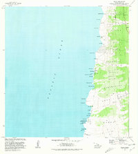 1981 Milolii1981 Print · USGSThe South Kona coast in the early eighties is recorded here as a landscape shaped by recent volcanic activity and ancient heritage. Researchers can trace the massive Alika Lava Flow of 1919, locate the Ahole Heiau, and explore the coastal village of Milolii.2 unique versions available
 - 1996 Map of Milolii, 1998 Print
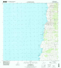 1996 Milolii1998 Print · USGSCoastal life in South Kona during the late twentieth century is defined by its volcanic heritage and remote shoreline. Researchers can trace the massive Alika Lava Flow of 1919 and the historic settlement of Milolii tucked into the rugged PACIFIC OCEAN coast.
End of results
Showing maps 1-10 of 10
Frequently asked questions
- What are the different types of historical maps available for Hoʻōpūloa?
- What is the oldest map of Hoʻōpūloa?
- Where can I purchase historical maps of Hoʻōpūloa for my home or office?
- Where can I download high-res historical maps of Hoʻōpūloa?
- Are there historical topographic maps available for Hoʻōpūloa?
- Is there historical aerial imagery available for Hoʻōpūloa?
- Where are historical maps of Hoʻōpūloa sourced from?