1900s (20th Century) Maps of Kaniohale at the Villages of Laʻiʻopua, Kailua
Explore 9 historic maps of Kaniohale at the Villages of Laʻiʻopua from the 1900s (20th Century). These maps offer a rare glimpse into what life looked like during the 1900s — showing old roads, neighborhoods, homes, and landmarks that have changed or disappeared over time.
Whether you're researching your family's past, planning a metal detecting trip, or studying how Kaniohale at the Villages of Laʻiʻopua's landscape evolved across the 1900s, these high-resolution maps are a powerful tool for exploring the history of this region.
- Focus on a specific era: All maps on this page are from the 1900s, giving you a focused view of this time period.
- See what’s changed: Compare century-old streets, trails, and buildings to today's modern landscape using overlays and satellite layers.
- Research with precision: Use these maps for genealogy, historical research, land use analysis, or educational projects.
- View, download, or print: Maps are fully viewable online in high resolution, and can be downloaded or printed for your own records.
Start exploring Kaniohale at the Villages of Laʻiʻopua's history through authentic maps from the 1900s. This is your window into the past.
Kaniohale at the Villages of Laʻiʻopua, Kailua maps
(9)- 1928 Map of Kailua
 1928 Kailua1928 Print · USGSThe West Hawaii coast and the heights of Puu Hualalei come into focus in the late 1920s. Genealogists and historians can trace family land in the Kealakehe Homesteads or locate cultural landmarks like Ahuena Heiau and the Kona Mill.3 unique versions available
 - 1954 Map of Hawaii North
 1954 Hawaii North1954 Print · USGSThe Big Island in the mid-fifties shows a landscape of active volcanic history and a peak sugar-mill economy. Trace the route of the Hawaii Consolidated Railway, locate the Olaa Plantation Mill, and see the extent of the Lava flow of 1881 near Hilo.
 - 1959 Map of Hawaii North
 1959 Hawaii North1959 Print · USGSThe northern half of Hawaii Island in the late fifties shows a landscape shaped by historic volcanic activity and a thriving sugar and ranching economy. Researchers can trace historic lava flows alongside local landmarks like Upolu Point Airport, Huehue Ranch, and the Pacific Sugar Mill.
 - 1959 Map of Kailua, 1961 Print
 1959 Kailua1961 Print · USGSThe North Kona coast was undergoing significant settlement shifts in the late fifties as homesteads climbed the volcanic slopes. Trace family history and land boundaries through the Kalaoa Homesteads, Honokohau School, and the Holualoa Makai Camp.3 unique versions available
 - 1961 Map of Hawaii North
 1961 Hawaii North1961 Print · USGSThe Big Island's northern reaches are shown here in the early sixties, during the peak of the sugar era and before modern resort development. Researchers can trace the Hawaii Consolidated railroad, locate the Ahu a Umi Heiau Ruins, and explore sugar industry landmarks like the Pacific Sugar Mill.2 unique versions available
 - 1975 Map of Hawaii, 1977 Print
 1975 Hawaii1977 Print · USGSThe Big Island in the mid-seventies is captured here as a landscape of volcanic giants and coastal sugar communities. Genealogists and historians can locate former plantation sites like Pepeekeo Mill or trace the routes of the Mamalahoa Highway through Kamuela.
 - 1980 Map of Hawaii County Sheet 1, 1984 Print
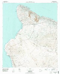 1980 Hawaii County Sheet 11984 Print · USGSThe Big Island's diverse terrain and transition into the 1980s are shown here, from the northern coast to the high mountain saddles. Genealogists and historians can trace homesteads and local roads near Kailua, Kukuihaele, and the Ahualoa area.
 - 1982 Map of Kailua, 1983 Print
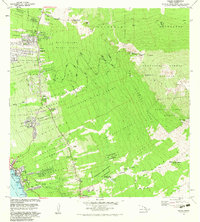 1982 Kailua1983 Print · USGSThe Kona coast in the early eighties shows the expansion of Kailua and its surrounding homesteads into the upland forests. Researchers can trace land divisions from Kailua-Kona PO to rural landmarks like Palani Junction and Honokohau School.
 - 1996 Map of Kailua, 1998 Print
 1996 Kailua1998 Print · USGSThe North Kona coast and the volcanic slopes of Hualalai are captured in the late twentieth century as residential homesteads began to climb the mountain. Genealogists and researchers can trace local landmarks like Keopu Cemetery, Palani Junction, and the Holualoa Mauka Camp.
End of results
Showing maps 1-9 of 9
Frequently asked questions
- What are the different types of historical maps available for Kaniohale at the Villages of Laʻiʻopua?
- What is the oldest map of Kaniohale at the Villages of Laʻiʻopua?
- Where can I purchase historical maps of Kaniohale at the Villages of Laʻiʻopua for my home or office?
- Where can I download high-res historical maps of Kaniohale at the Villages of Laʻiʻopua?
- Are there historical topographic maps available for Kaniohale at the Villages of Laʻiʻopua?
- Is there historical aerial imagery available for Kaniohale at the Villages of Laʻiʻopua?
- Where are historical maps of Kaniohale at the Villages of Laʻiʻopua sourced from?