Old Maps of Nīnole, Hawaii for Genealogy
Trace your family roots with 12 historic maps of Nīnole. These high-res maps reveal old neighborhoods, homesites, landmarks, and streets — helping you uncover where your ancestors lived and how the area evolved over time.
- Explore historic neighborhoods: Identify where your relatives may have lived in the 1800s or 1900s.
- Compare maps over time: Trace the changes in streets, buildings, and landmarks for multi-generational research.
- Perfect for genealogy & ancestry research: Used by family historians and researchers to map out lineage and migration.
These maps are an incredible resource for exploring your personal connection to Nīnole's past.
Nīnole, HI maps
(12)- 1915 Map of Honomu
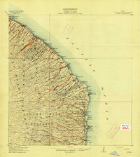 1915 Honomu1915 Print · USGSThe Hamakua and Hilo coastlines appear in incredible detail in this early territorial survey of Hawaii. Genealogists and historians can trace the foundations of plantation life at Honomu and Papaaloa, or locate long-standing landmarks like Akaka Falls and the Pohakupuka School.3 unique versions available
 - 1954 Map of Hawaii North
 1954 Hawaii North1954 Print · USGSThe Big Island in the mid-fifties shows a landscape of active volcanic history and a peak sugar-mill economy. Trace the route of the Hawaii Consolidated Railway, locate the Olaa Plantation Mill, and see the extent of the Lava flow of 1881 near Hilo.
 - 1959 Map of Hawaii North
 1959 Hawaii North1959 Print · USGSThe northern half of Hawaii Island in the late fifties shows a landscape shaped by historic volcanic activity and a thriving sugar and ranching economy. Researchers can trace historic lava flows alongside local landmarks like Upolu Point Airport, Huehue Ranch, and the Pacific Sugar Mill.
 - 1961 Map of Hawaii North
 1961 Hawaii North1961 Print · USGSThe Big Island's northern reaches are shown here in the early sixties, during the peak of the sugar era and before modern resort development. Researchers can trace the Hawaii Consolidated railroad, locate the Ahu a Umi Heiau Ruins, and explore sugar industry landmarks like the Pacific Sugar Mill.2 unique versions available
 - 1966 Map of Papaaloa, 1968 Print
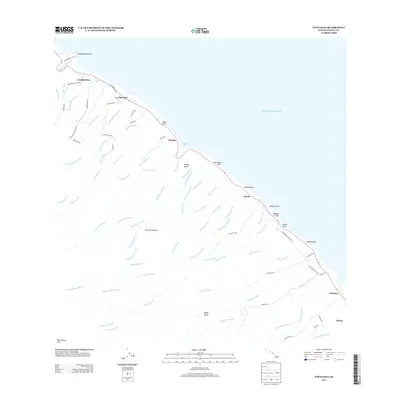
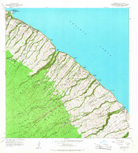 1966 Papaaloa1968 Print · USGSThe Hamakua Coast in the mid-sixties reveals a landscape of deep gulches and plantation-era land divisions. Researchers can trace historic family lands through the Papaaloa Homesteads or locate the Tidal Wave Memorial at Laupahoehoe.
 - 1975 Map of Hawaii, 1977 Print
 1975 Hawaii1977 Print · USGSThe Big Island in the mid-seventies is captured here as a landscape of volcanic giants and coastal sugar communities. Genealogists and historians can locate former plantation sites like Pepeekeo Mill or trace the routes of the Mamalahoa Highway through Kamuela.
 - 1980 Map of Papaaloa, 1981 Print
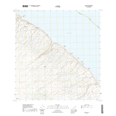
 1980 Papaaloa1981 Print · USGSThe Hamakua Coast of Hawaii Island appears in the early eighties as a network of homesteads and deep river gulches. Genealogists can trace family locations through numerous tracts like the Papaaloa Homesteads and find landmarks such as Kapehu Camp or the Tidal Wave Memorial.2 unique versions available
 - 1980 Map of Hawaii County Sheet 2, 1985 Print
 1980 Hawaii County Sheet 21985 Print · USGSThe eastern coast of the Big Island is captured here in the early eighties, showcasing the intersection of active volcanic landforms and historic plantation towns. Researchers can trace family roots through settlements like Laupahoehoe and Papaikou, or explore the road networks around Kilauea Crater and General Lyman Field.
 - 1992 Map of Papaaloa, 2003 Print
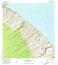
 1992 Papaaloa2003 Print · USGSThe Hamakua Coast comes alive in the early nineties, showing the intricate network of upland homesteads and coastal villages. Genealogists and historians can trace family lands within the Papa'aloa Homesteads or locate the Tidal Wave Memorial at Laupahoehoe.
 - 2013 Map of Papaaloa, 2013 Print
 2013 Papaaloa2013 Print · USGSCovers Nīnole, including Hakalau, Laupahoehoe, and other nearby areas
 - 2017 Map of Papaaloa, 2017 Print
 2017 Papaaloa2017 Print · USGSCovers Nīnole, including Hakalau, Laupahoehoe, and other nearby areas
 - 2024 Map of Papaaloa, 2024 Print
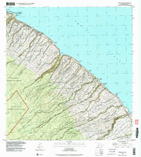
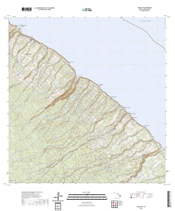 2024 Papaaloa2024 Print · USGSThe Hamakua Coast of the Big Island is shown here in the current era, where deep-cut gulches meet the Pacific. Researchers can trace the heritage of Laupahoehoe through landmarks like Saint Anthony's Catholic Church Cem and Laupahoehoe Point Cem.
End of results
Showing maps 1-12 of 12
Top cities near Nīnole
Frequently asked questions
- What are the different types of historical maps available for Nīnole?
- What is the oldest map of Nīnole?
- Where can I purchase historical maps of Nīnole for my home or office?
- Where can I download high-res historical maps of Nīnole?
- Are there historical topographic maps available for Nīnole?
- Is there historical aerial imagery available for Nīnole?
- Where are historical maps of Nīnole sourced from?