
1915 Map of Honomu
USGS Topo · Published 1915About this map
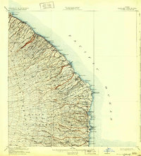
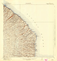
Deeply incised gulches and coastal landings define this 1915 survey of the Hamakua and Hilo coasts. Coastal villages such as Laupahoehoe and Papaikou are positioned atop the steep bluffs of the Pacific Ocean, supported by maritime infrastructure including Pepeekeo Landing and Papaikou Landing. The inland terrain is a dense network of drainage systems, where the Laupahoehoe Forest Reserve meets the headwaters of the Wailuku River. Numerous dramatic cataracts are noted, including Akaka Falls, Waiahi Falls, and Papakoloa Falls. Local education is anchored by the Pohakupuka School and Kaiwiki School, serving the scattered plantation communities. The map clearly delineates the administrative boundary between the North Hilo District and the South Hilo District, tracing the path of the Maulua Bay drainage into the highlands.
Find a feature on this map
66 named features on this map. Tap any name to fly to it.
Don’t see what you’re looking for? This feature index may not catch every label — zoom into the map to look around manually.
Map Details
Editions of this 1915 Honomu Map
3 editions found
Other maps of this area

1915 · Hamakua
USGS Topo · 1:62,500

1917 · Hilo
USGS Topo · 1:62,500

1924 · Makuu
USGS Topo · 1:62,500

1930 · Humuula
USGS Topo · 1:62,500

1932 · Hilo
USGS Topo · 1:62,500

1954 · Hawaii North
USGS Topo · 1:250,000

1956 · Pua Akala
USGS Topo · 1:24,000

1956 · Keanakolu
USGS Topo · 1:24,000

1956 · Upper Piihonua
USGS Topo · 1:24,000

1957 · Kukaiau
USGS Topo · 1:24,000