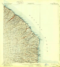
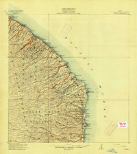
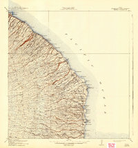
1915 Map of Honomu
USGS Topo · Published 1932About this map
The steep Hamakua Coast of the Big Island is defined here by a series of parallel streams and gulches that carve through the volcanic slopes of North Hilo District and South Hilo District. Surveyed before the First World War, the landscape is organized around a network of flumes and sugar-related infrastructure, which were vital for transporting cane to the coastal mills. Coastal settlements like Honomu and Pepeekeo serve as industrial and social hubs, supported by specialized maritime infrastructure such as Pepeekeo Landing and Papaikou Landing.
Find a feature on this map
74 named features on this map. Tap any name to fly to it.
Don’t see what you’re looking for? This feature index may not catch every label — zoom into the map to look around manually.
Map Details
Editions of this 1915 Honomu Map
3 editions found
Historical Maps of Wailea Through Time
1 maps found