2020s Maps of Wainaku, Hawaii
Explore 2 historic maps of Wainaku from the 2020s. These maps offer a rare glimpse into what life looked like during the 2020s — showing old roads, neighborhoods, homes, and landmarks that have changed or disappeared over time.
Whether you're researching your family's past, planning a metal detecting trip, or studying how Wainaku's landscape evolved across the 2020s, these high-resolution maps are a powerful tool for exploring the history of this region.
- Focus on a specific era: All maps on this page are from the 2020s, giving you a focused view of this time period.
- See what’s changed: Compare century-old streets, trails, and buildings to today's modern landscape using overlays and satellite layers.
- Research with precision: Use these maps for genealogy, historical research, land use analysis, or educational projects.
- View, download, or print: Maps are fully viewable online in high resolution, and can be downloaded or printed for your own records.
Start exploring Wainaku's history through authentic maps from the 2020s. This is your window into the past.
Wainaku, HI maps
(2)- 2024 Map of Hilo, 2024 Print
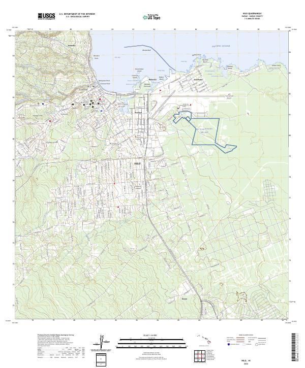 2024 Hilo2024 Print · USGSHilo's coastal landscape and urban growth are documented here in the early twenty-first century. Genealogists and historians can locate specific sites like Homelani Memorial Park, the Lava Flow of 1881, and the NG TS Keaukaha Mil Res.
 - 2024 Map of Papaikou, 2024 Print
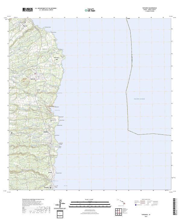 2024 Papaikou2024 Print · USGSThe Hamakua Coast comes alive in this contemporary survey, showing the transition from historic plantation centers to modern residential communities. Genealogists and local historians can trace family sites at Alae Cem, the Pepe'ekeo Mill, and Honomu.
End of results
Showing maps 1-2 of 2
Top cities near Wainaku
Frequently asked questions
- What are the different types of historical maps available for Wainaku?
- What is the oldest map of Wainaku?
- Where can I purchase historical maps of Wainaku for my home or office?
- Where can I download high-res historical maps of Wainaku?
- Are there historical topographic maps available for Wainaku?
- Is there historical aerial imagery available for Wainaku?
- Where are historical maps of Wainaku sourced from?