Old Maps of Kalawao County, Hawaii for Metal Detecting
Plan your next treasure hunt with 18 historic maps of Kalawao County. Find old homesites, ghost towns, trails, and gathering spots that may be lost to time — perfect for identifying promising metal detecting locations.
- Locate forgotten sites: Uncover places like long-lost settlements, abandoned rail lines, or gathering spots.
- Plan better hunts: Use map overlays combined with LiDAR or satellite views to narrow in on historically rich areas.
- Made for detectorists: Thousands of hobbyists use these maps to discover relics, coins, and hidden history.
Use these historic maps to boost your research and find new opportunities beneath the surface of Kalawao County.
Kalawao County, HI maps
(18)- 1952 Map of Kamalo, 1954 Print
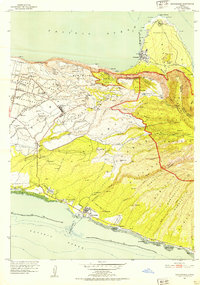
 1952 Kamalo1954 Print · USGSThe southern shore of Molokai and its dramatic northern valleys are documented here just after mid-century. Genealogists and historians can locate several ancient temples such as Kukui Heiau, the Hukoo PO at Ualapue, and remote north-coast sites like Wailau (Site).
 - 1952 Map of Kaunakakai, 1954 Print
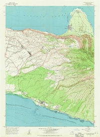
 1952 Kaunakakai1954 Print · USGSThe central and northern coasts of Molokai are documented here in the early fifties, featuring the isolated Kalaupapa Settlement and the hub of Kaunakakai. Genealogists can trace family plots and local landmarks like Hoolehua Cem and the Hoolehua Homesteads.
 - 1954 Map of Maui
 1954 Maui1954 Print · USGSThe central Hawaiian Islands are shown during the mid-fifties, detailing the agricultural and coastal infrastructure of Maui, Lanai, and Molokai. Genealogists and researchers can trace plantation-era history at Haliimaile Camp, locate old harbors like Kaumalapau Harbor, or explore the early bounds of Haleakala National Park.
 - 1966 Map of Maui
 1966 Maui1966 Print · USGSThe central islands of Maui, Molokai, Lanai, and Kahoolawe are shown in detail during the mid-1960s as plantation life and early tourism coexisted. Genealogists and researchers can trace family locations in old plantation towns like Puunene, the harbor at Lahaina, and Hoolehua on Molokai.
 - 1967 Map of Kaunakakai, 1969 Print
 1967 Kaunakakai1969 Print · USGSMolokai in the late sixties displays a unique geography of ancient shoreline aquaculture and mid-century homesteading. Genealogists and historians can trace family locations through the Kalanianaole Colony, Homalani Cem, and the remote settlement of Kalaupapa.
 - 1968 Map of Kamalo, 1970 Print
 1968 Kamalo1970 Print · USGSMolokai's southern coast and northern cliffs are captured in the late sixties, showcasing a landscape of ancient aquaculture and sacred sites. Genealogists and historians can trace traditional Kakaiaha Fishpond locations, local schools like Kilohana Sch, and the Malae Heiau.
 - 1974 Map of Maui
 1974 Maui1974 Print · USGSMid-century Hawaii is captured here through the detailed landscapes of Maui, Molokai, Lanai, and Kahoolawe as they appeared in the 1970s. Researchers can trace the layout of island hubs like Lahaina and Lanai City alongside remote landmarks like Wainapanapa Cave.2 unique versions available
 - 1983 Map of Molokai East
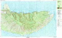 1983 Molokai East1983 Print · USGSEast Molokai in the early eighties reveals a striking contrast between the protected northern peninsula and the fishpond-lined southern shore. Researchers can trace historic sites like the Kalaupapa Settlement or locate traditional waters at Ualapue Fishpond and Kanoa Fishpond.2 unique versions available
 - 1993 Map of Kaunakakai, 1999 Print
 1993 Kaunakakai1999 Print · USGSMolokai's central corridor and north shore are shown here in the early nineties, from the bustling waterfront of the south to the isolated peninsula. Genealogists can trace homesteads and local landmarks like the Meyer Cemetery, Kamehameha Coconut Grove, and the Kalanianaole Colony.
 - 2013 Map of Kamalo, 2013 Print
 2013 Kamalo2013 Print · USGSCovers Kalawao County, including Kalawao, Maui County, and other nearby areas
 - 2013 Map of Kaunakakai OE N, 2013 Print
 2013 Kaunakakai OE N2013 Print · USGSCovers Kalawao County, including Maui County, United States, and other nearby areas
 - 2013 Map of Kaunakakai, 2013 Print
 2013 Kaunakakai2013 Print · USGSCovers Kalawao County, including Kaunakakai, Kualapuu, and other nearby areas
 - 2017 Map of Kaunakakai OE N, 2017 Print
 2017 Kaunakakai OE N2017 Print · USGSCovers Kalawao County, including Maui County, United States, and other nearby areas
 - 2017 Map of Kamalo, 2017 Print
 2017 Kamalo2017 Print · USGSCovers Kalawao County, including Kalawao, Maui County, and other nearby areas
 - 2017 Map of Kaunakakai, 2017 Print
 2017 Kaunakakai2017 Print · USGSCovers Kalawao County, including Kaunakakai, Kualapuu, and other nearby areas
 - 2024 Map of Kamalo, 2024 Print
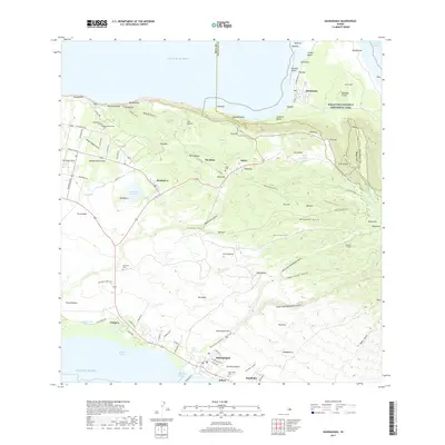
 2024 Kamalo2024 Print · USGSThe northern coast of Molokai is documented in this modern survey, highlighting the remote peninsula and steep cliffs of the Kalaupapa National Historical Park. Genealogists and historians can locate the Siloama Congregational Church, Kalawao Cem, and the massive sea cliffs at Pelekunu Bay.
 - 2024 Map of Kaunakakai, 2024 Print
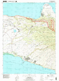
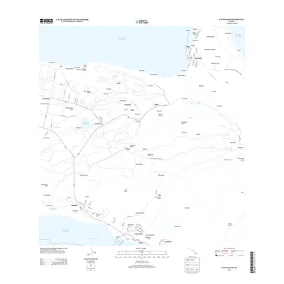
 2024 Kaunakakai2024 Print · USGSMolokai’s north and south shores are presented here, from the isolated Kalaupapa Peninsula to the coastal town of Kaunakakai. Genealogists can trace several burial grounds, including Homelani Cem and the Kalaupapa Settlement Cem.
 - 2024 Map of Kaunakakai OE N, 2024 Print
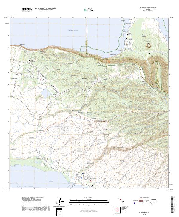
 2024 Kaunakakai OE N2024 Print · USGSThe northern tip of Molokai meets the Pacific in the modern era, showing the protected lands of Kalaupapa National Historical Park. Researchers can locate specialized coastal infrastructure like the Kalaupapa Airport and landforms such as Kahi'u Point.
End of results
Showing maps 1-18 of 18
Top cities of Kalawao County
Frequently asked questions
- What are the different types of historical maps available for Kalawao County?
- What is the oldest map of Kalawao County?
- Where can I purchase historical maps of Kalawao County for my home or office?
- Where can I download high-res historical maps of Kalawao County?
- Are there historical topographic maps available for Kalawao County?
- Is there historical aerial imagery available for Kalawao County?
- Where are historical maps of Kalawao County sourced from?