Old Maps of Hanalei, Hawaii for Academic Research
Study the evolution of Hanalei with 9 high-resolution historic maps. Whether you're teaching, researching, or modeling changes in land use, these maps provide essential visual documentation of urban, environmental, and geographic change.
- Analyze long-term change: Track patterns in development, transportation, and natural features.
- Ideal for environmental or urban studies: Support academic projects with primary historical map data.
- Use in the classroom or lab: Educators and researchers rely on these maps to bring historical context to life.
These maps are a powerful tool for teaching, research, and visualizing how Hanalei has changed over the decades.
Hanalei, HI maps
(9)- 1954 Map of Kauai
 1954 Kauai1954 Print · USGSKauai and Niihau are shown during a period of transition in the early fifties as plantation-era infrastructure began to change. Researchers can trace the Kilauea Sugar Plantation Railroad, the Anahola Settlement, and remote sites on Niihau like Puuwai.
 - 1963 Map of Hanalei, 1966 Print
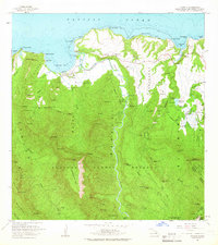 1963 Hanalei1966 Print · USGSThe northern coast of Kauai is captured here in the early sixties, showing a balance of coastal settlement and deep forest reserves. Genealogists and historians can trace the Hanalei Homesteads, the operations of Princeville Ranch, and landmarks like the Fish Pond.2 unique versions available
 - 1967 Map of Kauai
 1967 Kauai1967 Print · USGSThe Garden Isle and Niihau are shown here in the mid-sixties, capturing the island's transition from plantation roots to a more modern infrastructure. Genealogists can trace family connections in Moloaa Settlement or find coastal landmarks like Nonopapa and Kilauea Point Light.
 - 1970 Map of Kauai, 1974 Print
 1970 Kauai1974 Print · USGSThe islands of Kauai and Niihau are shown during the early 1970s, capturing the balance between military expansion and preserved wilderness. Researchers can trace the layout of Niihau's elusive villages like Puwai or explore Kauai's industrial landscape at Koloa Mill and Port Allen.2 unique versions available
 - 1983 Map of Hanalei
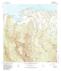 1983 Hanalei1983 Print · USGSKauai's North Shore is captured here in the early eighties, showing the development of Princeville alongside traditional agricultural areas. Researchers can trace the water networks and legacy land divisions of Hanalei Homesteads and the National Wildlife Refuge.
 - 1996 Map of Hanalei, 1998 Print
 1996 Hanalei1998 Print · USGSThe northern coast of Kauai in the late nineties shows a landscape defined by the Hanalei River valley and its surrounding forest reserves. Genealogists and researchers can trace local landmarks from Princeville and Hanapai to the Hanalei Landing and Hanalei Pavilion.
 - 2013 Map of Hanalei, 2013 Print
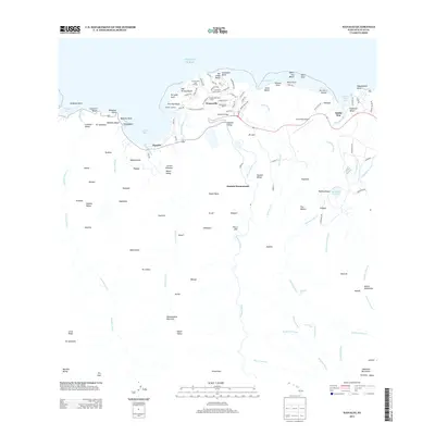 2013 Hanalei2013 Print · USGSCovers Hanalei, including Princeville, Kauai County, and other nearby areas
 - 2017 Map of Hanalei, 2017 Print
 2017 Hanalei2017 Print · USGSCovers Hanalei, including Princeville, Kauai County, and other nearby areas
 - 2024 Map of Hanalei, 2024 Print
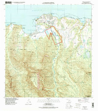
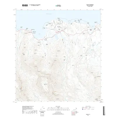
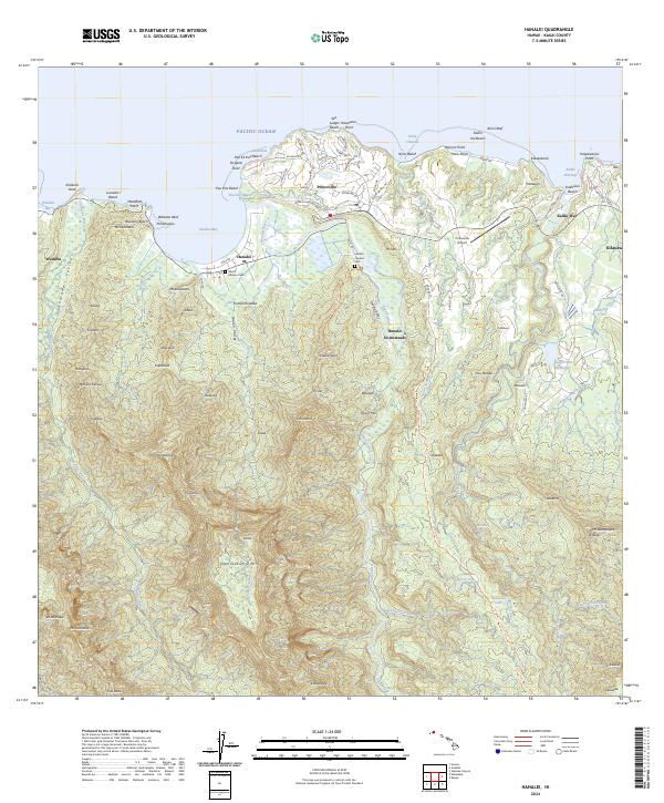 2024 Hanalei2024 Print · USGSThe northern coast of Kauai comes into sharp focus in this recent survey of the lush valley and reef-lined shore. Researchers can locate specific sites such as the Waioli Mission Cem, Hanalei Homesteads, and the Hanalei Chinese Cem.
End of results
Showing maps 1-9 of 9
Frequently asked questions
- What are the different types of historical maps available for Hanalei?
- What is the oldest map of Hanalei?
- Where can I purchase historical maps of Hanalei for my home or office?
- Where can I download high-res historical maps of Hanalei?
- Are there historical topographic maps available for Hanalei?
- Is there historical aerial imagery available for Hanalei?
- Where are historical maps of Hanalei sourced from?