Old Maps of Kealia, Hawaii
Explore 10 old maps of Kealia, spanning from 1954 to today. These high-resolution historic maps reveal how streets, neighborhoods, landmarks, and natural features evolved over time — perfect for genealogy, metal detecting, research, and local history exploration.
What you can do with these maps:
- See how Kealia changed over time: Compare historical maps to modern-day views to trace roads, homesites, rail lines & more.
- View detailed metadata: Each map includes creators, publishers, year, scale, and archive source.
- Overlay maps with satellite & LiDAR: Visualize the past alongside modern tools to explore terrain & human change.
- Trusted historical sources: Maps sourced from the USGS, Library of Congress, and other archives.
- Access maps your way: View online, download high-res files, or order prints for personal or research use.
Start exploring old maps of Kealia to uncover forgotten places, hidden landmarks, and the deep history beneath your feet.
Kealia, HI maps
(10)- 1954 Map of Kauai
 1954 Kauai1954 Print · USGSKauai and Niihau are shown during a period of transition in the early fifties as plantation-era infrastructure began to change. Researchers can trace the Kilauea Sugar Plantation Railroad, the Anahola Settlement, and remote sites on Niihau like Puuwai.
 - 1963 Map of Kapaa, 1965 Print
 1963 Kapaa1965 Print · USGSThe eastern shore of Kauai shows a unique blend of ancient heiau and mid-century expansion during the early 1960s. Genealogists and historians can locate family lands in the Kapaa Homesteads or trace sacred sites like Malae Heiau and Hauola.2 unique versions available
 - 1967 Map of Kauai
 1967 Kauai1967 Print · USGSThe Garden Isle and Niihau are shown here in the mid-sixties, capturing the island's transition from plantation roots to a more modern infrastructure. Genealogists can trace family connections in Moloaa Settlement or find coastal landmarks like Nonopapa and Kilauea Point Light.
 - 1970 Map of Kauai, 1974 Print
 1970 Kauai1974 Print · USGSThe islands of Kauai and Niihau are shown during the early 1970s, capturing the balance between military expansion and preserved wilderness. Researchers can trace the layout of Niihau's elusive villages like Puwai or explore Kauai's industrial landscape at Koloa Mill and Port Allen.2 unique versions available
 - 1978 Map of Kapaa, 1981 Print
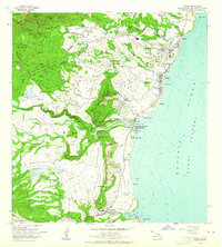
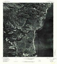 1978 Kapaa1981 Print · USGSThe eastern coast of Kauai comes into focus in the late seventies through this detailed aerial orthophotoquad. Researchers can trace the development of Kapaa and Hanamaulu or study the agricultural landscape surrounding the Wailua River.
 - 1983 Map of Kapaa, 1984 Print
 1983 Kapaa1984 Print · USGSThe eastern coast of Kauai appears in the early eighties as a landscape where ancient Hawaiian heritage meets modern island life. Genealogists and researchers can trace local landmarks like Poliahu Heiau, the Old Railroad Grade, and the Wailua Falls.2 unique versions available
 - 1996 Map of Kapaa, 1998 Print
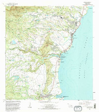
 1996 Kapaa1998 Print · USGSEastern Kauai at the close of the twentieth century shows a vibrant mix of coastal settlements and mountain forest reserves. Genealogists and historians can locate Kauai Memorial Gardens, the Hanamaulu Airstrip, and local landmarks like the Sleeping Giant.
 - 2013 Map of Kapaa, 2013 Print
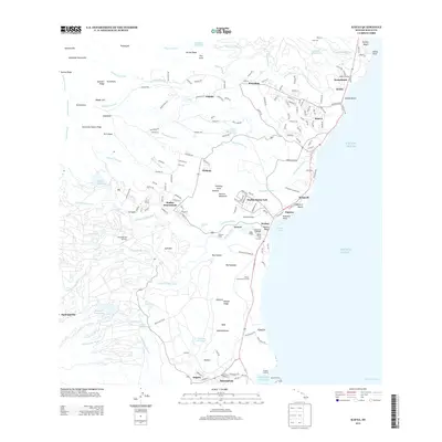 2013 Kapaa2013 Print · USGSCovers Kealia, including Kawaihau, Kapaa, and other nearby areas
 - 2017 Map of Kapaa, 2017 Print
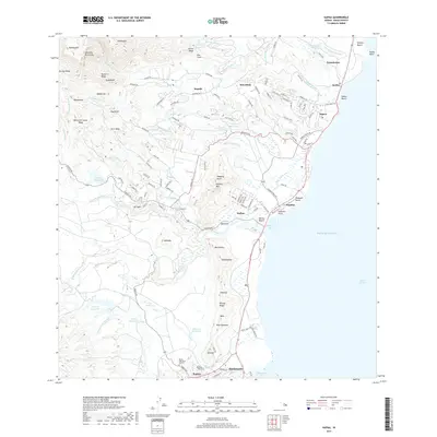 2017 Kapaa2017 Print · USGSCovers Kealia, including Kawaihau, Kapaa, and other nearby areas
 - 2024 Map of Kapaa, 2024 Print
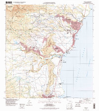
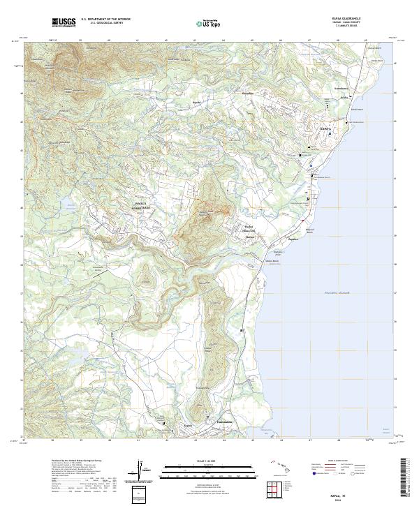 2024 Kapaa2024 Print · USGSThe eastern coast of Kauai comes alive in this contemporary survey of the settlements between Hanamaulu and Keālia. Genealogists and historians can trace community roots through numerous sites like the Kapaa Chinese Cemetery, Wailua Falls, and the Kapaa First Hawaiian Church.
End of results
Showing maps 1-10 of 10
Top cities near Kealia
Frequently asked questions
- What are the different types of historical maps available for Kealia?
- What is the oldest map of Kealia?
- Where can I purchase historical maps of Kealia for my home or office?
- Where can I download high-res historical maps of Kealia?
- Are there historical topographic maps available for Kealia?
- Is there historical aerial imagery available for Kealia?
- Where are historical maps of Kealia sourced from?