Old Maps of Lihue, Hawaii
Explore 9 old maps of Lihue, spanning from 1954 to today. These high-resolution historic maps reveal how streets, neighborhoods, landmarks, and natural features evolved over time — perfect for genealogy, metal detecting, research, and local history exploration.
What you can do with these maps:
- See how Lihue changed over time: Compare historical maps to modern-day views to trace roads, homesites, rail lines & more.
- View detailed metadata: Each map includes creators, publishers, year, scale, and archive source.
- Overlay maps with satellite & LiDAR: Visualize the past alongside modern tools to explore terrain & human change.
- Trusted historical sources: Maps sourced from the USGS, Library of Congress, and other archives.
- Access maps your way: View online, download high-res files, or order prints for personal or research use.
Start exploring old maps of Lihue to uncover forgotten places, hidden landmarks, and the deep history beneath your feet.
Lihue, HI maps
(9)- 1954 Map of Kauai
 1954 Kauai1954 Print · USGSKauai and Niihau are shown during a period of transition in the early fifties as plantation-era infrastructure began to change. Researchers can trace the Kilauea Sugar Plantation Railroad, the Anahola Settlement, and remote sites on Niihau like Puuwai.
 - 1963 Map of Lihue, 1964 Print
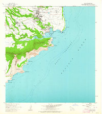 1963 Lihue1964 Print · USGSKauai’s eastern coast and the growing town of Lihue are captured in the early sixties as the island’s modern infrastructure was taking shape. Genealogists and historians can trace local institutions like Wilcox Sch and Lihue High Sch, or find the historic Menehune Fishpond and Nawiliwili Light Station.2 unique versions available
 - 1967 Map of Kauai
 1967 Kauai1967 Print · USGSThe Garden Isle and Niihau are shown here in the mid-sixties, capturing the island's transition from plantation roots to a more modern infrastructure. Genealogists can trace family connections in Moloaa Settlement or find coastal landmarks like Nonopapa and Kilauea Point Light.
 - 1970 Map of Kauai, 1974 Print
 1970 Kauai1974 Print · USGSThe islands of Kauai and Niihau are shown during the early 1970s, capturing the balance between military expansion and preserved wilderness. Researchers can trace the layout of Niihau's elusive villages like Puwai or explore Kauai's industrial landscape at Koloa Mill and Port Allen.2 unique versions available
 - 1978 Map of Lihue, 1981 Print
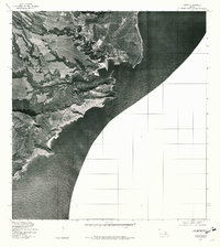 1978 Lihue1981 Print · USGSCoastal Kauai comes into sharp focus in the late 1970s, showcasing the development and geography of the island's southeast shore. Researchers can trace the layout of Lihue and the path of Huleia Stream as they appeared just before the turn of the decade.
 - 1983 Map of Lihue, 1984 Print
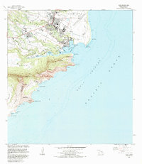 1983 Lihue1984 Print · USGSKauai’s primary commercial and transit hub comes into focus in the early eighties as the island’s infrastructure expanded around the bay. Genealogists and researchers can trace local institutions like Immaculate Conception Sch or find coastal landmarks from Nawiliwili to the ancient Menehune Fishpond.
 - 2013 Map of Lihue, 2013 Print
 2013 Lihue2013 Print · USGSCovers Lihue, including Niumalu, Puhi, and other nearby areas
 - 2017 Map of Lihue, 2017 Print
 2017 Lihue2017 Print · USGSCovers Lihue, including Niumalu, Puhi, and other nearby areas
 - 2024 Map of Lihue, 2024 Print
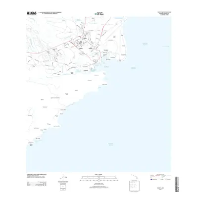
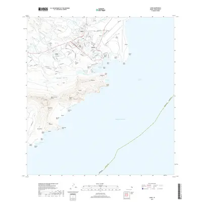
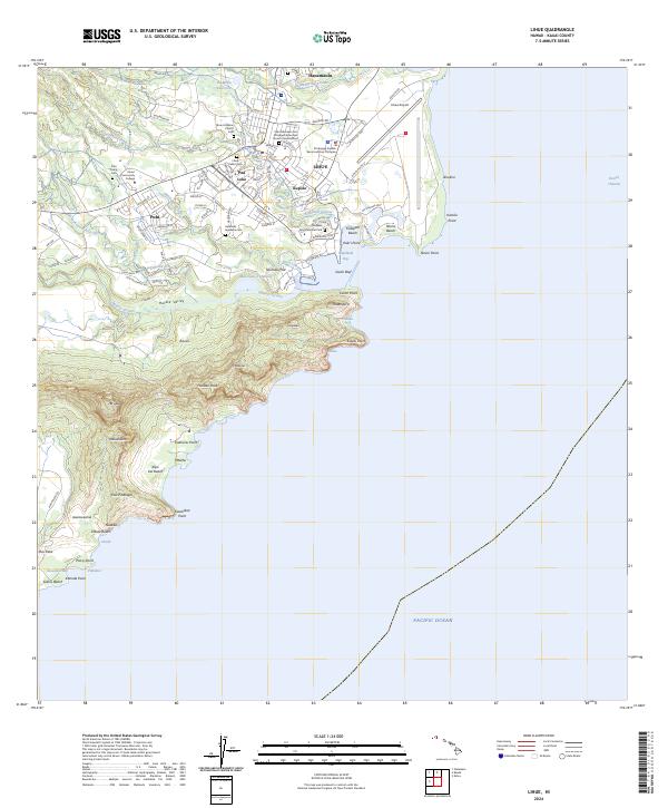 2024 Lihue2024 Print · USGSCoastal Kauai reveals its modern community layout and deep cultural roots in this recent study of the island's southeast shore. Family historians can locate several local burial sites like Puhi Camp Cem and Halehaka Japanese Cem alongside the ancient Menehune Fishpond.
End of results
Showing maps 1-9 of 9
Frequently asked questions
- What are the different types of historical maps available for Lihue?
- What is the oldest map of Lihue?
- Where can I purchase historical maps of Lihue for my home or office?
- Where can I download high-res historical maps of Lihue?
- Are there historical topographic maps available for Lihue?
- Is there historical aerial imagery available for Lihue?
- Where are historical maps of Lihue sourced from?