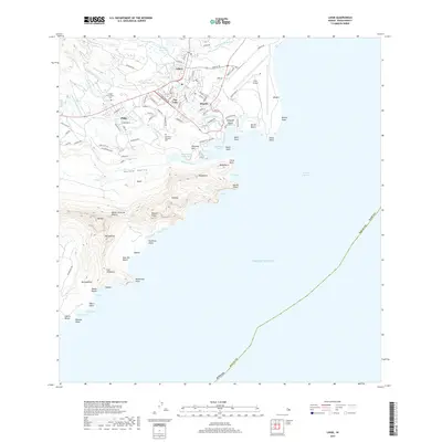
2017 Map of Lihue
USGS Topo · Published 2017About this map
The town of Lihue serves as the central hub of this eastern Kaua'i landscape, where residential and commercial streets meet the transport infrastructure of Lihue Airport. The map documents the developed corridors of Puhi, Pua Loke, and Kupolo, contrasting the modern expansion of Kauai Community Coll with cultural landmarks like the Halehaka Japanese Cem. South of the town, the terrain rises sharply toward the iconic ridgeline of Ha'upu and the distinctive Queen Victorias Profile.
Find a feature on this map
99 named features on this map. Tap any name to fly to it.
Don’t see what you’re looking for? This feature index may not catch every label — zoom into the map to look around manually.
Map Details
Editions of this 2017 Lihue Map
This is the sole edition of this map. No revisions or reprints were ever made.
Other maps of this area

1954 · Kauai
USGS Topo · 1:250,000

1963 · Lihue
USGS Topo · 1:24,000

1963 · Kapaa
USGS Topo · 1:24,000

1963 · Koloa
USGS Topo · 1:24,000

1965 · Waialeale
USGS Topo · 1:24,000

1967 · Kauai
USGS Topo · 1:250,000

1970 · Kauai
USGS Topo · 1:250,000

1978 · Kapaa
USGS Topo · 1:24,000

1978 · Lihue
USGS Topo · 1:24,000
1978 · Koloa
USGS Topo · 1:24,000