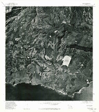
1978 Map of Koloa
USGS Topo · Published 1981About this map
Koloa and Kalaheo anchor this coastal landscape on the island of Kauai, captured during the late 1970s. The orthophoto format provides a clear view of the land-use patterns of the era, contrasting the geometric agricultural fields with the dramatic, shadowed ridges of the Alexander Reservation. A prominent landmark in the southeastern portion of the quadrangle is the Waita Reservoir, a large body of water positioned just inland from the Pacific Ocean coastline. The settlement patterns show the development of these communities amidst a landscape deeply shaped by water management and topographic elevation changes, with roads and dwellings concentrated along the lower-lying coastal plains and valley floors.
Find a feature on this map
5 named features on this map. Tap any name to fly to it.
Don’t see what you’re looking for? This feature index may not catch every label — zoom into the map to look around manually.
Map Details
Editions of this 1978 Koloa Map
This is the sole edition of this map. No revisions or reprints were ever made.
Other maps of this area

1954 · Kauai
USGS Topo · 1:250,000

1963 · Lihue
USGS Topo · 1:24,000

1963 · Hanapepe
USGS Topo · 1:24,000

1963 · Kapaa
USGS Topo · 1:24,000

1963 · Koloa
USGS Topo · 1:24,000

1965 · Waimea Canyon
USGS Topo · 1:24,000

1965 · Waialeale
USGS Topo · 1:24,000

1967 · Kauai
USGS Topo · 1:250,000

1970 · Kauai
USGS Topo · 1:250,000
1977 · Hanapepe
USGS Topo · 1:24,000