
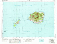
1970 Map of Kauai
USGS Topo · Published 1974About this map
The islands of Kauai and Niihau are shown here in the early 1970s, connected by the Kaulakahi Channel. The map documents the intricate network of forest reserves and state parks that dominate the interior of Kauai, including the massive Waimea Canyon St Pk and the Puu Ka Pele For Res. Along the western coastline, the presence of the Pacific Missile Range Facility at PMRF Barking Sands highlights the region's mid-century importance to maritime and aerospace operations. On the privately-owned island of Niihau, rare details of settlements like Puwai, Kiekie, and Kamalino are visible, along with Halulu Lake, the state's largest natural lake. The map also traces the agricultural and industrial infrastructure of the era, such as the Koloa Mill and shipping hubs like Port Allen.
Find a feature on this map
122 named features on this map. Tap any name to fly to it.
Don’t see what you’re looking for? This feature index may not catch every label — zoom into the map to look around manually.
Map Details
Editions of this 1970 Kauai Map
2 editions found
Other maps of this area

1954 · Oahu
USGS Topo · 1:250,000

1954 · Kauai
USGS Topo · 1:250,000

1961 · Oahu
USGS Topo · 1:250,000

1963 · Anahola
USGS Topo · 1:24,000

1963 · Lihue
USGS Topo · 1:24,000

1963 · Kekaha
USGS Topo · 1:24,000

1963 · Hanapepe
USGS Topo · 1:24,000

1963 · Kapaa
USGS Topo · 1:24,000

1963 · Koloa
USGS Topo · 1:24,000

1963 · Hanalei
USGS Topo · 1:24,000