
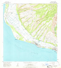
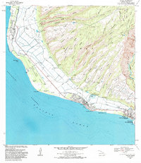
1963 Map of Kekaha
USGS Topo · Published 1965About this map
The coastal sugar-and-military landscape of southwestern Kauai is documented here in the early 1960s, a period defined by large-scale irrigation and defense infrastructure. The settlement of Kekaha serves as the hub, supported by community landmarks such as St Theresa Sch, Kekaha Sch, and Faye Park. To the northwest, the Bonham Military Reservation and its Auxiliary Landing Field dominate the lowlands, reflecting the strategic importance of the Pacific coast during this era.
Find a feature on this map
66 named features on this map. Tap any name to fly to it.
Don’t see what you’re looking for? This feature index may not catch every label — zoom into the map to look around manually.
Map Details
Editions of this 1963 Kekaha Map
2 editions found
Other maps of this area

1954 · Kauai
USGS Topo · 1:250,000

1963 · Hanapepe
USGS Topo · 1:24,000

1965 · Waimea Canyon
USGS Topo · 1:24,000

1965 · Makaha Point
USGS Topo · 1:24,000

1967 · Kauai
USGS Topo · 1:250,000

1970 · Kauai
USGS Topo · 1:250,000
1977 · Hanapepe
USGS Topo · 1:24,000
1983 · Hanapepe
USGS Topo · 1:24,000
1983 · Makaha Point
USGS Topo · 1:24,000
1983 · Kekaha
USGS Topo · 1:24,000