
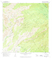
1965 Map of Waimea Canyon
USGS Topo · Published 1967About this map
Waimea Canyon State Park and the Na Pali-Kona Forest Reserve define the landscape of central Kauai in the mid-1960s. The deep canyons and steep ridges are marked by dramatic water features, including Waipoo Falls and the many cascades along the Waialae River. A complex network of irrigation and power infrastructure is visible, including the Mauka Powerhouse and several gaging stations along the Waimea River.
Find a feature on this map
108 named features on this map. Tap any name to fly to it.
Don’t see what you’re looking for? This feature index may not catch every label — zoom into the map to look around manually.
Map Details
Editions of this 1965 Waimea Canyon Map
2 editions found
Other maps of this area

1954 · Kauai
USGS Topo · 1:250,000

1963 · Kekaha
USGS Topo · 1:24,000

1963 · Hanapepe
USGS Topo · 1:24,000

1963 · Koloa
USGS Topo · 1:24,000

1963 · Hanalei
USGS Topo · 1:24,000

1965 · Haena
USGS Topo · 1:24,000

1965 · Makaha Point
USGS Topo · 1:24,000

1965 · Waialeale
USGS Topo · 1:24,000

1967 · Kauai
USGS Topo · 1:250,000

1970 · Kauai
USGS Topo · 1:250,000